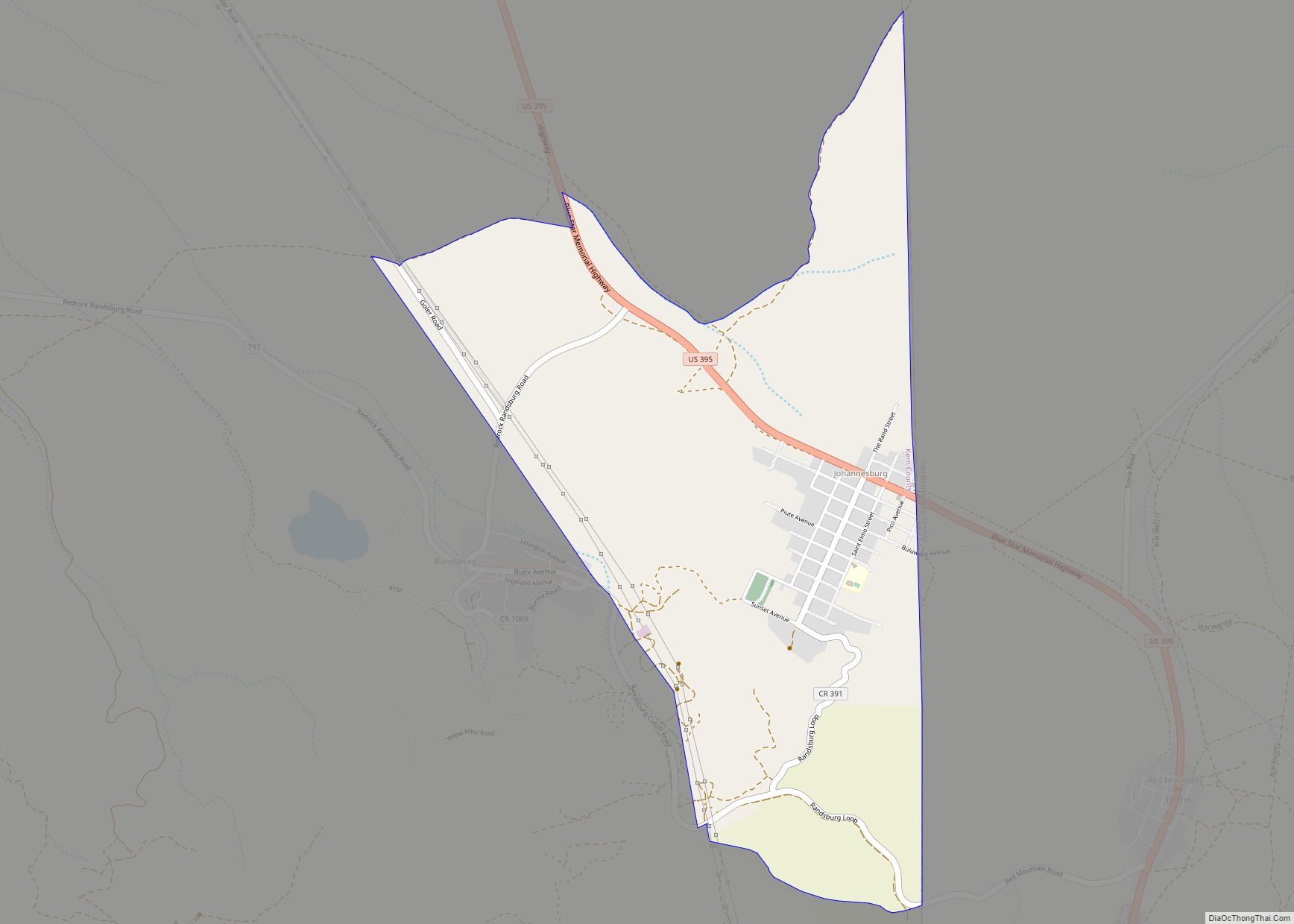
Map of Junction City CDP, California

Map of Junction City CDP, California

Junction City is a census-designated place (CDP) in Trinity County, California. Junction City sits at an elevation of 1,909 feet (582 m). Its population is 658 as of the 2020 census, down from 680 from the 2010 census. Junction City is located 8 miles (13 km) west of Weaverville. The Trinity River runs through the town and … Read more

Map of Julian CDP

Map of Julian CDP, California

Julian is a census-designated place (CDP) in San Diego County, California. As of the 2020 census, the population was 1,768, up from 1,502 at the time of the 2010 census. Julian is an official California Historical Landmark (No. 412). The Julian townsite and surrounding area is defined by the San Diego County Zoning Ordinance Section … Read more

Map of Joshua Tree CDP

Map of Joshua Tree CDP

Joshua Tree is a census-designated place (CDP) in San Bernardino County, California, United States. The population was 7,414 at the 2010 census. At approximately 2,700 feet (820 meters) above sea level, Joshua Tree and its surrounding communities are located in the High Desert of California. The center of the business district in Joshua Tree is … Read more

Map of Keeler CDP

Map of Keeler CDP

Keeler, formerly known as Hawley, is a census-designated place (CDP) in Inyo County, California, United States. Keeler is located on the east shore of Owens Lake 11.5 miles (19 km) south-southeast of New York Butte. The population was 71 people at the 2020 census, up from 66 at the 2010 census. Keeler CDP overview: Name: Keeler … Read more

Map of Keddie CDP

Map of Keddie CDP

Keddie is a census-designated place in Plumas County, California, United States. The population was 66 at the 2010 census. Keddie CDP overview: Name: Keddie CDP LSAD Code: 57 LSAD Description: CDP (suffix) State: California County: Plumas County Elevation: 3,264 ft (995 m) Total Area: 0.645 sq mi (1.671 km²) Land Area: 0.645 sq mi (1.671 km²) Water Area: 0 sq mi (0 km²)  0% Total Population: … Read more

Map of June Lake CDP

Map of June Lake CDP

June Lake is an unincorporated community and census-designated place (CDP) in Mono County, California, United States. It is located against the southern rim of the Mono Basin, 12.5 miles (20 km) south of Lee Vining, at an elevation of 7,654 feet (2,333 m). The majority of the developed community is spread narrowly along a five-mile stretch of … Read more

Map of Kelseyville CDP

Map of Kelseyville CDP

Kelseyville is a census-designated place (CDP) in Lake County, California, United States. Kelseyville is located six miles (9.7 kilometers) southeast of Lakeport, at an elevation of 1,384 feet (422 meters). The population was 3,353 at the 2010 census, up from 2,928 at the 2000 census. Kelseyville CDP overview: Name: Kelseyville CDP LSAD Code: 57 LSAD … Read more

Map of Kelly Ridge CDP

Map of Kelly Ridge CDP

Kelly Ridge is a census-designated place in Butte County, northern California. Kelly Ridge CDP overview: Name: Kelly Ridge CDP LSAD Code: 57 LSAD Description: CDP (suffix) State: California County: Butte County Elevation: 1,050 ft (320 m) Total Area: 1.951 sq mi (5.054 km²) Land Area: 1.951 sq mi (5.054 km²) Water Area: 0 sq mi (0 km²)  0% Total Population: 2,544 Population Density: 1,300/sq mi (500/km²) FIPS … Read more

Map of Keene CDP

Map of Keene CDP, California

Keene (formerly, Wells) is a census-designated place (CDP) in Kern County, California in the foothills of the Tehachapi Mountains at the southern extreme of the San Joaquin Valley. Keene is located 8.5 miles (14 km) northwest of Tehachapi, at an elevation of 2,602 feet (793 m). The population was 469 at the 2020 census, up from 431 … Read more

Map of Kensington CDP

Map of Kensington CDP, California

Kensington is an unincorporated community and census designated place located in the Berkeley Hills, in the East Bay, part of the San Francisco Bay Area, in Contra Costa County, California. In the 20th century it was considered part of Berkeley, although it is across the county line. House numbers follow the pattern used in Berkeley, … Read more

Map of Kennedy CDP, California

Map of Kennedy CDP, California

Kennedy is a census-designated place (CDP) in San Joaquin County, California, United States. The population was 3,356, at the 2020 census, up from 3,254 at the 2000 census. Kennedy CDP overview: Name: Kennedy CDP LSAD Code: 57 LSAD Description: CDP (suffix) State: California County: San Joaquin County Elevation: 23 ft (7 m) Total Area: 1.175 sq mi (3.043 km²) Land … Read more

Map of Kennedy Meadows CDP

Map of Kennedy Meadows CDP

Kennedy Meadows CDP overview: Name: Kennedy Meadows CDP LSAD Code: 57 LSAD Description: CDP (suffix) State: California County: Tulare County FIPS code: 0638076 Online Interactive Map Kennedy Meadows online map. Source: Basemap layers from Google Map, Open Street Map (OSM), Arcgisonline, Wmflabs. Boundary Data from Database of Global Administrative Areas. Kennedy Meadows location map. Where … Read more