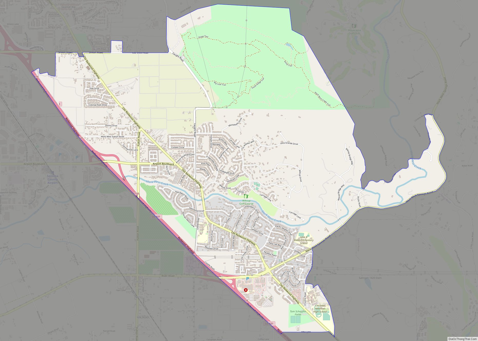
Map of Laton CDP

Map of Laton CDP

Laton /ˈleɪtən/ is a census-designated place (CDP) in Fresno County, California, United States. The population was 1,824 at the 2010 census, up from 1,236 at the 2000 census. Laton is located 23 miles (37 km) south-southeast of Fresno, at an elevation of 259 feet (79 m). Laton CDP overview: Name: Laton CDP LSAD Code: 57 LSAD … Read more

Map of Lathrop city

Map of Lathrop city, California

Lathrop is a city located 9 miles (14 km) south of Stockton in San Joaquin County, California, United States. The 2022 California Census reported that Lathrop’s population was 30,659. The city is located in Northern California at the intersection of Interstate 5 and California State Route 120, in the San Joaquin Valley. Lathrop city overview: Name: … Read more

Map of Las Lomas CDP

Map of Las Lomas CDP, California

Las Lomas (Spanish for ‘The Hills’) is an unincorporated community and census-designated place (CDP) in Monterey County, California, United States. Las Lomas is located 7 miles (11 km) north-northwest of Prunedale. The elevation is 43 feet (13 m). The population was 3,046 at the 2020 census. Las Lomas CDP overview: Name: Las Lomas CDP LSAD Code: 57 … Read more

Map of Le Grand CDP

Map of Le Grand CDP, California

Le Grand (also Legrand) is an unincorporated community and census-designated place (CDP) in Merced County, California, United States. Le Grand is 14 miles (23 km) east-southeast of Merced, the county seat at an elevation of 253 feet (77 m). The population was 1,592 at the 2020 census, down from 1,659 at the 2010 census. Le Grand CDP … Read more

Map of Laytonville CDP

Map of Laytonville CDP

Laytonville is a census-designated place (CDP) in Mendocino County, California, United States. It is located 23 miles (37 km) north-northwest of Willits, at an elevation of 1,670 feet (510 m). The population was 1,152 at the 2020 census, down from 1,227 at the 2010 census. Laytonville CDP overview: Name: Laytonville CDP LSAD Code: 57 LSAD Description: CDP … Read more

Map of Lawndale city

Map of Lawndale city, California

Lawndale is a city in Los Angeles County, California, United States. The population was 32,769 at the 2010 census, up from 31,712 according to the 2000 census. The city is in the South Bay region of the Greater Los Angeles Area. Lawndale city overview: Name: Lawndale city LSAD Code: 25 LSAD Description: city (suffix) State: … Read more

Map of Leggett CDP

Map of Leggett CDP, California

Leggett (formerly Leggett Valley) is a census-designated place in Mendocino County, California, United States. It is located on the South Fork of the Eel River, 21 miles (34 km) by road northwest of Laytonville, at an elevation of 984 ft (300 m). It is home to some of the largest trees in the world. The nearby Smithe Redwoods … Read more

Map of Lee Vining CDP

Map of Lee Vining CDP

Lee Vining (formerly Leevining, Poverty Flat, and Lakeview) is an unincorporated community and census-designated place (CDP) in Mono County, California, United States. It is located 25 miles (40 km) south-southeast of Bridgeport, at an elevation of 6,781 feet (2,067 m). Lee Vining is located on the southwest shore of Mono Lake. The population was 217 as of … Read more

Map of Lebec CDP

Map of Lebec CDP

Lebec is an unincorporated community and census-designated place in southwestern Kern County, California. As of the 2010 census, the population was 1,468. Lebec CDP overview: Name: Lebec CDP LSAD Code: 57 LSAD Description: CDP (suffix) State: California County: Kern County Elevation: 3,481 ft (1,061 m) Total Area: 15.329 sq mi (39.702 km²) Land Area: 15.329 sq mi (39.701 km²) Water Area: 0 sq mi (0.001 km²) … Read more

Map of Lemon Hill CDP

Map of Lemon Hill CDP

Lemon Hill is a census-designated place in an unincorporated area of Sacramento County, California, south of the city of Sacramento. Lemon Hill sits at an elevation of 30 feet (9.1 m). The 2010 United States census reported Lemon Hill’s population was 13,729. Prior to the 2010 United States census, Lemon Hill was grouped with Parkway and … Read more

Map of Lemon Grove city

Map of Lemon Grove city, California

Lemon Grove is a city in San Diego County, California, United States. The population was 27,627 at the 2020 census, up from 25,320 at the 2010 census. Lemon Grove city overview: Name: Lemon Grove city LSAD Code: 25 LSAD Description: city (suffix) State: California County: San Diego County Incorporated: July 1, 1977 Elevation: 446 ft (136 m) … Read more

Map of Lemon Cove CDP

Map of Lemon Cove CDP

Lemon Cove is a census-designated place (CDP) in the San Joaquin Valley in Tulare County, California, United States. The population was 308 at the 2010 census, up from 298 at the 2000 census. Lemon Cove CDP overview: Name: Lemon Cove CDP LSAD Code: 57 LSAD Description: CDP (suffix) State: California County: Tulare County Elevation: 502 ft … Read more