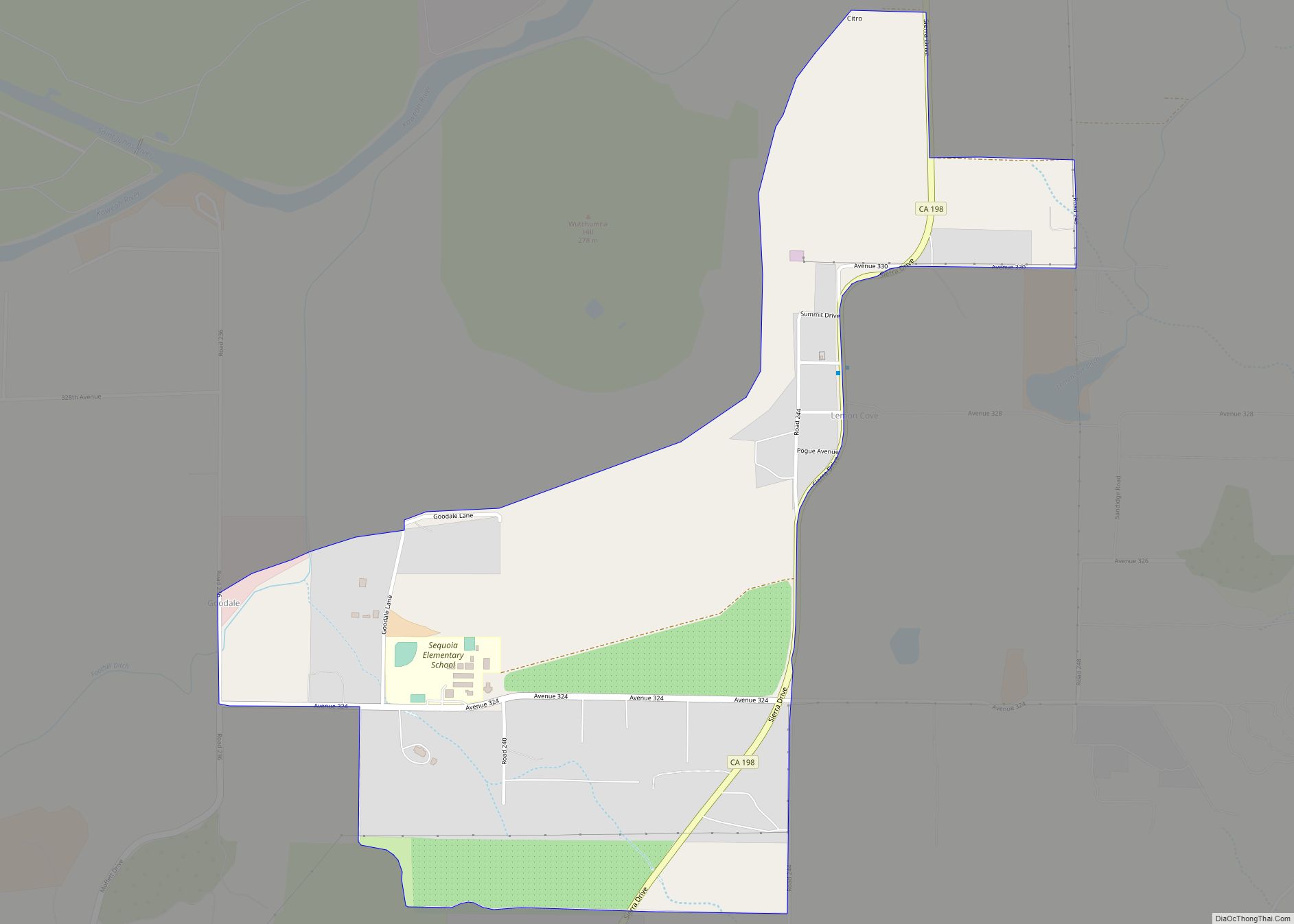
Map of Lennox CDP

Map of Lennox CDP, California

Lennox (pronunciation) is a census-designated place (CDP) in Los Angeles County, California, United States. The population was 22,753 at the 2010 census, down from 22,950 at the 2000 census. Lennox CDP overview: Name: Lennox CDP LSAD Code: 57 LSAD Description: CDP (suffix) State: California County: Los Angeles County Elevation: 72 ft (22 m) Total Area: 1.093 sq mi (2.832 km²) … Read more

Map of Lemoore city

Map of Lemoore city

Lemoore (formerly, La Tache and Lee Moore’s) is a city in Kings County, California, United States. Lemoore is located 7.5 miles (12 km) west-southwest of Hanford, at an elevation of 230 feet (70 m). It is part of the Hanford-Corcoran Metropolitan Statistical Area (MSA Code 25260). The population was 24,531 at the 2010 Census. The California Department … Read more

Map of Lemoore Station CDP

Map of Lemoore Station CDP

Lemoore Station is a census-designated place (CDP) in Naval Air Station Lemoore, Kings County, California, United States. It is part of the Hanford–Corcoran Metropolitan Statistical Area. The population was 7,438 as of the 2010 United States Census. Lemoore Station CDP overview: Name: Lemoore Station CDP LSAD Code: 57 LSAD Description: CDP (suffix) State: California County: … Read more

Map of Lenwood CDP

Map of Lenwood CDP

Lenwood is a census-designated place (CDP) in the Mojave Desert near Barstow, in San Bernardino County, California. The population was 3,543 at the 2010 census, up from 3,222 at the 2000 census. It is located on the Mojave River, 3 miles (4.8 km) west of Barstow. Lenwood CDP overview: Name: Lenwood CDP LSAD Code: 57 LSAD … Read more

Map of Lewiston city

Map of Lewiston CDP, California

Lewiston is a census-designated place (CDP) in Trinity County, California, United States. Its population is 1,222 as of the 2020 census, up from 1,193 from the 2010 census. Lewiston CDP overview: Name: Lewiston CDP LSAD Code: 57 LSAD Description: CDP (suffix) State: California County: Trinity County Elevation: 1,814 ft (553 m) Total Area: 20.009 sq mi (51.824 km²) Land Area: … Read more

Map of Leona Valley CDP

Map of Leona Valley CDP

Leona Valley (Leona, Spanish for “Lioness”) is a census-designated place located in the geographic Leona Valley of northern Los Angeles County, California, in the transition between the Sierra Pelona Mountains and Mojave Desert, just west of Palmdale and the Antelope Valley. The population was 1,607 at the 2010 census. Leona Valley is best known for … Read more

Map of Lincoln Village CDP

Map of Lincoln Village CDP, California

Lincoln Village is a census-designated place (CDP) in San Joaquin County, California, United States. The population was 4,381 at the 2010 census, up from 4,216 at the 2000 census. Lincoln Village CDP overview: Name: Lincoln Village CDP LSAD Code: 57 LSAD Description: CDP (suffix) State: California County: San Joaquin County Elevation: 13 ft (4 m) Total Area: … Read more

Map of Likely CDP

Map of Likely CDP

Likely (formerly, South Fork) is a census-designated place in Modoc County, California. It is located near the South Fork of the Pit River, 18 miles (29 km) south of the county seat of Alturas, at an elevation of 4,449 feet (1,356 m). Its population is 53 as of the 2020 census, down from 63 at the time … Read more

Map of Lexington Hills CDP

Map of Lexington Hills CDP

Lexington Hills is a census-designated place and an unincorporated area in Santa Clara County, California, United States. The population was 2,492 at the 2020 census. The area is located in the Santa Cruz Mountains, about five miles south of Los Gatos and about 14 miles (23 km) north of Santa Cruz. Lexington Hills is the name … Read more

Map of Lindcove CDP

Map of Lindcove CDP

Lindcove is a census-designated place in Tulare County, California, United States. The population was 406 at the 2010 census. Lindcove CDP overview: Name: Lindcove CDP LSAD Code: 57 LSAD Description: CDP (suffix) State: California County: Tulare County Elevation: 453 ft (138 m) Total Area: 0.682 sq mi (1.767 km²) Land Area: 0.682 sq mi (1.767 km²) Water Area: 0 sq mi (0 km²)  0% Total Population: … Read more

Map of Linda CDP

Map of Linda CDP

Linda (Spanish for “Pretty”) is a census-designated place (CDP) in Yuba County, California, United States. The population was 17,773 at the 2010 census, up from 13,474 at the 2000 census. Linda is located 2 miles (3.2 km) north-northwest of Olivehurst. Linda CDP overview: Name: Linda CDP LSAD Code: 57 LSAD Description: CDP (suffix) State: California County: … Read more

Map of Lincoln city, California

Map of Lincoln city, California

Lincoln is a city in Placer County, California, United States, part of the Sacramento metropolitan area. Located ten miles north of Roseville in an area of rapid suburban development, it grew 282 percent between 2000 and 2010, making it the fastest-growing city over 10,000 people in the U.S. Its 2019 population was estimated to be … Read more