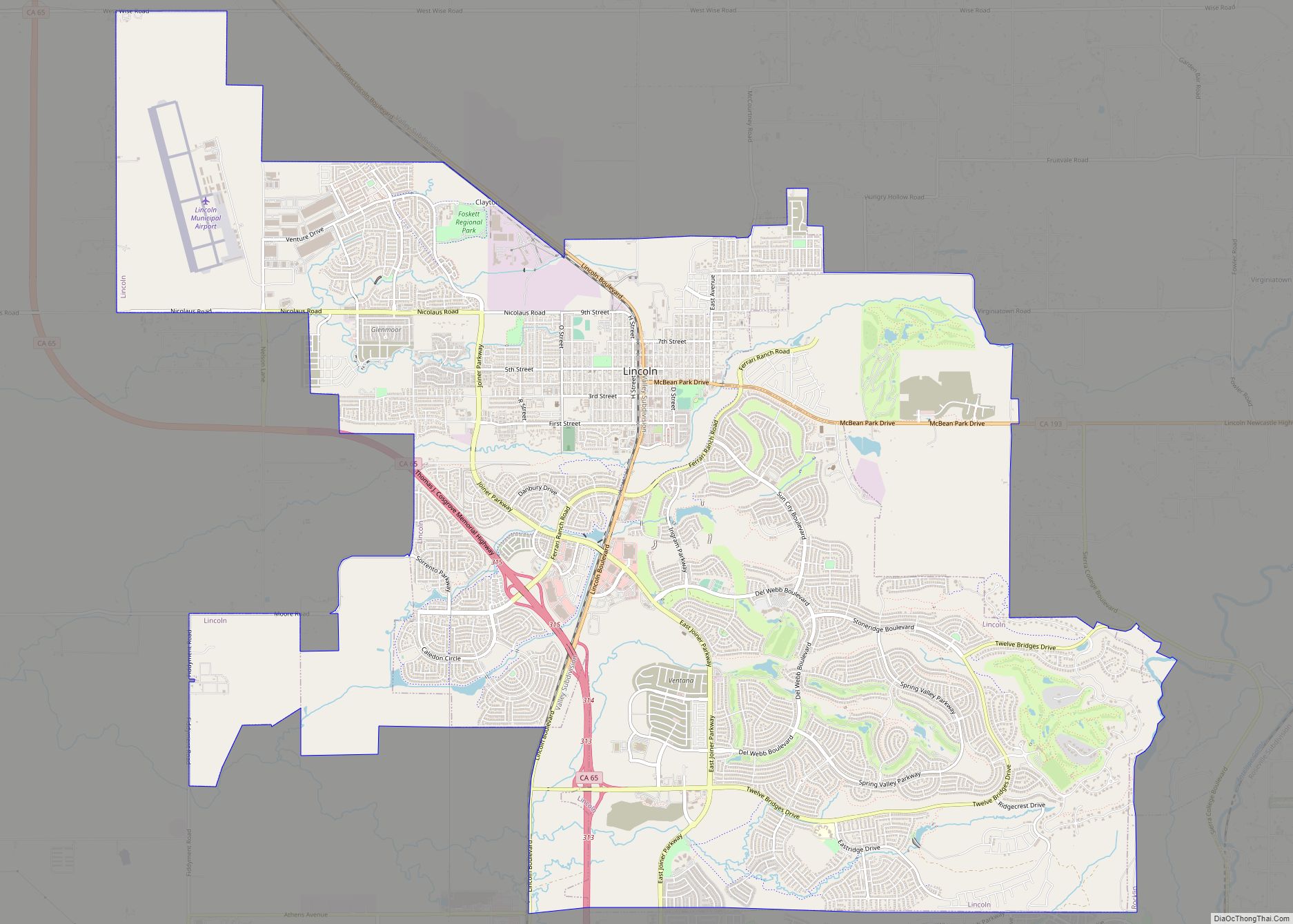
Map of Linden CDP, California

Map of Linden CDP, California

Linden is a census-designated place (CDP) in San Joaquin County, California, United States. The population was 1,784 at the 2010 census, up from 1,103 at the 2000 census. The city is host of the Linden Cherry Festival each spring. Linden CDP overview: Name: Linden CDP LSAD Code: 57 LSAD Description: CDP (suffix) State: California County: … Read more

Map of Linnell Camp CDP

Map of Linnell Camp CDP

Linnell Camp is a census-designated place (CDP) in Tulare County, California. Linnell Camp sits at an elevation of 358 feet (109 m). The 2010 United States census reported Linnell Camp’s population was 849. Linnell Camp CDP overview: Name: Linnell Camp CDP LSAD Code: 57 LSAD Description: CDP (suffix) State: California County: Tulare County Elevation: 358 ft (109 m) … Read more

Map of Lindsay city

Map of Lindsay city, California

Lindsay is a city in Tulare County, California, United States. The population was 12,659 at the 2020 census. Lindsay is located southeast of Visalia and north of Porterville and is considered part of the Visalia-Porterville Metropolitan Area and the Porterville Urban Area by the United States Census Bureau. Lindsay city overview: Name: Lindsay city LSAD … Read more

Map of Little River CDP

Map of Little River CDP, California

Little River (formerly known as Littleriver, Bell’s Harbor, and Kent’s Landing) is a small census-designated place in Mendocino County, California, United States. It lies at an elevation of 66 feet (20 m), 3 miles (5 km) south of the town of Mendocino and running along the Pacific Ocean coast on State Route 1. The town takes its … Read more

Map of Little Grass Valley CDP

Map of Little Grass Valley CDP

Little Grass Valley is a census-designated place in Plumas County, California, USA. As of the 2010 census, it had a total population of 2. Little Grass Valley CDP overview: Name: Little Grass Valley CDP LSAD Code: 57 LSAD Description: CDP (suffix) State: California County: Plumas County Total Area: 10.002 sq mi (25.906 km²) Land Area: 10.002 sq mi (25.906 km²) Water … Read more

Map of Litchfield CDP

Map of Litchfield CDP, California

Litchfield is a census-designated place in Lassen County, California. It is located 15 miles (24 km) east of Susanville, at an elevation of 4,065 feet (1,239 m). Its population is 160 as of the 2020 census, down from 195 from the 2010 census. Litchfield CDP overview: Name: Litchfield CDP LSAD Code: 57 LSAD Description: CDP (suffix) State: … Read more

Map of Live Oak CDP

Map of Live Oak CDP, California

Live Oak is a census-designated place (CDP) in Santa Cruz County, California between the cities of Santa Cruz and Capitola and north of the former Union Pacific railroad. Live Oak sits at an elevation of 102 feet (31 m). The population was 17,038 at the 2020 census. The population of the greater Live Oak area, including … Read more

Map of Littlerock CDP

Map of Littlerock CDP

Littlerock is a census-designated place in California United States. The population was 1,377 at the 2010 census, down from 1,402 at the 2000 census. The Littlerock, and Sun Village community, which is typically referred to as Littlerock, has a population around 15,000. According to the Greater Antelope Valley Economic Alliance report of 2009, the Palmdale … Read more

Map of Little Valley CDP

Map of Little Valley CDP, California

Little Valley is an unincorporated community and census-designated place in Lassen County, California, United States. It is located 43 miles (69 km) northwest of Susanville, at an elevation of 4,190 feet (1,280 m). Its population is 84 as of the 2020 census. Little Valley CDP overview: Name: Little Valley CDP LSAD Code: 57 LSAD Description: CDP (suffix) … Read more

Map of Lockeford CDP

Map of Lockeford CDP

Lockeford is an unincorporated community in San Joaquin County, California, United States. For statistical purposes, the United States Census Bureau has defined Lockeford as a census-designated place (CDP). The census definition of the area may not precisely correspond to local understanding of the area with the same name. The population was 3,521 at the 2020 … Read more

Map of Livingston city, California

Map of Livingston city, California

Livingston is a city in Merced County, California, United States. Livingston is located 7 miles (11 km) west-northwest of Atwater, at an elevation of 131 feet (40 m). According to the 2020 census, the city population was 14,172, up from 13,058 in 2010. Livingston’s total area is 3.7 square miles (9.6 km), including undeveloped farmland annexed in … Read more

Map of Livermore city

Map of Livermore city, California

Livermore (formerly Livermorès, Livermore Ranch, and Nottingham) is a city in Alameda County, California. With a 2020 population of 87,955, Livermore is the most populous city in the Tri-Valley, giving its name to the Livermore Valley. It is located on the eastern edge of California’s San Francisco Bay Area. The current mayor is John Marchand. … Read more