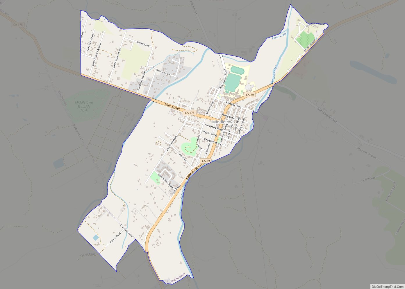
Map of Milford CDP

Map of Milford CDP, California

Milford is a census-designated place in Lassen County, California. It is located on Mill Creek 15 miles (24 km) south of Litchfield, at an elevation of 4222 feet (1287 m). Its population is 147 as of the 2020 census, down from 167 from the 2010 census. The settlement began when Judson Dakin and J.C. Wemple opened … Read more

Map of Millbrae city

Map of Millbrae city

Millbrae is a city located in northern San Mateo County, California, United States. To its northeast is San Francisco International Airport, San Bruno is on its northwest, and Burlingame on its southeast. It is bordered by San Andreas Lake to the southwest. The population was 23,216 at the 2020 census. Millbrae city overview: Name: Millbrae … Read more

Map of Mill Valley city

Map of Mill Valley city

Mill Valley is a city in Marin County, California, United States, located about 14 miles (23 km) north of San Francisco via the Golden Gate Bridge and 52 miles (84 km) from Napa Valley. The population was 14,231 at the 2020 census. Mill Valley is located on the western and northern shores of Richardson Bay, and the … Read more

Map of Mineral CDP

Map of Mineral CDP, California

Mineral is a boundaried but unincorporated forest village in Tehama County, California, United States. It has been part of a much larger census-designated place since 1980, for which the population was 123 at the 2010 census, down from 143 at the 2000 census. Mineral CDP overview: Name: Mineral CDP LSAD Code: 57 LSAD Description: CDP … Read more

Map of Milpitas city

Map of Milpitas city

Milpitas (Spanish for ‘little milpas’) is a city in Santa Clara County, California, in Silicon Valley. As of the 2020 census, the city population was 80,273. The city’s origins lie in Rancho Milpitas, granted to Californio ranchero José María Alviso in 1835. Milpitas incorporated in 1954 and has become home to numerous high tech companies, … Read more

Map of Millville CDP

Map of Millville CDP, California

Millville is a census-designated place (CDP) in Shasta County, California, United States. Its population is 724 as of the 2020 census, down from 727 from the 2010 census. Millville CDP overview: Name: Millville CDP LSAD Code: 57 LSAD Description: CDP (suffix) State: California County: Shasta County Elevation: 510 ft (157 m) Total Area: 8.213 sq mi (21.272 km²) Land Area: … Read more

Map of Miranda CDP

Map of Miranda CDP, California

Miranda (formerly Jacobsen’s) is a census-designated place in Humboldt County, California. It is located 2.5 miles (4 km) northwest of Phillipsville, at an elevation of 351 feet (107 m). The ZIP Code is 95553. The population was 520 at the 2010 census. The name Miranda was originally applied to the area’s post office on August 26, 1905. … Read more

Map of Mira Monte CDP

Map of Mira Monte CDP

Mira Monte (/ˌmɪərə ˈmɒnti/ (listen); Spanish for “Mountain View”) is a rural community in Ventura County, California, United States. Mira Monte is located in between the communities of Oak View, Meiners Oaks, and southwest of the City of Ojai, California. For statistical purposes, the United States Census Bureau has defined Mira Monte as a census-designated … Read more

Map of Minkler CDP

Map of Minkler CDP

Minkler is a census-designated place in eastern Fresno County, California. The place is located on Highway 180, 2.25 miles (3.6 km) east-southeast of Centerville and 7.6 miles north of Reedley at an elevation of 397 feet (121 m). It has a population of 1,003 people. The town is named for Charles O. Minkler, a local farmer. … Read more

Map of Mission Viejo city

Map of Mission Viejo city

Mission Viejo (/viˈeɪhoʊ/ vee-AY-hoh; corruption of Misión Vieja, Spanish for “Old Mission”) is a commuter city in the Saddleback Valley in Orange County, California, United States. Mission Viejo is considered one of the largest master-planned communities ever built under a single project in the United States and is rivaled only by Highlands Ranch in size. … Read more

Map of Mission Hills CDP

Map of Mission Hills CDP, California

Mission Hills is a census-designated place (CDP) in Santa Barbara County, California, a short distance north of Lompoc on Highway 1. The population was 3,576 at the 2010 census, up from 3,142 at the 2000 census. Mission Hills CDP overview: Name: Mission Hills CDP LSAD Code: 57 LSAD Description: CDP (suffix) State: California County: Santa … Read more

Map of Mission Canyon CDP

Map of Mission Canyon CDP

Mission Canyon is a census-designated place and an unincorporated suburb of Santa Barbara, California, in Santa Barbara County, United States. The population was 2,381 at the 2010 census, down from 2,610 at the 2000 census. Mission Canyon is directly north — on the mountain side — of the city of Santa Barbara, and derives its … Read more