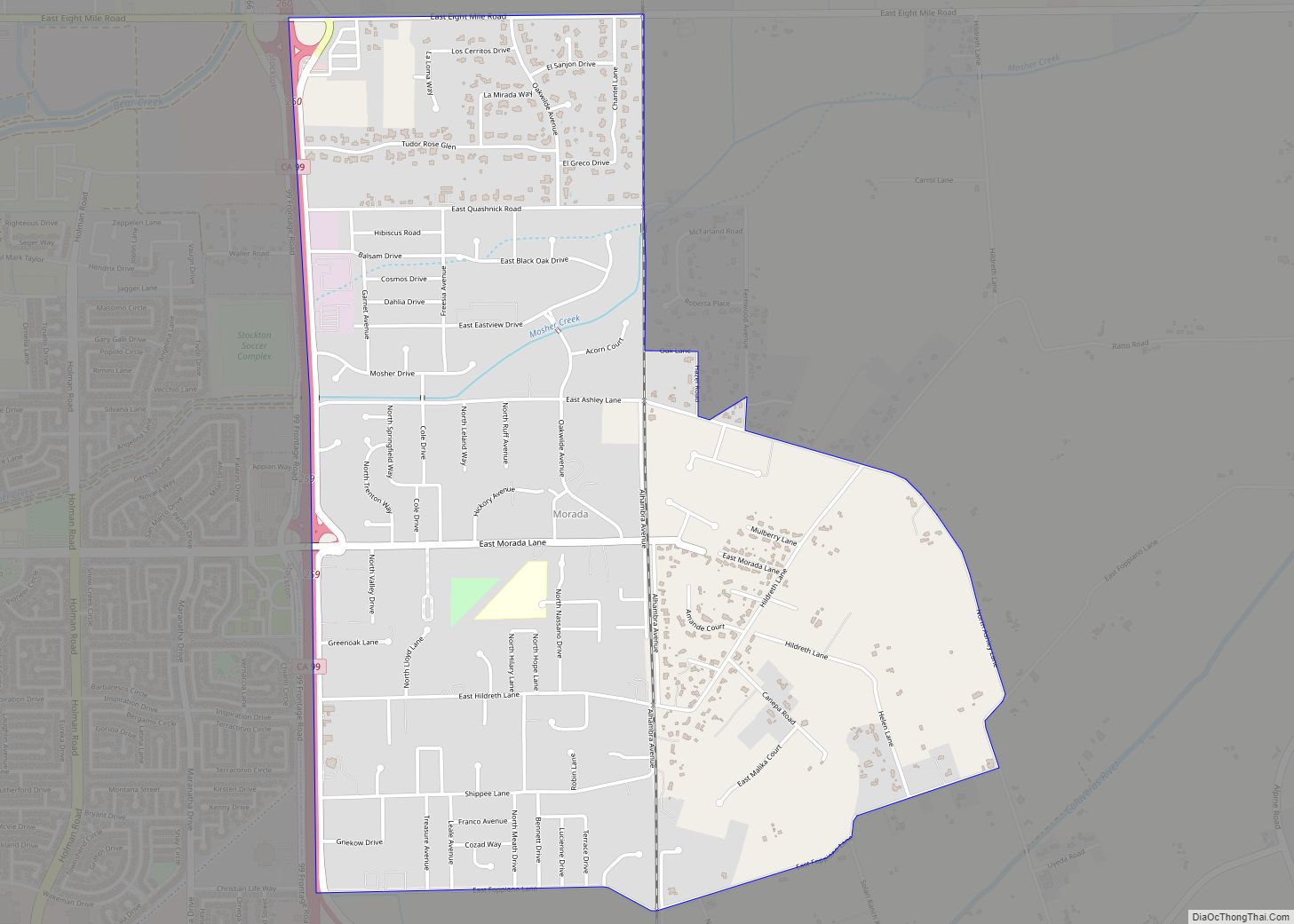
Map of Moskowite Corner CDP

Map of Moskowite Corner CDP

Moskowite Corner is a census-designated place in Napa County, California. Moskowite Corner sits at an elevation of 833 feet (254 m). The 2010 United States census reported Moskowite Corner’s population was 211. Moskowite Corner CDP overview: Name: Moskowite Corner CDP LSAD Code: 57 LSAD Description: CDP (suffix) State: California County: Napa County Elevation: 833 ft (254 m) Total … Read more

Map of Morro Bay city

Map of Morro Bay city

Morro Bay (Morro, Spanish for “Hill”) is a seaside city in San Luis Obispo County, California. Located on the Central Coast of California, the city population was 10,757 as of the 2020 census, up from 10,234 at the 2010 census. The town overlooks Morro Bay, a natural embayment with an all-weather small craft commercial and … Read more

Map of Morongo Valley CDP

Map of Morongo Valley CDP

Morongo Valley is a census-designated place (CDP) on State Route 62 in San Bernardino County, California, United States. The population was 3,552 at the 2010 census, up from 1,929 at the 2000 census. The town is bordered by Yucca Valley, California. Morongo Valley CDP overview: Name: Morongo Valley CDP LSAD Code: 57 LSAD Description: CDP … Read more

Map of Mount Hebron CDP

Map of Mount Hebron CDP

Mount Hebron is a census-designated place in Siskiyou County, California, United States. Its population is 103 as of the 2020 census, up from 95 from the 2010 census. Mount Hebron CDP overview: Name: Mount Hebron CDP LSAD Code: 57 LSAD Description: CDP (suffix) State: California County: Siskiyou County Elevation: 4,262 ft (1,299 m) Total Area: 0.713 sq mi (1.847 km²) … Read more

Map of Moss Landing CDP

Map of Moss Landing CDP

Moss Landing, formerly Moss, is an unincorporated community and census-designated place (CDP) in Monterey County, California, United States. It is located 18 miles (29 km) north-northeast of Monterey, at an elevation of 10 feet (3.048 m). It is on the shore of Monterey Bay, at the mouth of Elkhorn Slough and at the head of the submarine … Read more

Map of Moss Beach CDP

Map of Moss Beach CDP

Moss Beach is a coastal census-designated place in San Mateo County, California, with a year 2020 census population of 3,214. Located in Moss Beach are the Fitzgerald Marine Reserve, a marine sanctuary; the Half Moon Bay Airport, the historic Moss Beach Distillery; and the Seal Cove Inn, a destination lodging property. Moss Beach is a … Read more

Map of Mount Shasta city

Map of Mount Shasta city

Mount Shasta (also known as Mount Shasta City) is a city in Siskiyou County, California, at about 3,600 feet (1,100 m) above sea level on the flanks of Mount Shasta, a prominent northern California landmark. The city is less than 9 miles (14 km) southwest of the summit of its namesake volcano. Its population is 3,223 as … Read more

Map of Mount Laguna CDP

Map of Mount Laguna CDP

Mount Laguna is a small census-designated place (CDP) in San Diego County, California. It is approximately 6,000 feet (1,800 m) above sea level in a forest of Jeffrey pine, east of San Diego in the Laguna Mountains on the eastern edge of the Cleveland National Forest. The hamlet sits at the high point of a scenic … Read more

Map of Mount Hermon CDP

Map of Mount Hermon CDP, California

Mount Hermon is an unincorporated community and census-designated place (CDP) in Santa Cruz County, California. Mount Hermon CDP overview: Name: Mount Hermon CDP LSAD Code: 57 LSAD Description: CDP (suffix) State: California County: Santa Cruz County Elevation: 584 ft (178 m) Total Area: 0.889 sq mi (2.303 km²) Land Area: 0.889 sq mi (2.303 km²) Water Area: 0 sq mi (0 km²)  0% Total Population: 1,110 … Read more

Map of Mountain House CDP

Map of Mountain House CDP

Mountain House is a planned community in San Joaquin County, California. Mountain House is 5 miles (8.0 km) northwest of Tracy, 10 miles from Livermore, 0.5 miles from Interstate 580 to San Francisco, and about 50 miles (80 km) east of San Francisco. The population was 24,499 at the 2020 census. For statistical purposes, the United States … Read more

Map of Mountain Gate CDP

Map of Mountain Gate CDP

Mountain Gate is a census-designated place (CDP) in Shasta County, California, United States. Mountain Gate sits at an elevation of 915 feet (279 m). Its population is 815 as of the 2020 census, down from 943 from the 2010 census. Mountain Gate CDP overview: Name: Mountain Gate CDP LSAD Code: 57 LSAD Description: CDP (suffix) State: … Read more

Map of Mountain Center CDP

Map of Mountain Center CDP

Mountain Center is an unincorporated community and census-designated place in the San Jacinto Mountains, within western central Riverside County, California. Mountain Center CDP overview: Name: Mountain Center CDP LSAD Code: 57 LSAD Description: CDP (suffix) State: California County: Riverside County Elevation: 4,518 ft (1,377 m) Total Area: 1.886 sq mi (4.885 km²) Land Area: 1.884 sq mi (4.881 km²) Water Area: 0.002 sq mi (0.004 km²) … Read more