Map of East Lake-Orient Park CDP

Map of East Lake-Orient Park CDP

East Lake-Orient Park is an unincorporated census-designated place in Hillsborough County, Florida, United States. The population was 22,753 at the 2010 census, up from 5,703 at the 2000 census following an expansion of its borders. The area is the home of the Florida State Fairgrounds, which hosts the Florida State Fair in mid-February of each … Read more

Map of East Bronson CDP

Map of East Bronson CDP

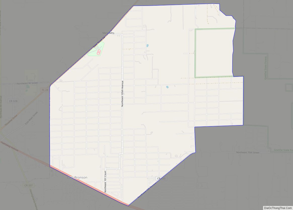
East Bronson is a census-designated place (CDP) in Levy County, Florida, United States. The population was 1,945 at the 2010 census. East Bronson CDP overview: Name: East Bronson CDP LSAD Code: 57 LSAD Description: CDP (suffix) State: Florida County: Levy County Total Area: 11.44 sq mi (29.63 km²) Land Area: 11.44 sq mi (29.63 km²) Water Area: 0.00 sq mi (0.00 km²) Total Population: … Read more

Map of Eagle Lake city

Map of Eagle Lake city, Florida

Eagle Lake is a city in Polk County, Florida, United States. The population was 2,255 at the 2010 census. It is part of the Lakeland–Winter Haven Metropolitan Statistical Area. Eagle Lake city overview: Name: Eagle Lake city LSAD Code: 25 LSAD Description: city (suffix) State: Florida County: Polk County Incorporated: 1921 Elevation: 171 ft (52 m) Total … Read more

Map of East Palatka CDP

Map of East Palatka CDP

East Palatka is a census-designated place (CDP) in Putnam County, Florida, United States. It is located on the east side of the City of Palatka at the intersection of U.S. Route 17/State Road 20/State Road 100 and the southwestern terminus of State Road 207. The population was 1,654 at the 2010 census. East Palatka is … Read more

Map of East Milton CDP

Map of East Milton CDP

East Milton is an unincorporated community and census-designated place in Santa Rosa County, Florida, United States. Its population was 11,074 as of the 2010 census. As its name indicates, the community is located on the east bank of the Blackwater River opposite Milton, and to the north of Navarre. East Milton CDP overview: Name: East … Read more

Map of East Lake CDP

Map of East Lake CDP

East Lake is a census-designated place (CDP) in Pinellas County, Florida, United States. The population was 30,962 at the 2010 census. It was one of the last areas in the densely populated county to develop. It is often confused with East Lake in neighboring Hillsborough County. East Lake CDP overview: Name: East Lake CDP LSAD … Read more

Map of Eatonville town

Map of Eatonville town, Florida

Eatonville is a town in Orange County, Florida, United States, six miles north of Orlando. It is part of Greater Orlando. Incorporated on August 15, 1887, it was one of the first self-governing all-black municipalities in the United States. The Eatonville Historic District and Moseley House Museum are in Eatonville. Author Zora Neale Hurston grew … Read more

Map of Eastpoint CDP

Map of Eastpoint CDP

Eastpoint is a census-designated place (CDP) in Franklin County, Florida, United States. The population was 2,337 at the 2010 census. Eastpoint CDP overview: Name: Eastpoint CDP LSAD Code: 57 LSAD Description: CDP (suffix) State: Florida County: Franklin County Elevation: 7 ft (2 m) Total Area: 7.47 sq mi (19.34 km²) Land Area: 7.44 sq mi (19.28 km²) Water Area: 0.02 sq mi (0.06 km²) Total Population: … Read more

Map of East Williston CDP

Map of East Williston CDP, Florida

East Williston is a census-designated place (CDP) in Levy County, Florida, United States. The population was 694 at the 2010 census. East Williston CDP overview: Name: East Williston CDP LSAD Code: 57 LSAD Description: CDP (suffix) State: Florida County: Levy County Total Area: 3.01 sq mi (7.79 km²) Land Area: 3.01 sq mi (7.79 km²) Water Area: 0.00 sq mi (0.00 km²) Total Population: … Read more

Map of Ebro town

Map of Ebro town, Florida

Ebro is a town in Washington County, Florida, United States. The population was 270 at the 2010 census. As of 2018, the population recorded by the U.S. Census Bureau is 275. It is believed that the Spanish named the town, as there is an Ebro River in Spain. Ebro town overview: Name: Ebro town LSAD … Read more

Map of Edgewood city, Florida

Map of Edgewood city, Florida

Edgewood is a city in Orange County, Florida, United States. The population was 2,503 at the 2010 census. It is part of the Orlando–Kissimmee–Sanford Metropolitan Statistical Area. Edgewood city overview: Name: Edgewood city LSAD Code: 25 LSAD Description: city (suffix) State: Florida County: Orange County Elevation: 89 ft (27 m) Total Area: 1.54 sq mi (3.98 km²) Land Area: 1.24 sq mi … Read more

Map of Edgewater city, Florida

Map of Edgewater city, Florida

Edgewater is a city in Volusia County, Florida, United States, situated along the Indian River, adjacent to the Mosquito Lagoon. As of the 2020 United States Census, the city had a population of 23,097. It is a part of the Deltona–Daytona Beach–Ormond Beach, FL metropolitan statistical area, which was home to 590,289 people in 2010. … Read more