Map of Kapolei CDP

Map of Kapolei CDP

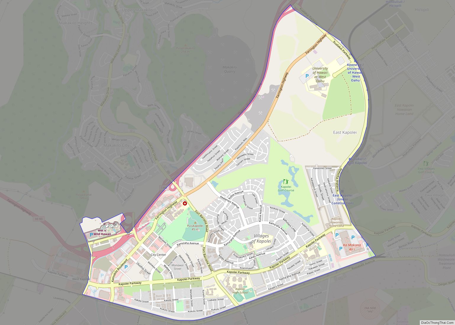
Kapolei (Hawaiian pronunciation: [kəpoˈlej]) is a planned community in Honolulu County, Hawaiʻi, United States, on the island of Oʻahu. It is colloquially known as the “second city” of Oʻahu, in relation to Honolulu. For statistical purposes, the United States Census Bureau has defined Kapolei as a census-designated place (CDP) within the consolidated city-county of Honolulu. The … Read more

Map of Kapalua CDP

Map of Kapalua CDP

Kapalua is a census-designated place (CDP) in Maui County, Hawaiʻi, United States. A resort development by the Maui Land & Pineapple Company extends inland from Kapalua Bay and Honolua Bay. The population was 495 at the 2020 census. Kapalua CDP overview: Name: Kapalua CDP LSAD Code: 57 LSAD Description: CDP (suffix) State: Hawaii County: Maui … Read more

Map of Keaau CDP

Map of Keaau CDP

Keaʻau (also written as Keaau) is a census-designated place (CDP) in Hawaiʻi County, Hawaii. located in the District of Puna. The population was 1,195 at the time of the 2020 census. The population decreased by 12.1% from 2,253 at the time of the 2010 census. Keaau CDP overview: Name: Keaau CDP LSAD Code: 57 LSAD … Read more

Map of Kawela Bay CDP

Map of Kawela Bay CDP

Kawela Bay is a census-designated place and small community in the Koʻolauloa District on the northern coast of the island of Oʻahu, City & County of Honolulu, Hawaii, United States. In Hawaiian, ka wela means “the heat”. As of the 2020 census, the CDP had a population of 325. Kawela Bay CDP overview: Name: Kawela … Read more

Map of Kaunakakai CDP

Map of Kaunakakai CDP

Kaunakakai (Hawaiian pronunciation: [kɐwnəkəˈkɐj]) is a census-designated place (CDP) in Maui County, Hawaiʻi, United States. It is the largest town on the island of Molokaʻi. The population was 3,419 at the 2020 census. It has the largest port on the island and the longest pier in Hawaii. The town was made famous in the 1930s by … Read more

Map of Keokea CDP

Map of Keokea CDP

Keokea (Hawaiian: Kēōkea) is an unincorporated community and census-designated place (CDP) on the island of Maui in Maui County, Hawaii, United States. It is situated on Hawaii State Highway 37 (the Kula Highway) at North Latitude 20.71 degrees, West Longitude 156.36 degrees. Its elevation is 2,860 feet (870 meters) above sea level. As of the … Read more

Map of Kekaha CDP

Map of Kekaha CDP

Kekaha (literally, “the place” in Hawaiian) is a census-designated place (CDP) in Kauaʻi County, Hawaiʻi, United States. The population was 3,715 at the 2020 census, up from 3,175 at the 2000 census. Kekaha CDP overview: Name: Kekaha CDP LSAD Code: 57 LSAD Description: CDP (suffix) State: Hawaii County: Kauai County Elevation: 10 ft (3 m) Total Area: … Read more

Map of Kealakekua CDP

Map of Kealakekua CDP

Kealakekua is a census-designated place (CDP) in Hawaiʻi County, Hawaiʻi, United States. The population was 2,019 at the 2010 census, up from 1,645 at the 2000 census. It was the subject of the 1933 popular song, “My Little Grass Shack in Kealakekua, Hawaii” by Bill Cogswell, Tommy Harrison and Johnny Noble, which became a Hawaiian … Read more

Map of Ko Olina CDP

Map of Ko Olina CDP

Ko Olina Resort is a 642-acre (2.60 km) master-planned vacation and residential community on the leeward coast of Oahu, 17 miles (27 km) west of Honolulu. Ko Olina has 2 miles (3.2 km) of coastal frontage and includes three natural and four man-made lagoons with white-sand beaches. The master-planned resort community, owned by Honolulu-based The Resort Group, is … Read more

Map of Kilauea CDP

Map of Kilauea CDP

Kīlauea is an unincorporated community and census-designated place (CDP) in Kauaʻi County, Hawaii, United States. As of the 2020 census it had a population of 3,014. Kīlauea shares the name of the active volcano Kīlauea on the island of Hawaii. The name translates to “spewing” or “much spreading” in the Hawaiian language. Kilauea CDP overview: … Read more

Map of Kihei CDP

Map of Kihei CDP

Kihei (Hawaiian: Kīhei, pronounced [tiːˈhɛj]) is a census-designated place (CDP) in Maui County, Hawaii, United States. The population was 21,423 at the 2020 census. Kihei CDP overview: Name: Kihei CDP LSAD Code: 57 LSAD Description: CDP (suffix) State: Hawaii County: Maui County Elevation: 10 ft (3 m) Total Area: 11.75 sq mi (30.42 km²) Land Area: 9.36 sq mi (24.25 km²) Water Area: 2.38 sq mi … Read more

Map of Kukuihaele CDP

Map of Kukuihaele CDP

Kukuihaele is a census-designated place (CDP) in Hawaiʻi County, Hawaiʻi, United States. The population was 281 at the 2020 census. Kukuihaele CDP overview: Name: Kukuihaele CDP LSAD Code: 57 LSAD Description: CDP (suffix) State: Hawaii County: Hawaii County Elevation: 730 ft (185 m) Total Area: 2.29 sq mi (5.94 km²) Land Area: 1.71 sq mi (4.44 km²) Water Area: 0.58 sq mi (1.50 km²) Total Population: … Read more