Map of Tilton village

Map of Tilton village

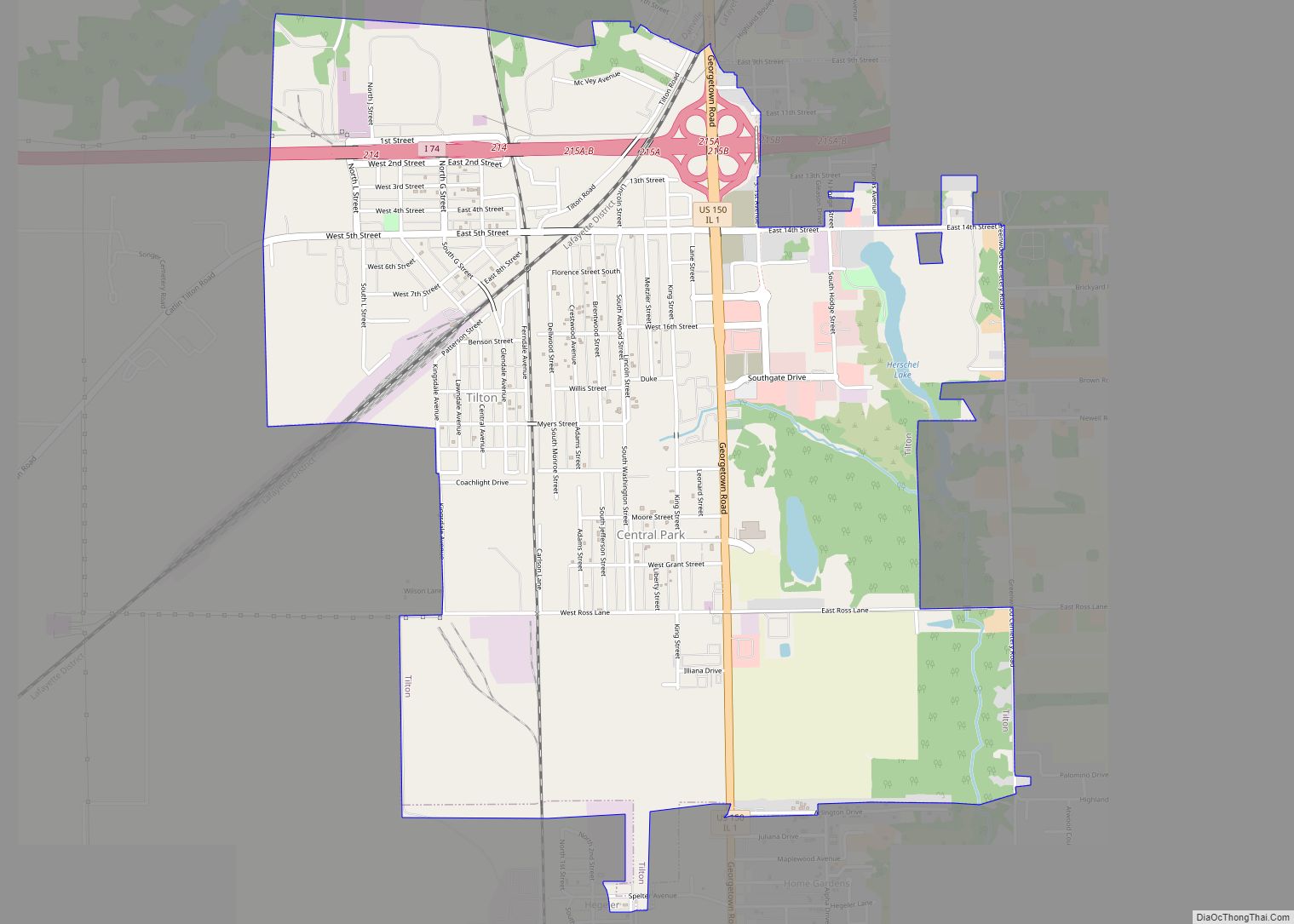
Tilton is a village in Danville Township, Vermilion County, Illinois, United States. It is part of the Danville, Illinois Metropolitan Statistical Area. The population is 3,300 in 2020. It is named after Charles Tilton, a friend of Abraham Lincoln, who worked for the railroads. Lincoln reputedly had Thanksgiving dinner at Tilton’s house in the village … Read more

Map of Tinley Park village

Map of Tinley Park village

Tinley Park (formerly Bremen) is a village in Cook County, Illinois, United States, with a small portion in Will County. The village is a suburb of Chicago. Per the 2020 census, the population was 55,971. It is one of the fastest growing suburbs southwest of Chicago. In 2009 BusinessWeek named Tinley as the best place … Read more

Map of Time village

Map of Time village

Time is a village in Pike County, Illinois, United States. The population was 29 at the 2000 census. Time village overview: Name: Time village LSAD Code: 47 LSAD Description: village (suffix) State: Illinois County: Pike County Elevation: 692 ft (211 m) Total Area: 0.25 sq mi (0.66 km²) Land Area: 0.25 sq mi (0.66 km²) Water Area: 0.00 sq mi (0.00 km²) Total Population: 26 Population … Read more

Map of Toledo village, Illinois

Map of Toledo village, Illinois

Toledo is a village in and the county seat of Cumberland County, Illinois, United States. The population was 1,161 at the 2020 census. Toledo is part of the Charleston–Mattoon Micropolitan Statistical Area. Toledo village overview: Name: Toledo village LSAD Code: 47 LSAD Description: village (suffix) State: Illinois County: Cumberland County Elevation: 600 ft (200 m) Total Area: … Read more

Map of Tiskilwa village

Map of Tiskilwa village

Tiskilwa is a village in Bureau County, Illinois, United States. The population was 740 at the 2020 census. It is part of the Ottawa Micropolitan Statistical Area. Exelon Wind, a division of Exelon Power, owns and operates the Illinois Wind AgriWind Project in Tiskilwa. Tiskilwa village overview: Name: Tiskilwa village LSAD Code: 47 LSAD Description: … Read more

Map of Tolono village

Map of Tolono village

Tolono is a village in Tolono Township, Champaign County, Illinois, United States. The population was 3,604 at the 2020 census. Its name was fabricated by J.B. Calhoun, land commission of the Illinois Central Railroad, who wrote about it simply: “[I] placed the vowel o three times, thus o-o-o, and filling in with the consonants t-l-n.” … Read more

Map of Toluca city

Map of Toluca city

Toluca is a city in Marshall County, Illinois, United States. The population was 1,340 at the 2020 census. It is part of the Peoria, Illinois, Metropolitan Statistical Area. Toluca city overview: Name: Toluca city LSAD Code: 25 LSAD Description: city (suffix) State: Illinois County: Marshall County Elevation: 696 ft (212 m) Total Area: 1.06 sq mi (2.75 km²) Land Area: … Read more

Map of Topeka city

Map of Topeka village, Illinois

Topeka is an incorporated town in Mason County, Illinois, United States. The population was 60 at the 2020 census. Topeka village overview: Name: Topeka village LSAD Code: 47 LSAD Description: village (suffix) State: Illinois County: Mason County Incorporated: April 10, 1869 (1869-04-10) Elevation: 476 ft (145 m) Total Area: 0.14 sq mi (0.35 km²) Land Area: 0.14 sq mi (0.35 km²) Water Area: 0.00 sq mi (0.00 km²) Total … Read more

Map of Tonica village

Map of Tonica village

Tonica is a village in LaSalle County, Illinois, United States. The population was 749 at the 2020 census, down from 768 at the 2010 census. It is part of the Ottawa Micropolitan Statistical Area. Tonica village overview: Name: Tonica village LSAD Code: 47 LSAD Description: village (suffix) State: Illinois County: LaSalle County Elevation: 666 ft (203 m) … Read more

Map of Tovey village

Map of Tovey village

Tovey is a village in Christian County, Illinois, United States. The town’s population was 464 at the 2020 census. Tovey village overview: Name: Tovey village LSAD Code: 47 LSAD Description: village (suffix) State: Illinois County: Christian County Elevation: 600 ft (200 m) Total Area: 0.22 sq mi (0.58 km²) Land Area: 0.22 sq mi (0.58 km²) Water Area: 0.00 sq mi (0.00 km²) Total Population: 464 … Read more

Map of Toulon city

Map of Toulon city

Toulon is a city in Stark County, Illinois, United States. The population was 1,292 at the 2010 census. It is the county seat of Stark County. Toulon is part of the Peoria, Illinois Metropolitan Statistical Area, and is the northwestern terminus of the Rock Island Trail State Park. Toulon city overview: Name: Toulon city LSAD … Read more

Map of Tower Hill village

Map of Tower Hill village

Tower Hill is a village in Shelby County, Illinois, United States. The population was 611 at the 2010 census. Tower Hill village overview: Name: Tower Hill village LSAD Code: 47 LSAD Description: village (suffix) State: Illinois County: Shelby County Elevation: 653 ft (199 m) Total Area: 1.00 sq mi (2.60 km²) Land Area: 1.00 sq mi (2.60 km²) Water Area: 0.00 sq mi (0.00 km²) Total … Read more