Map of Reddick village, Illinois

Map of Reddick village, Illinois

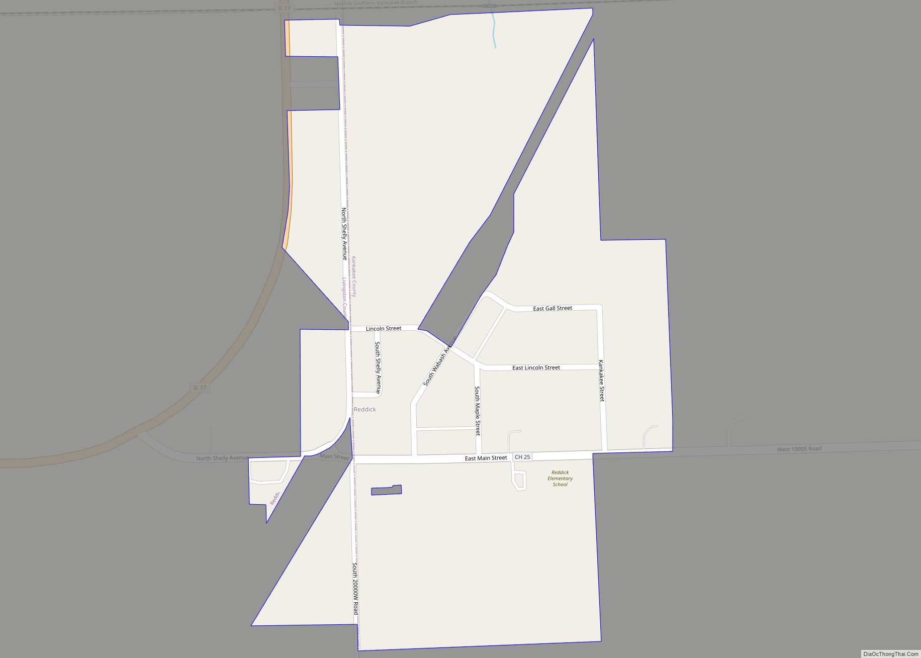
Reddick is a village in Kankakee County, Illinois, United States. A small portion of the village extends into Livingston County. The population was 163 at the 2010 census, down from 219 at the 2000 census. The Kankakee County portion of Reddick is included in the Kankakee–Bradley, Illinois Metropolitan Statistical Area, while the small Livingston County … Read more

Map of Reynolds village, Illinois

Map of Reynolds village, Illinois

Reynolds is a village mainly in Rock Island County in the U.S. state of Illinois. The population was 498 at the 2020 census. A small portion on the south side is in Mercer County. The village was founded in 1876. Reynolds village overview: Name: Reynolds village LSAD Code: 47 LSAD Description: village (suffix) State: Illinois … Read more

Map of Rentchler CDP

Map of Rentchler CDP

Rentchler is a census-designated place in St. Clair County, Illinois, United States. Its population was 34 as of the 2010 census. Rentchler CDP overview: Name: Rentchler CDP LSAD Code: 57 LSAD Description: CDP (suffix) State: Illinois County: St. Clair County Elevation: 453 ft (138 m) Total Area: 0.31 sq mi (0.81 km²) Land Area: 0.31 sq mi (0.81 km²) Water Area: 0.00 sq mi (0.00 km²) … Read more

Map of Richton Park village

Map of Richton Park village

Richton Park is a village and a southern suburb of Chicago in Cook County, Illinois, United States. The population was 12,775 at the 2020 census. The community was named after a Richton in Vermont, the native home of a first settler. Richton Park village overview: Name: Richton Park village LSAD Code: 47 LSAD Description: village … Read more

Map of Richmond village, Illinois

Map of Richmond village, Illinois

Richmond is a village in McHenry County, Illinois, United States, 46 miles northwest of Chicago. It is a commuter village within the Chicago metropolitan area. The population was 2,089 at the 2020 census. Richmond village overview: Name: Richmond village LSAD Code: 47 LSAD Description: village (suffix) State: Illinois County: McHenry County Total Area: 4.29 sq mi (11.11 km²) … Read more

Map of Ridge Farm village

Map of Ridge Farm village

Ridge Farm is a village in Elwood Township, Vermilion County, Illinois, United States. It is part of the Danville, Illinois Metropolitan Statistical Area. The population was 940 at the 2020 census. Ridge Farm village overview: Name: Ridge Farm village LSAD Code: 47 LSAD Description: village (suffix) State: Illinois County: Vermilion County Elevation: 705 ft (215 m) Total … Read more

Map of Richview village

Map of Richview village

Richview is a village in Washington County, Illinois, United States. The population was 253 at the 2010 census. Richview village overview: Name: Richview village LSAD Code: 47 LSAD Description: village (suffix) State: Illinois County: Washington County Elevation: 538 ft (164 m) Total Area: 1.15 sq mi (2.97 km²) Land Area: 1.15 sq mi (2.97 km²) Water Area: 0.00 sq mi (0.00 km²) Total Population: 238 Population … Read more

Map of Ridott village

Map of Ridott village

Ridott is a village in Stephenson County, Illinois, United States. As of the 2010 census, the village population was 164, up from 158 in 2000. Ridott village overview: Name: Ridott village LSAD Code: 47 LSAD Description: village (suffix) State: Illinois County: Stephenson County Elevation: 758 ft (231 m) Total Area: 0.07 sq mi (0.19 km²) Land Area: 0.07 sq mi (0.19 km²) Water … Read more

Map of Ridgway village, Illinois

Map of Ridgway village, Illinois

Ridgway is a village in Gallatin County, Illinois, United States. As of the 2020 census, the population was 851. As of 2018, Rebecca Mitchell was the town mayor. Ridgway village overview: Name: Ridgway village LSAD Code: 47 LSAD Description: village (suffix) State: Illinois County: Gallatin County Elevation: 374 ft (114 m) Total Area: 0.88 sq mi (2.28 km²) Land Area: … Read more

Map of Rio village, Illinois

Map of Rio village, Illinois

Rio is a village in Knox County, Illinois, United States. The population was 220 at the 2010 census. It is part of the Galesburg Micropolitan Statistical Area. Rio is pronounced “Rye-Oh”. Rio village overview: Name: Rio village LSAD Code: 47 LSAD Description: village (suffix) State: Illinois County: Knox County Elevation: 781 ft (238 m) Total Area: 0.31 sq mi … Read more

Map of Ringwood village

Map of Ringwood village, Illinois

Ringwood is a northwest suburban village in McHenry County, Illinois, United States. It is a commuter village, part of the Chicago metropolitan area. The population was 844 at the 2020 census. Ringwood village overview: Name: Ringwood village LSAD Code: 47 LSAD Description: village (suffix) State: Illinois County: McHenry County Founded: 1994 Elevation: 858 ft (262 m) Total … Read more

Map of River Forest village

Map of River Forest village, Illinois

River Forest is a suburban village adjacent to Chicago in Cook County, Illinois, United States. Per the 2020 census, the population was 11,717. Two universities make their home in River Forest, Dominican University and Concordia University Chicago. The village is closely tied to the larger neighboring community of Oak Park. There are significant architectural designs … Read more