Map of Lubec CDP

Map of Lubec CDP

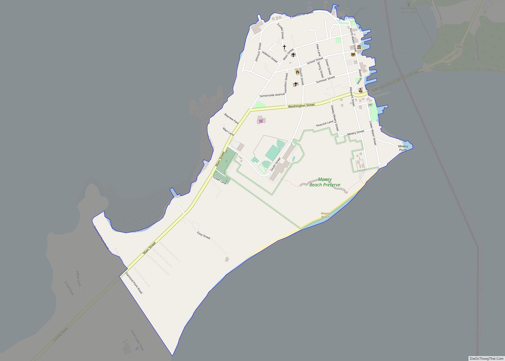
Lubec (/luːˈbɛk/ loo-BEK) is a town in Washington County, Maine, United States. It is the easternmost municipality in the contiguous U.S. (see extreme points of the United States) and is the country’s closest continental location to Africa. The town, with a population of 1,237 at the 2020 census, is home to Quoddy Head State Park. … Read more

Map of Livermore Falls CDP

Map of Livermore Falls CDP

Livermore Falls is a census-designated place (CDP) in the town of Livermore Falls in Androscoggin County, Maine, United States. The population of the CDP was 1,594 at the 2010 census, out of a population of 3,187 within the full town. Livermore Falls CDP overview: Name: Livermore Falls CDP LSAD Code: 57 LSAD Description: CDP (suffix) … Read more

Map of Mapleton CDP, Maine

Map of Mapleton CDP, Maine

Mapleton is a census-designated place (CDP) comprising the main village within the town of Mapleton in Aroostook County, Maine, United States. The population of the CDP was 683 at the 2010 census, out of a population of 1,948 for the entire town. Mapleton CDP overview: Name: Mapleton CDP LSAD Code: 57 LSAD Description: CDP (suffix) … Read more

Map of Madison CDP, Maine

Map of Madison CDP, Maine

Madison is a census-designated place (CDP) in the town of Madison in Somerset County, Maine, United States. The population was 2,733 at the 2000 census. Madison CDP overview: Name: Madison CDP LSAD Code: 57 LSAD Description: CDP (suffix) State: Maine County: Somerset County Elevation: 302 ft (92 m) Total Area: 6.71 sq mi (17.38 km²) Land Area: 6.43 sq mi (16.65 km²) Water … Read more

Map of Madawaska CDP

Map of Madawaska CDP

Madawaska is a census-designated place (CDP) comprising the main village within the town of Madawaska in Aroostook County, Maine, United States. The population of the CDP was 2,967 at the 2010 census, out of a population of 4,035 for the entire town. Madawaska CDP overview: Name: Madawaska CDP LSAD Code: 57 LSAD Description: CDP (suffix) … Read more

Map of Mechanic Falls CDP

Map of Mechanic Falls CDP

Mechanic Falls is a census-designated place (CDP) in the town of Mechanic Falls in Androscoggin County, Maine, United States. The population of the CDP was 2,237 at the 2010 census, out of a total town population of 3,031. Mechanic Falls CDP overview: Name: Mechanic Falls CDP LSAD Code: 57 LSAD Description: CDP (suffix) State: Maine … Read more

Map of Mars Hill CDP

Map of Mars Hill CDP, Maine

Mars Hill is a census-designated place (CDP) comprising the main village within the town of Mars Hill in Aroostook County, Maine, United States. The population of the CDP was 980 at the 2010 census, out of a population of 1,493 for the entire town. Prior to 2010, the village was part of the Mars Hill-Blaine … Read more

Map of Mexico CDP, Maine

Map of Mexico CDP, Maine

Mexico is a census-designated place (CDP) in the town of Mexico in Oxford County, Maine, United States. The population was 1,946 at the 2000 census. Mexico CDP overview: Name: Mexico CDP LSAD Code: 57 LSAD Description: CDP (suffix) State: Maine County: Oxford County Elevation: 479 ft (146 m) Total Area: 1.83 sq mi (4.73 km²) Land Area: 1.77 sq mi (4.58 km²) Water … Read more

Map of Milo CDP, Maine

Map of Milo CDP, Maine

Milo is a census-designated place (CDP) in the town of Milo in Piscataquis County, Maine, United States. The population was 1,898 at the 2000 census. Milo CDP overview: Name: Milo CDP LSAD Code: 57 LSAD Description: CDP (suffix) State: Maine County: Piscataquis County Elevation: 318 ft (97 m) Total Area: 8.06 sq mi (20.86 km²) Land Area: 7.75 sq mi (20.07 km²) Water … Read more

Map of Millinocket CDP

Map of Millinocket CDP

Millinocket is a census-designated place (CDP) comprising most of the developed land within the town of Millinocket in Penobscot County, Maine, United States. The population of the CDP was 4,466 at the 2010 census. Millinocket CDP overview: Name: Millinocket CDP LSAD Code: 57 LSAD Description: CDP (suffix) State: Maine County: Penobscot County Elevation: 371 ft (113 m) … Read more

Map of Milford CDP, Maine

Map of Milford CDP, Maine

Milford is a census-designated place (CDP) consisting of the main area of settlement within the town of Milford in Penobscot County, Maine, United States. The population was 2,233 at the 2010 census. Milford CDP overview: Name: Milford CDP LSAD Code: 57 LSAD Description: CDP (suffix) State: Maine County: Penobscot County Elevation: 135 ft (41 m) Total Area: … Read more

Map of Newport CDP, Maine

Map of Newport CDP, Maine

Newport is a census-designated place (CDP) consisting of the main area of settlement within the town of Newport in Penobscot County, Maine, United States. The population of the CDP was 1,776 at the 2010 census. Newport CDP overview: Name: Newport CDP LSAD Code: 57 LSAD Description: CDP (suffix) State: Maine County: Penobscot County Elevation: 207 ft … Read more