Map of Ypsilanti city

Map of Ypsilanti city, Michigan

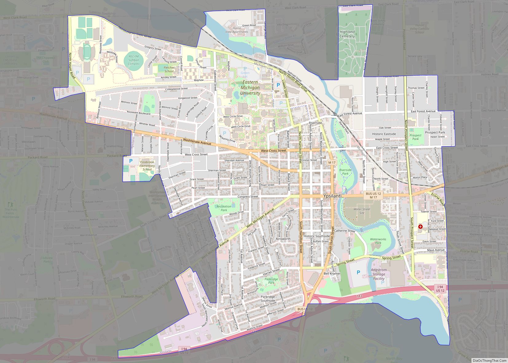
Ypsilanti (/ˌɪpsɪˈlænti/), commonly shortened to Ypsi, is a city in Washtenaw County in the U.S. state of Michigan, best known as the home of Eastern Michigan University. As of the 2020 census, the city’s population was 20,648. The city is bounded to the north by Superior Township and on the west, south, and east by … Read more

Map of Yale city, Michigan

Map of Yale city, Michigan

Yale is a city in St. Clair County in the U.S. state of Michigan. The population was 1,955 at the 2010 census. Yale is considered unofficially as the Bologna Capital of the world, in part due to its Yale Bologna Festival, which began in 1989. Yale bologna is sold in grocery stores throughout the area. … Read more

Map of Wyoming city, Michigan

Map of Wyoming city, Michigan

Wyoming city overview: Name: Wyoming city LSAD Code: 25 LSAD Description: city (suffix) State: Michigan County: Kent County Incorporated: 1959 Elevation: 666 ft (203 m) Total Area: 24.95 sq mi (64.62 km²) Land Area: 24.74 sq mi (64.08 km²) Water Area: 0.21 sq mi (0.54 km²) Total Population: 76,501 Population Density: 3,092.07/sq mi (1,193.84/km²) Area code: 616 FIPS code: 2688940 GNISfeature ID: 1627295 Online Interactive Map Wyoming … Read more

Map of Wyandotte city

Map of Wyandotte city, Michigan

Wyandotte (/ˈwaɪəndɒt/ WY-ən-dot) is a city in Wayne County in the U.S. state of Michigan. The population was 25,058 at the 2020 census. Wyandotte is located in southeastern Michigan, approximately 11 miles (18 km) south of Detroit on the Detroit River, and it is part of the collection of communities known as Downriver. Wyandotte is bounded … Read more

Map of Zilwaukee city

Map of Zilwaukee city

Zilwaukee is a city in Saginaw County in the U.S. state of Michigan. The 2020 census places the population at 1,534. The city is adjacent to and was created from Zilwaukee Township. It is the home of the Zilwaukee Bridge. Zilwaukee city overview: Name: Zilwaukee city LSAD Code: 25 LSAD Description: city (suffix) State: Michigan … Read more

Map of Zeeland city

Map of Zeeland city, Michigan

Zeeland (/ˈziːlənd/ ZEE-lənd) is a city in Ottawa County in the U.S. state of Michigan. The population was 5,719 at the 2020 census. The city is located at the western edge of Zeeland Charter Township. Its name is taken from the Dutch province of Zeeland. Zeeland city overview: Name: Zeeland city LSAD Code: 25 LSAD … Read more