Map of Baring city

Map of Baring city, Missouri

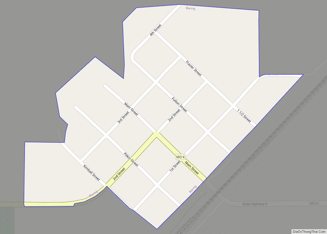
Baring is a city in northern Knox County, Missouri, United States. As of the 2020 census, its population is 125. Baring is located on the Burlington Northern and Santa Fe railroad’s mainline between Chicago and Los Angeles, which can carry heavy mixed freight and intermodal traffic, as well as Amtrak’s Southwest Chief passenger train. Baring … Read more

Map of Ballwin city

Map of Ballwin city

Ballwin is a western suburb of St. Louis, located in St. Louis County, Missouri, United States. The population was 31,103 as of the 2020 census. Ballwin city overview: Name: Ballwin city LSAD Code: 25 LSAD Description: city (suffix) State: Missouri County: St. Louis County Incorporated: December 29, 1950 Elevation: 623 ft (190 m) Total Area: 8.98 sq mi (23.26 km²) … Read more

Map of Bates City city

Map of Bates City

Bates City is a city in western Lafayette County, Missouri, and is part of the Kansas City metropolitan area within the United States. The population was 219 at the 2010 census. Bates City overview: Name: Bates City LSAD Code: 25 LSAD Description: city (suffix) State: Missouri County: Lafayette County Elevation: 810 ft (250 m) Total Area: 1.13 sq mi … Read more

Map of Barnhart CDP

Map of Barnhart CDP

Barnhart is a census-designated place (CDP) in Jefferson County, Missouri, United States. Barnhart is also a suburb of St. Louis Barnhart CDP overview: Name: Barnhart CDP LSAD Code: 57 LSAD Description: CDP (suffix) State: Missouri County: Jefferson County Elevation: 554 ft (169 m) Total Area: 5.26 sq mi (13.62 km²) Land Area: 5.10 sq mi (13.21 km²) Water Area: 0.16 sq mi (0.41 km²) Total Population: … Read more

Map of Barnett city

Map of Barnett city

Barnett is a city in Morgan County, Missouri, United States. The population was 203 at the 2010 census. Barnett city overview: Name: Barnett city LSAD Code: 25 LSAD Description: city (suffix) State: Missouri County: Morgan County Elevation: 974 ft (297 m) Total Area: 0.27 sq mi (0.71 km²) Land Area: 0.27 sq mi (0.71 km²) Water Area: 0.00 sq mi (0.00 km²) Total Population: 158 Population … Read more

Map of Bel-Ridge village

Map of Bel-Ridge village

Bel-Ridge is a suburban city in northern St. Louis County, Missouri, United States. The population was 2,737 at the 2010 census. Bel-Ridge is part of the Normandy Schools Collaborative. Bel-Ridge became a city in 2015 by a vote of the voters. Bel-Ridge village overview: Name: Bel-Ridge village LSAD Code: 47 LSAD Description: village (suffix) State: … Read more

Map of Bel-Nor village

Map of Bel-Nor village

Bel-Nor is a northwestern suburban city of St. Louis in St. Louis County, Missouri, United States. The population was 1,499 as of the 2010 census. In April 2015, the residents of Bel-Nor voted to become a city. Bel-Nor village overview: Name: Bel-Nor village LSAD Code: 47 LSAD Description: village (suffix) State: Missouri County: St. Louis … Read more

Map of Battlefield city

Map of Battlefield city

Battlefield is a city in Greene County, Missouri, United States. As of the 2020 census, the city’s population was 5,990. It is part of the Springfield, Missouri Metropolitan Statistical Area. The town has no post office and shares the ZIP code (65619) with Brookline. Battlefield city overview: Name: Battlefield city LSAD Code: 25 LSAD Description: … Read more

Map of Belle city

Map of Belle city, Missouri

Belle is a city in northeast Maries County and extending north into southeast Osage County in the U.S. state of Missouri. The population was 1,381 at the 2020 census. The Osage County portion of Belle is part of the Jefferson City, Missouri Metropolitan Statistical Area. Belle city overview: Name: Belle city LSAD Code: 25 LSAD … Read more

Map of Bella Villa city

Map of Bella Villa city

Bella Villa is a city in St. Louis County, Missouri, in the United States. As of the 2010 census, the city population was 729. Bella Villa city overview: Name: Bella Villa city LSAD Code: 25 LSAD Description: city (suffix) State: Missouri County: St. Louis County Incorporated: May 26, 1947 Elevation: 456 ft (139 m) Total Area: 0.13 sq mi … Read more

Map of Bell City city

Map of Bell City

Bell City is a city in northeastern Stoddard County, Missouri, United States. It was founded as a sawmill town circa 1900, and lies at the foothills of Crowley’s Ridge on Missouri Route 91. The population was 448 at the 2010 census. Dorothy Burton is the current mayor. Bell City overview: Name: Bell City LSAD Code: … Read more

Map of Bellerive Acres city

Map of Bellerive Acres city

Bellerive Acres city overview: Name: Bellerive Acres city LSAD Code: 25 LSAD Description: city (suffix) State: Missouri FIPS code: 2904248 Online Interactive Map Bellerive Acres online map. Source: Basemap layers from Google Map, Open Street Map (OSM), Arcgisonline, Wmflabs. Boundary Data from Database of Global Administrative Areas. Bellerive Acres location map. Where is Bellerive Acres … Read more