Map of Kansas City, Missouri

Map of Kansas City, Missouri

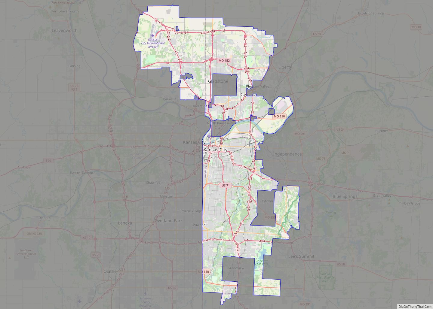
Kansas City, Missouri (KC or KCMO) is the largest city in Missouri by population and area. As of the 2020 census, the city had a population of 508,090 in 2020, making it the 36th most-populous city in the United States. It is the central city of the Kansas City metropolitan area, which straddles the Missouri–Kansas … Read more

Map of Columbia city, Missouri

Map of Columbia city, Missouri

Columbia /kəˈlʌmbiə/ is a city in the U.S. state of Missouri. It is the county seat of Boone County and home to the University of Missouri. Founded in 1821, it is the principal city of the five-county Columbia metropolitan area. It is Missouri’s fourth most-populous and fastest growing city, with an estimated 128,555 residents in … Read more

Map of Florida village

Map of Florida village, Missouri

Florida village overview: Name: Florida village LSAD Code: 47 LSAD Description: village (suffix) State: Missouri County: Monroe County FIPS code: 2924760 Online Interactive Map Florida online map. Source: Basemap layers from Google Map, Open Street Map (OSM), Arcgisonline, Wmflabs. Boundary Data from Database of Global Administrative Areas. Florida location map. Where is Florida village? Florida … Read more

Map of Adrian city, Missouri

Map of Adrian city, Missouri

Adrian is a city in northern Bates County, Missouri, U.S. It is part of the Kansas City metropolitan area. The population was 1,677 at the 2010 census. Adrian city overview: Name: Adrian city LSAD Code: 25 LSAD Description: city (suffix) State: Missouri County: Bates County Incorporated: 1880 Elevation: 846 ft (258 m) Total Area: 1.76 sq mi (4.55 km²) Land … Read more

Map of Agency village, Missouri

Map of Agency village, Missouri

Agency is a village in Buchanan County, Missouri, United States. The population was 684 at the 2010 census. It is part of the St. Joseph, MO–KS Metropolitan Statistical Area. Agency village overview: Name: Agency village LSAD Code: 47 LSAD Description: village (suffix) State: Missouri County: Buchanan County Incorporated: 1903 Elevation: 896 ft (273 m) Total Area: 3.73 sq mi … Read more

Map of Affton CDP

Map of Affton CDP

Affton is a census-designated place (CDP) in south St. Louis County, Missouri, United States, near St. Louis. The population was 20,417 at the 2020 United States Census. Affton CDP overview: Name: Affton CDP LSAD Code: 57 LSAD Description: CDP (suffix) State: Missouri County: St. Louis County Elevation: 558 ft (170 m) Total Area: 4.57 sq mi (11.84 km²) Land Area: … Read more

Map of Advance city, Missouri

Map of Advance city, Missouri

Advance is a city located at the intersection of State Highway 25 and State Highway 91/Route C in northern Stoddard County, Missouri, United States. The population was 1,347 at the 2010 census. Advance was founded circa 1882. The town is pronounced ADD-vance. Advance city overview: Name: Advance city LSAD Code: 25 LSAD Description: city (suffix) … Read more

Map of Albany city, Missouri

Map of Albany city, Missouri

Albany is a city and county seat of Gentry County, Missouri, United States. With an annual growth rate of -0.30%. The population was 1,679 at the 2020 census. Albany city overview: Name: Albany city LSAD Code: 25 LSAD Description: city (suffix) State: Missouri County: Gentry County Incorporated: 1845 Elevation: 899 ft (274 m) Total Area: 2.44 sq mi (6.33 km²) … Read more