Map of Parnell city, Missouri

Map of Parnell city, Missouri

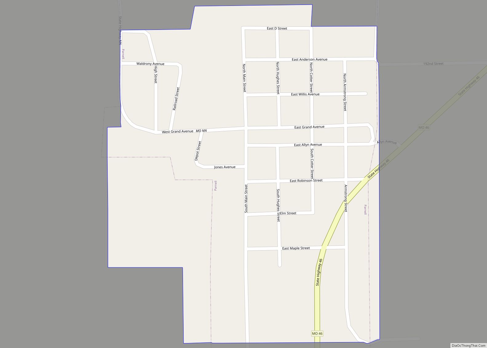
Parnell is a city in northeast Nodaway County, Missouri, United States, near the Platte River. The population was 191 at the 2010 Census. It was home to the father-son horse trainers Ben and Jimmy Jones, whose horses won eight Kentucky Derbies and two Triple Crowns. Parnell city overview: Name: Parnell city LSAD Code: 25 LSAD … Read more

Map of Parma city, Missouri

Map of Parma city, Missouri

Parma is a city in New Madrid County, Missouri, United States. The population was 713 at the 2010 census. Parma city overview: Name: Parma city LSAD Code: 25 LSAD Description: city (suffix) State: Missouri County: New Madrid County Elevation: 282 ft (86 m) Total Area: 0.64 sq mi (1.65 km²) Land Area: 0.64 sq mi (1.65 km²) Water Area: 0.00 sq mi (0.00 km²) Total Population: … Read more

Map of Pascola village

Map of Pascola village

Pascola is a village in Pemiscot County, Missouri, United States. The population was 108 at the 2010 census. Pascola village overview: Name: Pascola village LSAD Code: 47 LSAD Description: village (suffix) State: Missouri County: Pemiscot County Elevation: 266 ft (81 m) Total Area: 0.16 sq mi (0.41 km²) Land Area: 0.16 sq mi (0.41 km²) Water Area: 0.00 sq mi (0.00 km²) Total Population: 87 Population … Read more

Map of Pasadena Park village

Map of Pasadena Park village

Pasadena Park is a village in St. Louis County, Missouri, United States. The population was 470 at the 2010 census. It is part of the Normandy School District, and is distinct from the city of Pasadena Hills. Pasadena Park village overview: Name: Pasadena Park village LSAD Code: 47 LSAD Description: village (suffix) State: Missouri County: … Read more

Map of Passaic town

Map of Passaic town, Missouri

Passaic is a town in Bates County, Missouri, and is part of the Kansas City metropolitan area within the United States. Passaic town overview: Name: Passaic town LSAD Code: 43 LSAD Description: town (suffix) State: Missouri County: Bates County Elevation: 869 ft (265 m) Total Area: 0.07 sq mi (0.18 km²) Land Area: 0.07 sq mi (0.18 km²) Water Area: 0.00 sq mi (0.00 km²) Total … Read more

Map of Peaceful Village village

Map of Peaceful Village village

Peaceful Village village overview: Name: Peaceful Village village LSAD Code: 47 LSAD Description: village (suffix) State: Missouri County: Jefferson County FIPS code: 2956620 Online Interactive Map Peaceful Village online map. Source: Basemap layers from Google Map, Open Street Map (OSM), Arcgisonline, Wmflabs. Boundary Data from Database of Global Administrative Areas. Peaceful Village location map. Where … Read more

Map of Paynesville village, Missouri

Map of Paynesville village, Missouri

Paynesville is a village in Pike County, Missouri, United States. The population was 77 at the 2010 census. Paynesville village overview: Name: Paynesville village LSAD Code: 47 LSAD Description: village (suffix) State: Missouri County: Pike County Elevation: 535 ft (163 m) Total Area: 0.26 sq mi (0.68 km²) Land Area: 0.26 sq mi (0.68 km²) Water Area: 0.00 sq mi (0.00 km²) Total Population: 60 Population … Read more

Map of Pattonsburg city

Map of Pattonsburg city

Pattonsburg is a city in northwest Daviess County, Missouri, United States. The population was 314 at the 2020 census. Pattonsburg city overview: Name: Pattonsburg city LSAD Code: 25 LSAD Description: city (suffix) State: Missouri County: Daviess County Elevation: 860 ft (260 m) Total Area: 0.61 sq mi (1.57 km²) Land Area: 0.61 sq mi (1.57 km²) Water Area: 0.00 sq mi (0.00 km²) Total Population: 314 … Read more

Map of Penermon village

Map of Penermon village

Penermon is a village in Stoddard County, Missouri, United States. The population was 64 at the 2010 census. Penermon village overview: Name: Penermon village LSAD Code: 47 LSAD Description: village (suffix) State: Missouri County: Stoddard County Elevation: 295 ft (90 m) Total Area: 0.21 sq mi (0.55 km²) Land Area: 0.21 sq mi (0.55 km²) Water Area: 0.00 sq mi (0.00 km²) Total Population: 51 Population … Read more

Map of Pendleton village, Missouri

Map of Pendleton village, Missouri

Pendleton is an incorporated village in Warren County, Missouri, United States. The population was 43 at the 2010 census. Pendleton village overview: Name: Pendleton village LSAD Code: 47 LSAD Description: village (suffix) State: Missouri County: Warren County Total Area: 0.30 sq mi (0.79 km²) Land Area: 0.30 sq mi (0.79 km²) Water Area: 0.00 sq mi (0.00 km²) Total Population: 34 Population Density: 111.48/sq mi … Read more

Map of Peculiar city

Map of Peculiar city

Peculiar is a city in Cass County, Missouri and is part of the Kansas City metropolitan area within the United States. The population was 4,608 at the 2010 census. The town motto is “Where the ‘odds’ are with you.” Peculiar city overview: Name: Peculiar city LSAD Code: 25 LSAD Description: city (suffix) State: Missouri County: … Read more

Map of Pevely city

Map of Pevely city

Pevely is a city in Jefferson County, Missouri, United States, and is also a suburb of St. Louis. The population was 6,107, at the 2020 United States Census. Pevely city overview: Name: Pevely city LSAD Code: 25 LSAD Description: city (suffix) State: Missouri County: Jefferson County Incorporated: 1953 Elevation: 449 ft (137 m) Total Area: 4.96 sq mi (12.85 km²) … Read more