Map of Purdin city

Map of Purdin city

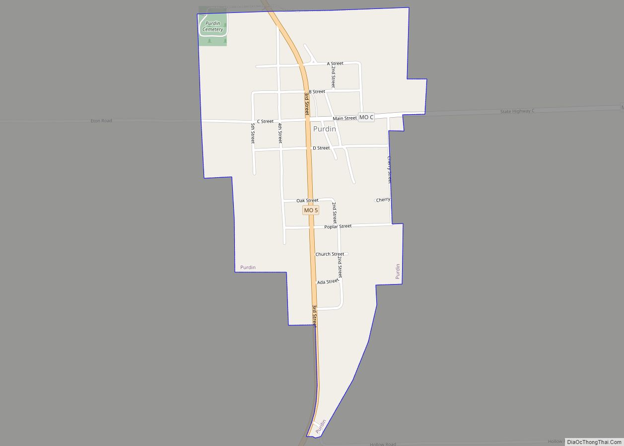
Purdin is a city in northwest Linn County, Missouri, United States. The population was 141 at the 2020 census. Purdin city overview: Name: Purdin city LSAD Code: 25 LSAD Description: city (suffix) State: Missouri County: Linn County Elevation: 869 ft (265 m) Total Area: 0.31 sq mi (0.80 km²) Land Area: 0.31 sq mi (0.79 km²) Water Area: 0.00 sq mi (0.00 km²) Total Population: 141 … Read more

Map of Purcell city

Map of Purcell city, Missouri

Purcell is a city in Jasper County, Missouri, United States. As of the 2020 census, the city population was 318. Purcell city overview: Name: Purcell city LSAD Code: 25 LSAD Description: city (suffix) State: Missouri County: Jasper County Elevation: 938 ft (286 m) Total Area: 0.43 sq mi (1.13 km²) Land Area: 0.43 sq mi (1.13 km²) Water Area: 0.00 sq mi (0.00 km²) Total Population: … Read more

Map of Quitman CDP, Missouri

Map of Quitman CDP, Missouri

Quitman is an unincorporated community in west central Nodaway County, Missouri, United States. The population was 45 at the 2010 census. Quitman CDP overview: Name: Quitman CDP LSAD Code: 57 LSAD Description: CDP (suffix) State: Missouri County: Nodaway County Elevation: 965 ft (294 m) Total Area: 0.16 sq mi (0.41 km²) Land Area: 0.16 sq mi (0.41 km²) Water Area: 0.00 sq mi (0.00 km²) Total … Read more

Map of Queen City city

Map of Queen City, Missouri

Queen City is a city in Schuyler County, Missouri, United States. As of the 2020 census, its population was 562. It is part of the Kirksville Micropolitan Statistical Area. Queen City overview: Name: Queen City LSAD Code: 25 LSAD Description: city (suffix) State: Missouri County: Schuyler County Elevation: 997 ft (304 m) Total Area: 1.03 sq mi (2.67 km²) Land … Read more

Map of Puxico city

Map of Puxico city

Puxico is a city in Stoddard County, Missouri, United States. The population was 881 at the 2010 census. Puxico city overview: Name: Puxico city LSAD Code: 25 LSAD Description: city (suffix) State: Missouri County: Stoddard County Elevation: 374 ft (114 m) Total Area: 0.67 sq mi (1.75 km²) Land Area: 0.67 sq mi (1.73 km²) Water Area: 0.01 sq mi (0.02 km²) Total Population: 873 Population … Read more

Map of Ravanna CDP

Map of Ravanna CDP

Ravanna is a census-designated place in Mercer County, Missouri, United States. It is located approximately seven miles northeast of Princeton on U.S. Route 136. The population was 60 at the 2020 census. Ravanna was platted in 1857. A variant name was “Sonoma”. A post office called Sonoma was established in 1855, the name was changed … Read more

Map of Randolph village, Missouri

Map of Randolph village, Missouri

Randolph is a city in Clay County, Missouri, United States. The population was 57 at the 2020 census. It is completely surrounded by Kansas City and is a part of the Kansas City metropolitan area. Randolph village overview: Name: Randolph village LSAD Code: 47 LSAD Description: village (suffix) State: Missouri County: Clay County Elevation: 758 ft … Read more

Map of Qulin city

Map of Qulin city

Qulin /ˈkjuːlɪn/ KEW-lin is a city located in Butler County in Southeast Missouri, United States. The population was 460 at the 2020 census. Qulin is included within the Poplar Bluff Metropolitan Statistical Area. Qulin city overview: Name: Qulin city LSAD Code: 25 LSAD Description: city (suffix) State: Missouri County: Butler County Elevation: 315 ft (96 m) Total … Read more

Map of Raymore city

Map of Raymore city

Raymore is a city in Cass County, Missouri, United States, within the Kansas City Metropolitan Area. Raymore is one of the fastest-growing cities in the state of Missouri. The population was 21,676 at the 2020 census. Raymore city overview: Name: Raymore city LSAD Code: 25 LSAD Description: city (suffix) State: Missouri County: Cass County Founded: … Read more

Map of Raymondville town

Map of Raymondville town, Missouri

Raymondville is a town in Texas County, Missouri, United States. The population was 345 at the 2020 census. Raymondville town overview: Name: Raymondville town LSAD Code: 43 LSAD Description: town (suffix) State: Missouri County: Texas County Elevation: 1,312 ft (400 m) Total Area: 2.95 sq mi (7.65 km²) Land Area: 2.95 sq mi (7.65 km²) Water Area: 0.00 sq mi (0.00 km²) Total Population: 345 Population … Read more

Map of Ravenwood town

Map of Ravenwood town

Ravenwood is a city in eastern Nodaway County, Missouri, United States, near the Platte River. The population was 440 at the 2010 census, at which time it was a town. Ravenwood town overview: Name: Ravenwood town LSAD Code: 43 LSAD Description: town (suffix) State: Missouri County: Nodaway County Elevation: 1,034 ft (315 m) Total Area: 0.30 sq mi (0.78 km²) … Read more

Map of Raytown city

Map of Raytown city

Raytown is a city in Jackson County, Missouri, United States, and is a suburb of Kansas City. The population was at 30,012 in 2020 census. The mayor of Raytown is Michael McDonough and the mayor pro tem is Ryan Myers. It is part of the Kansas City metropolitan area. Raytown city overview: Name: Raytown city … Read more