Map of Richland city, Missouri

Map of Richland city, Missouri

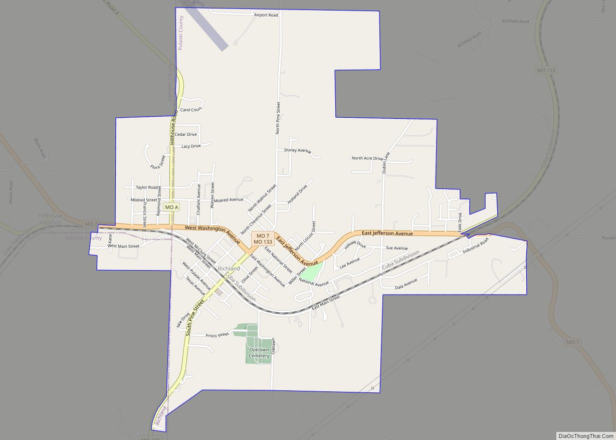
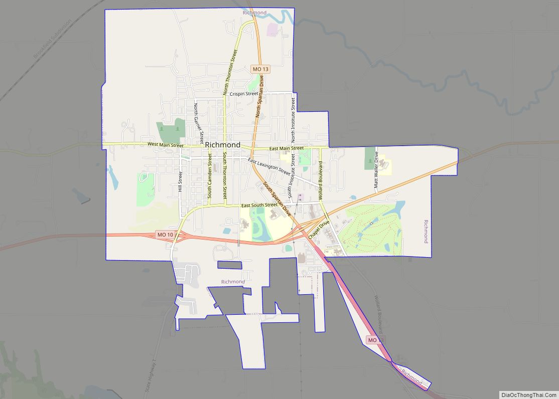
Richland is a city in Camden, Laclede, and Pulaski counties in the U.S. state of Missouri. The population was 1,863 at the 2010 census. Richland city overview: Name: Richland city LSAD Code: 25 LSAD Description: city (suffix) State: Missouri County: Camden County, Laclede County, Pulaski County Elevation: 1,099 ft (335 m) Total Area: 2.29 sq mi (5.93 km²) Land Area: … Read more

Map of Richards town

Map of Richards town

Richards is a village in northwest Vernon County, Missouri, United States. The population was 96 at the 2010 census. Richards town overview: Name: Richards town LSAD Code: 43 LSAD Description: town (suffix) State: Missouri County: Vernon County Elevation: 843 ft (257 m) Total Area: 0.27 sq mi (0.70 km²) Land Area: 0.27 sq mi (0.69 km²) Water Area: 0.00 sq mi (0.00 km²) Total Population: 43 … Read more

Map of Ridgely village, Missouri

Map of Ridgely village, Missouri

Ridgely is a village in Platte County, Missouri within the United States. The population was 104 at the 2010 census. It lies within the Kansas City metropolitan area. Ridgely village overview: Name: Ridgely village LSAD Code: 47 LSAD Description: village (suffix) State: Missouri County: Platte County Elevation: 938 ft (286 m) Total Area: 1.38 sq mi (3.57 km²) Land Area: … Read more

Map of Richmond city, Missouri

Map of Richmond city, Missouri

Richmond is a city in Ray County, Missouri, and part of the Kansas City metropolitan area within the United States. The population was 6,013 at the 2020 census. It is the county seat of Ray County. Richmond city overview: Name: Richmond city LSAD Code: 25 LSAD Description: city (suffix) State: Missouri County: Ray County Elevation: … Read more

Map of Ridgeway city, Missouri

Map of Ridgeway city, Missouri

Ridgeway is a city in Harrison County, Missouri, United States. The population was 372 at the 2020 census. Ridgeway city overview: Name: Ridgeway city LSAD Code: 25 LSAD Description: city (suffix) State: Missouri County: Harrison County Elevation: 1,056 ft (322 m) Total Area: 1.23 sq mi (3.17 km²) Land Area: 1.22 sq mi (3.15 km²) Water Area: 0.01 sq mi (0.02 km²) Total Population: 372 Population … Read more

Map of River Bend village

Map of River Bend village, Missouri

River Bend is a village in Jackson County, Missouri, United States. The population was 3 at the 2020 census. It is the only part of Jackson County that lies north of the Missouri River. In 1951, the Missouri River was relocated to a new channel, creating River Bend, (also known as Liberty Bend). The county … Read more

Map of Ritchey town

Map of Ritchey town

Ritchey is a village in Newton County, Missouri, United States. The population was 82 at the 2010 census. It is part of the Joplin, Missouri Metropolitan Statistical Area. Ritchey town overview: Name: Ritchey town LSAD Code: 43 LSAD Description: town (suffix) State: Missouri County: Newton County Elevation: 1,079 ft (329 m) Total Area: 0.05 sq mi (0.13 km²) Land Area: … Read more

Map of Risco city

Map of Risco city

Risco is a city in New Madrid County, Missouri, United States. The population was 346 at the 2010 census. Risco city overview: Name: Risco city LSAD Code: 25 LSAD Description: city (suffix) State: Missouri County: New Madrid County Elevation: 279 ft (85 m) Total Area: 0.56 sq mi (1.45 km²) Land Area: 0.56 sq mi (1.45 km²) Water Area: 0.00 sq mi (0.00 km²) Total Population: … Read more

Map of Riverview village, Missouri

Map of Riverview village, Missouri

Riverview is a village in St. Louis County, Missouri, United States. The population was 2,397 at the 2020 census. Riverview village overview: Name: Riverview village LSAD Code: 47 LSAD Description: village (suffix) State: Missouri County: St. Louis County Elevation: 528 ft (161 m) Total Area: 0.83 sq mi (2.15 km²) Land Area: 0.83 sq mi (2.15 km²) Water Area: 0.00 sq mi (0.00 km²) Total Population: … Read more

Map of Riverview Estates village

Map of Riverview Estates village

Riverview Estates village overview: Name: Riverview Estates village LSAD Code: 47 LSAD Description: village (suffix) State: Missouri County: Cass County FIPS code: 2962210 Online Interactive Map Riverview Estates online map. Source: Basemap layers from Google Map, Open Street Map (OSM), Arcgisonline, Wmflabs. Boundary Data from Database of Global Administrative Areas. Riverview Estates location map. Where … Read more

Map of Riverside city, Missouri

Map of Riverside city, Missouri

Riverside is a city in Platte County, Missouri and is part of the Kansas City metropolitan area within the United States. The population was 2,937 at the 2010 census. Riverside city overview: Name: Riverside city LSAD Code: 25 LSAD Description: city (suffix) State: Missouri County: Platte County Elevation: 751 ft (229 m) Total Area: 5.80 sq mi (15.03 km²) Land … Read more

Map of Rock Hill city, Missouri

Map of Rock Hill city, Missouri

Rock Hill is a suburban town in St. Louis County, Missouri, United States. The population was 4,635 at the 2010 census. It is home to the Fairfax House on the National Register of Historic Places. Rock Hill city overview: Name: Rock Hill city LSAD Code: 25 LSAD Description: city (suffix) State: Missouri County: St. Louis … Read more