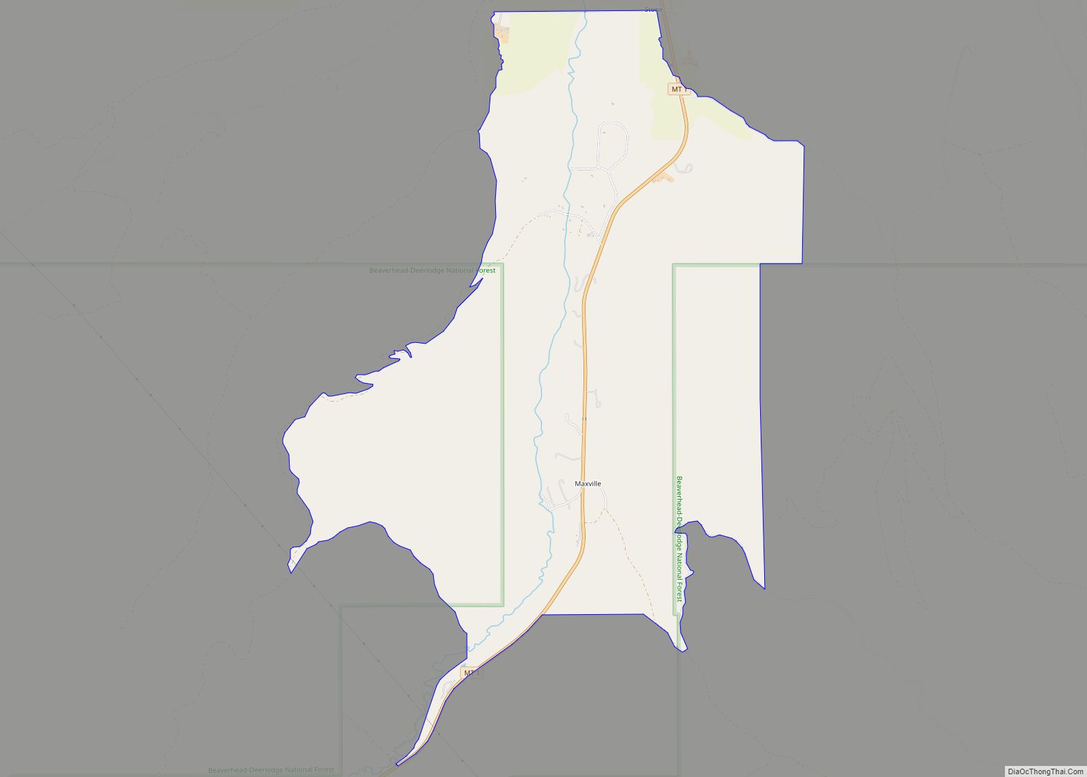
Map of Martin City CDP
Martin City is an unincorporated community and census-designated place (CDP) in Flathead County, Montana, United States. As of the 2010 census, it had a population of 500, up from 331 in 2000. Martin City owes its existence to the early 1950s construction of the Hungry Horse Dam. Martin City CDP overview: Name: Martin City CDP ... Read more
Map of Martin City CDP
Map of Marion CDP, Montana
Marion is a census-designated place and unincorporated community in Flathead County, Montana, United States. Its population was 886 as of the 2010 census. Marion has a post office with ZIP code 59925. The Great Northern Railway created Marion in 1891 as the terminus of a short spur line that ran west from Kalispell. Between 1892 ... Read more
Map of Marion CDP, Montana
Map of Manhattan town, Montana
Manhattan is a town in Gallatin County, Montana, United States. The population was 2,086 at the 2020 census. It is part of the ‘Bozeman Micropolitan Statistical Area’. Manhattan town overview: Name: Manhattan town LSAD Code: 43 LSAD Description: town (suffix) State: Montana County: Gallatin County Elevation: 4,246 ft (1,294 m) Total Area: 1.74 sq mi (4.50 km²) Land Area: 1.74 sq mi ... Read more
Map of Manhattan town, Montana
Map of Malta city, Montana
Malta (/ˈmɔːltə/ (listen) MAWL-tə) is a city in, and the county seat of, Phillips County, Montana, United States, located at the intersection of U.S. Routes 2 and 191. The population was 1,860 at the 2020 census. Malta city overview: Name: Malta city LSAD Code: 25 LSAD Description: city (suffix) State: Montana County: Phillips County Elevation: ... Read more
Map of Malta city, Montana
Map of Montana City CDP
Montana City is an unincorporated community and census-designated place (CDP) in Jefferson County, Montana, United States. The population was 2,715 at the 2010 census, up from 2,094 in 2000. It is part of the Helena Micropolitan Statistical Area. Montana City CDP overview: Name: Montana City CDP LSAD Code: 57 LSAD Description: CDP (suffix) State: Montana ... Read more
Map of Montana City CDP
Map of Old Agency CDP
Old Agency is a census-designated place (CDP) in Sanders County, Montana, United States. The population was 95 at the 2000 census. Old Agency CDP overview: Name: Old Agency CDP LSAD Code: 57 LSAD Description: CDP (suffix) State: Montana County: Sanders County Elevation: 2,549 ft (777 m) Total Area: 0.66 sq mi (1.70 km²) Land Area: 0.57 sq mi (1.46 km²) Water Area: 0.09 sq mi ... Read more
Map of Old Agency CDP
Map of Noxon CDP
Noxon is a census-designated place (CDP) in Sanders County, Montana, United States. The population of the whole CDP was 255 at the 2020 census. The town was established in 1883 as a Northern Pacific Railroad station. Nearby is the Noxon Rapids Dam. Noxon CDP overview: Name: Noxon CDP LSAD Code: 57 LSAD Description: CDP (suffix) ... Read more
Map of Noxon CDP
Map of North Browning CDP
North Browning is a census-designated place (CDP) in Glacier County, Montana, United States. The population was 2,408 at the 2010 census. North Browning CDP overview: Name: North Browning CDP LSAD Code: 57 LSAD Description: CDP (suffix) State: Montana County: Glacier County Elevation: 4,367 ft (1,331 m) Total Area: 2.90 sq mi (7.51 km²) Land Area: 2.89 sq mi (7.49 km²) Water Area: 0.01 sq mi ... Read more
Map of North Browning CDP
Map of Niarada CDP
Niarada (Salish: Npq’ʷáqs, Kutenai: yaqakxaǂq̓anwuʔkki) is a census-designated place (CDP) in Flathead and Sanders counties in Montana, United States. The population was 27 at the 2010 census, down from 50 in 2000. Niarada CDP overview: Name: Niarada CDP LSAD Code: 57 LSAD Description: CDP (suffix) State: Montana County: Flathead County, Lake County, Sanders County Elevation: ... Read more
Map of Niarada CDP
Map of Neihart town
Neihart is a town in Cascade County, Montana, United States. It is located in the center of Little Belt Mountains. The population was 43 at the 2020 census. It is part of the Great Falls, Montana, Metropolitan Statistical Area. Neihart town overview: Name: Neihart town LSAD Code: 43 LSAD Description: town (suffix) State: Montana County: ... Read more
Map of Neihart town
Map of Nashua town, Montana
Nashua is a town in Valley County, Montana, United States. The population was 301 at the 2020 census. The town was established as a station on the St. Paul, Minneapolis & Manitoba Railway in 1888. Nashua had a brief economic boom during the building of Fort Peck Dam in the 1930s. Nashua town overview: Name: ... Read more
Map of Nashua town, Montana
Map of Musselshell CDP
Musselshell is an unincorporated village in Musselshell County, Montana, United States. It is also the namesake of a census designated place (CDP) which incorporates the village. The population of the village is unknown, but the population of the entire CDP was 60 at the 2010 census and 2000 census. The village is located near the ... Read more
Map of Musselshell CDP