Map of Chupadero CDP
Chupadero is a census-designated place (CDP) in Santa Fe County, New Mexico, United States. It is part of the Santa Fe, New Mexico Metropolitan Statistical Area. The population was 362 at the 2010 census. Chupadero CDP overview: Name: Chupadero CDP LSAD Code: 57 LSAD Description: CDP (suffix) State: New Mexico County: Santa Fe County Elevation: ... Read more
Map of Chupadero CDP
Map of Chimayo CDP
Chimayo CDP overview: Name: Chimayo CDP LSAD Code: 57 LSAD Description: CDP (suffix) State: New Mexico County: Rio Arriba County, Santa Fe County FIPS code: 3514950 Online Interactive Map Chimayo online map. Source: Basemap layers from Google Map, Open Street Map (OSM), Arcgisonline, Wmflabs. Boundary Data from Database of Global Administrative Areas. Chimayo location map. ... Read more
Map of Chimayo CDP
Map of Chilili CDP
Chilili is a census-designated place in Bernalillo County, New Mexico, United States. The population was 137 at the 2010 census. It is part of the Albuquerque Metropolitan Statistical Area. Chilili CDP overview: Name: Chilili CDP LSAD Code: 57 LSAD Description: CDP (suffix) State: New Mexico County: Bernalillo County Elevation: 6,814 ft (2,077 m) Total Area: 0.99 sq mi (2.57 km²) ... Read more
Map of Chilili CDP
Map of Chili CDP, New Mexico
Chili is an unincorporated community and census-designated place in Rio Arriba County, New Mexico. Its population was 654 as of the 2010 census. U.S. Route 84 passes through the community. The name comes from a station of the D&RG railroad that was known locally as the “Chili Line.” Chili CDP overview: Name: Chili CDP LSAD ... Read more
Map of Chili CDP, New Mexico
Map of Chical CDP
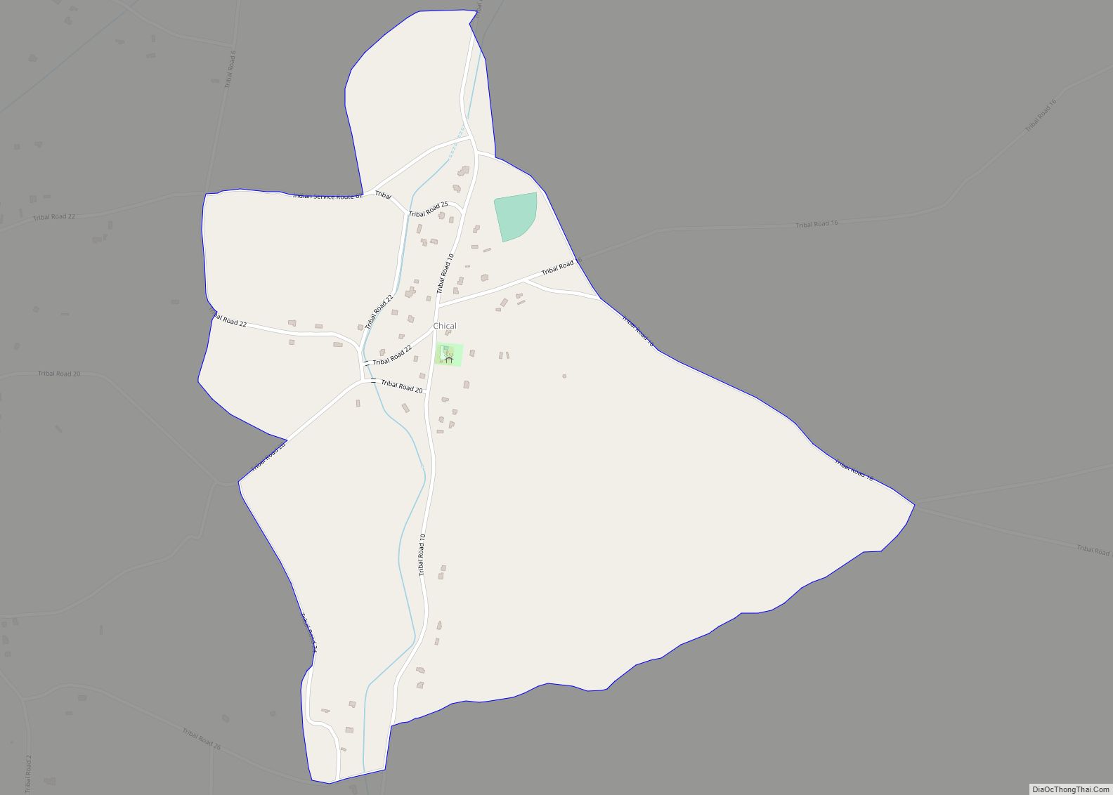
Chical is a census-designated place in Valencia County, New Mexico, United States. Its population was 107 as of the 2010 census. Chical CDP overview: Name: Chical CDP LSAD Code: 57 LSAD Description: CDP (suffix) State: New Mexico County: Valencia County Elevation: 4,902 ft (1,494 m) Total Area: 0.81 sq mi (2.10 km²) Land Area: 0.81 sq mi (2.10 km²) Water Area: 0.00 sq mi (0.00 km²) ... Read more
Map of Chical CDP
Map of Chaparral CDP
Chaparral is an unincorporated community and census-designated place (CDP) in Doña Ana and Otero counties, New Mexico. The population was 14,631 at the 2010 census. Chaparral is primarily a bedroom community for the neighboring city of El Paso, Texas, and the neighboring military installations of White Sands Missile Range and Fort Bliss. It is officially ... Read more
Map of Chaparral CDP
Map of Cochiti CDP
Cochiti (/ˈkoʊtʃəti/; Eastern Keresan: Kotyit [kʰocʰi̥tʰ]; Western Keresan K’úutìim’é [kʼúːtʰìːm̰é], Navajo: Tǫ́ʼgaaʼ /tʰṍʔkɑ̀ːʔ/) is a census-designated place (CDP) in Sandoval County, New Mexico, United States. A historic pueblo of the Cochiti people, one of the Keresan Nations, it is part of the Albuquerque Metropolitan Statistical Area. The population was 528 at the 2010 census. Located ... Read more
Map of Cochiti CDP
Map of Cochiti Lake CDP
Cochiti Lake is a census-designated place in Sandoval County, New Mexico, United States. Its population was 569 as of the 2010 census. Cochiti Lake CDP overview: Name: Cochiti Lake CDP LSAD Code: 57 LSAD Description: CDP (suffix) State: New Mexico County: Sandoval County Elevation: 5,584 ft (1,702 m) Total Area: 1.24 sq mi (3.22 km²) Land Area: 1.24 sq mi (3.22 km²) Water ... Read more
Map of Cochiti Lake CDP
Map of Cobre CDP
Cobre is a census-designated place in Grant County, New Mexico, United States. Its population was 39 as of the 2010 census. New Mexico State Road 356 passes through the community. Cobre CDP overview: Name: Cobre CDP LSAD Code: 57 LSAD Description: CDP (suffix) State: New Mexico County: Grant County Elevation: 5,994 ft (1,827 m) Total Area: 0.07 sq mi ... Read more
Map of Cobre CDP
Map of Clovis city, New Mexico
Clovis is a city in and the county seat of Curry County, New Mexico. The city had a population of 37,775 as of the 2010 census, and a 2019 estimated population of 38,319. Clovis is located in the New Mexico portion of the Llano Estacado, in the eastern part of the state. A largely agricultural ... Read more
Map of Clovis city, New Mexico
Map of Cloudcroft village
Cloudcroft is a village in Otero County, New Mexico, United States, and is located within the Lincoln National Forest. The population was 674 at the 2010 census. Despite being located in an otherwise arid region, its high elevation (8,676 feet (2,644 m) allows for a mild summer and forested surroundings that makes it a popular tourist ... Read more
Map of Cloudcroft village
Map of Cliff CDP
Cliff is a census-designated place in Grant County, New Mexico, United States. Its population was 293 as of the 2010 census. Cliff CDP overview: Name: Cliff CDP LSAD Code: 57 LSAD Description: CDP (suffix) State: New Mexico County: Grant County Elevation: 4,498 ft (1,371 m) Total Area: 10.25 sq mi (26.55 km²) Land Area: 10.25 sq mi (26.55 km²) Water Area: 0.00 sq mi (0.00 km²) ... Read more
Map of Cliff CDP