Map of Conesville village, Ohio

Map of Conesville village, Ohio

Conesville is a village in Coshocton County, Ohio, United States, along the Muskingum River. The population was 328 at the 2020 census. Conesville village overview: Name: Conesville village LSAD Code: 47 LSAD Description: village (suffix) State: Ohio County: Coshocton County Elevation: 745 ft (227 m) Total Area: 0.14 sq mi (0.36 km²) Land Area: 0.14 sq mi (0.36 km²) Water Area: 0.00 sq mi (0.00 km²) … Read more

Map of Concorde Hills CDP

Map of Concorde Hills CDP

Concorde Hills is a census-designated place (CDP) in Sycamore Township, Hamilton County, Ohio, United States. The population was 644 at the 2020 census. Concorde Hills CDP overview: Name: Concorde Hills CDP LSAD Code: 57 LSAD Description: CDP (suffix) State: Ohio County: Hamilton County Elevation: 800 ft (200 m) Total Area: 0.35 sq mi (0.91 km²) Land Area: 0.35 sq mi (0.91 km²) Water … Read more

Map of Commercial Point village

Map of Commercial Point village

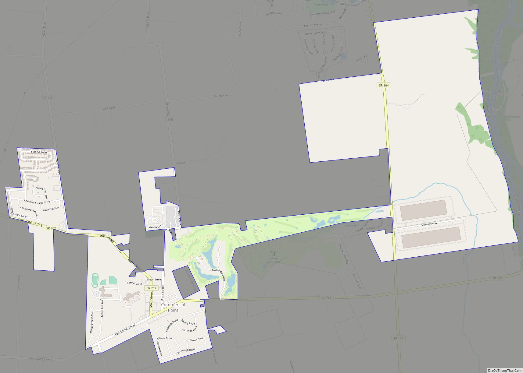
Commercial Point is a village in Pickaway County, Ohio, United States. The population was 1,582 at the 2010 census. It is the fastest-growing community in Pickaway County and one of the fastest-growing villages in central Ohio. It is a suburb of Columbus, OH Commercial Point village overview: Name: Commercial Point village LSAD Code: 47 LSAD … Read more

Map of Corning village, Ohio

Map of Corning village, Ohio

Corning is a village in Perry County, Ohio, United States. The population was 488 at the 2020 census. Corning village overview: Name: Corning village LSAD Code: 47 LSAD Description: village (suffix) State: Ohio County: Perry County Elevation: 725 ft (221 m) Total Area: 0.43 sq mi (1.11 km²) Land Area: 0.43 sq mi (1.11 km²) Water Area: 0.00 sq mi (0.00 km²) Total Population: 488 Population … Read more

Map of Coolville village

Map of Coolville village

Coolville is a village located in Troy Township, Athens County, Ohio, United States, in the southeast area of the state. The population was 452 at the 2020 census. Coolville village overview: Name: Coolville village LSAD Code: 47 LSAD Description: village (suffix) State: Ohio County: Athens County Elevation: 699 ft (213 m) Total Area: 1.00 sq mi (2.58 km²) Land Area: … Read more

Map of Crooksville village

Map of Crooksville village

Crooksville is a village in Perry County, Ohio, United States, along Moxahala Creek. The population was 2,418 at the 2020 census. It was the home of Hull pottery, one of the best known Ohio potteries. Crooksville village overview: Name: Crooksville village LSAD Code: 47 LSAD Description: village (suffix) State: Ohio County: Perry County Elevation: 784 ft … Read more

Map of Cridersville village

Map of Cridersville village

Cridersville /ˈkraɪdərzvɪl/ is a village in Auglaize County, Ohio, United States. The population was 1,852 at the 2010 census. It is included in the Wapakoneta, Ohio Micropolitan Statistical Area. The village is located about halfway between the cities of Lima and Wapakoneta. It is located in Duchouquet Township and is adjacent to Shawnee Township in … Read more

Map of Creston village, Ohio

Map of Creston village, Ohio

Creston is a village in Medina and Wayne counties in the U.S. state of Ohio. The population was 2,171 at the 2010 census. Creston village overview: Name: Creston village LSAD Code: 47 LSAD Description: village (suffix) State: Ohio County: Medina County, Wayne County Elevation: 991 ft (302 m) Total Area: 2.19 sq mi (5.67 km²) Land Area: 2.19 sq mi (5.67 km²) Water … Read more

Map of Crestline village, Ohio

Map of Crestline village, Ohio

Crestline is a village in Crawford and Richland Counties in the U.S. state of Ohio. Crestline’s population was 4,630 at the 2010 census. It is the third largest municipality in Crawford County. The Crawford County portion of Crestline is part of the Bucyrus Micropolitan Statistical Area, while the small portion of the village that extends … Read more

Map of Craig Beach village

Map of Craig Beach village

Craig Beach is a village in northwestern Mahoning County, Ohio, United States. Located along the shores of Lake Milton, the population was 1,076 at the 2020 census. It is part of the Youngstown–Warren metropolitan area. Craig Beach village overview: Name: Craig Beach village LSAD Code: 47 LSAD Description: village (suffix) State: Ohio County: Mahoning County … Read more

Map of Covington village, Ohio

Map of Covington village, Ohio

Covington is a village in Miami County, Ohio, United States. The population was 2,584 at the 2010 census. It is part of the Dayton Metropolitan Statistical Area. The village was incorporated as Covington in 1835 on the site of the 1793 Fort Rowdy. Covington village overview: Name: Covington village LSAD Code: 47 LSAD Description: village … Read more

Map of Covedale CDP

Map of Covedale CDP

Covedale is a census-designated place (CDP) in Green Township, Hamilton County, Ohio, United States. The population was 6,472 at the 2020 census. The CDP represents the part of the former village of Covedale that was not annexed by the city of Cincinnati in the 1890s. Covedale CDP overview: Name: Covedale CDP LSAD Code: 57 LSAD … Read more