Map of Groesbeck CDP

Map of Groesbeck CDP, Ohio

Groesbeck is a census-designated place (CDP) in Hamilton County, Ohio, United States. The population was 7,365 at the 2020 census. It is a suburb of Cincinnati. Groesbeck CDP overview: Name: Groesbeck CDP LSAD Code: 57 LSAD Description: CDP (suffix) State: Ohio County: Hamilton County Elevation: 866 ft (264 m) Total Area: 2.93 sq mi (7.60 km²) Land Area: 2.93 sq mi (7.60 km²) … Read more

Map of Hannibal CDP, Ohio

Map of Hannibal CDP, Ohio

Hannibal is a census-designated place in eastern Ohio Township, Monroe County, Ohio, United States. It has a post office with the ZIP code 43931. In the 2020 Census, it had a population of 314. Hannibal lies along Ohio State Route 7, near an intersection with Ohio State Route 536. It is located along the Ohio … Read more

Map of Hanging Rock village

Map of Hanging Rock village

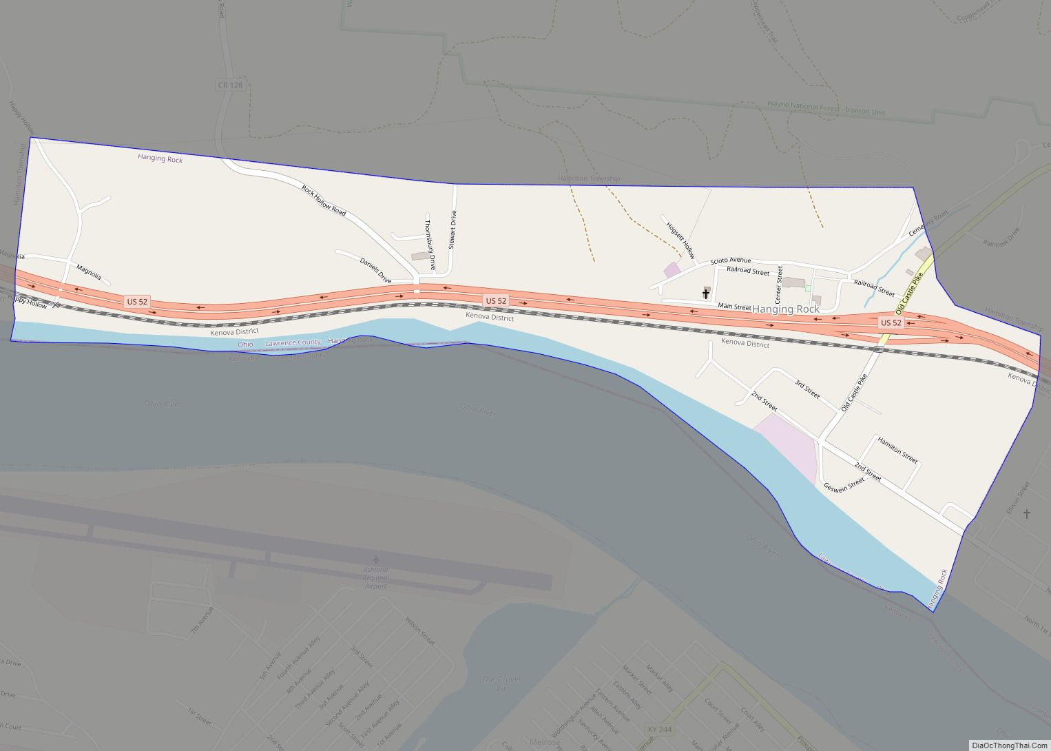
Hanging Rock is a village in Lawrence County, Ohio, United States, along the Ohio River. The population was 221 at the 2010 census. It is regularly labeled a speed trap; the village earned revenues of $109,186 in mayor’s court receipts in 2000, compared with $3,106 in property taxes. Hanging Rock is a part of the … Read more

Map of Hartford (Croton) village, Ohio

Map of Hartford (Croton) village, Ohio

Hartford (also called Croton) is a village in the township of the same name in Licking County, Ohio, United States. The population was 397 at the 2010 census. Hartford (Croton) village overview: Name: Hartford (Croton) village LSAD Code: 47 LSAD Description: village (suffix) State: Ohio County: Licking County Elevation: 1,175 ft (358 m) Total Area: 0.54 sq mi (1.39 km²) … Read more

Map of Harrod village

Map of Harrod village

Harrod is a village in Allen County, Ohio, United States. The population was 423 at the 2020 census. It is included in the Lima, Ohio Metropolitan Statistical Area. Harrod village overview: Name: Harrod village LSAD Code: 47 LSAD Description: village (suffix) State: Ohio County: Allen County Elevation: 981 ft (299 m) Total Area: 0.24 sq mi (0.61 km²) Land Area: … Read more

Map of Harrisville village, Ohio

Map of Harrisville village, Ohio

Harrisville is a village in Harrison County, Ohio, United States. The population was 179 at the 2020 census. Harrisville village overview: Name: Harrisville village LSAD Code: 47 LSAD Description: village (suffix) State: Ohio County: Harrison County Elevation: 1,250 ft (381 m) Total Area: 0.15 sq mi (0.39 km²) Land Area: 0.15 sq mi (0.39 km²) Water Area: 0.00 sq mi (0.00 km²) Total Population: 179 Population … Read more

Map of Harrison city, Ohio

Map of Harrison city, Ohio

Harrison is a city in western Hamilton County, Ohio, United States. The population was 12,563 at the 2020 census. It is part of the Cincinnati metropolitan area. Harrison city overview: Name: Harrison city LSAD Code: 25 LSAD Description: city (suffix) State: Ohio County: Hamilton County Elevation: 522 ft (159 m) Total Area: 5.37 sq mi (13.91 km²) Land Area: 5.34 sq mi … Read more

Map of Harrisburg village, Ohio

Map of Harrisburg village, Ohio

Harrisburg is a village in Franklin and Pickaway counties in the U.S. state of Ohio. The population was 315 at the 2020 census. Harrisburg village overview: Name: Harrisburg village LSAD Code: 47 LSAD Description: village (suffix) State: Ohio County: Franklin County, Pickaway County Elevation: 794 ft (242 m) Total Area: 0.15 sq mi (0.40 km²) Land Area: 0.15 sq mi (0.40 km²) Water … Read more

Map of Harpster village

Map of Harpster village

Harpster is a village in Wyandot County, Ohio, United States. The population was 204 at the 2010 census. Harpster village overview: Name: Harpster village LSAD Code: 47 LSAD Description: village (suffix) State: Ohio County: Wyandot County Elevation: 906 ft (276 m) Total Area: 1.97 sq mi (5.10 km²) Land Area: 1.97 sq mi (5.10 km²) Water Area: 0.00 sq mi (0.00 km²) Total Population: 160 Population … Read more

Map of Harbor View village

Map of Harbor View village

Harbor View is a village in Lucas County, Ohio, United States. The population was 123 at the 2010 census. Harbor View village overview: Name: Harbor View village LSAD Code: 47 LSAD Description: village (suffix) State: Ohio County: Lucas County Elevation: 581 ft (177 m) Total Area: 0.02 sq mi (0.06 km²) Land Area: 0.02 sq mi (0.06 km²) Water Area: 0.00 sq mi (0.00 km²) Total … Read more

Map of Harbor Hills CDP, Ohio

Map of Harbor Hills CDP, Ohio

Harbor Hills is a census-designated place (CDP) in southern Licking County, Ohio, United States. The population was 1,509 at the 2010 census, up from 1,303 at the 2000 census. A post office called Harbor Hills was established in 1927, and remained in operation until 1943. Harbor Hills CDP overview: Name: Harbor Hills CDP LSAD Code: … Read more

Map of Hanoverton village

Map of Hanoverton village

Hanoverton is a village in western Columbiana County, Ohio, United States. The population was 354 at the 2020 census. It is part of the Salem micropolitan area, 23 miles (37 km) miles east of Canton and 28 miles (45 km) southwest of Youngstown. Hanoverton village overview: Name: Hanoverton village LSAD Code: 47 LSAD Description: village (suffix) State: … Read more