Map of Holmesville village, Ohio

Map of Holmesville village, Ohio

Holmesville is a village in Holmes County, Ohio, United States, along Killbuck Creek. The population was 372 at the 2010 census. Holmesville was platted in 1836, and named for its location with Holmes County. Holmesville village overview: Name: Holmesville village LSAD Code: 47 LSAD Description: village (suffix) State: Ohio County: Holmes County Elevation: 860 ft (262 m) … Read more

Map of Holloway village, Ohio

Map of Holloway village, Ohio

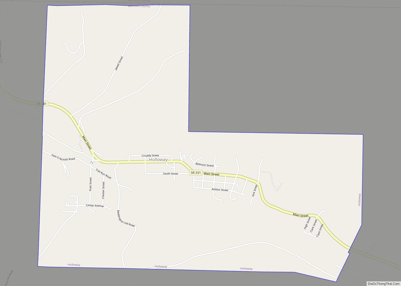
Holloway is a village in Belmont County, Ohio, United States. The population was 330 at the 2020 census. It is part of the Wheeling metropolitan area. Holloway was laid out in 1883, and named after the local Holloway family. Holloway village overview: Name: Holloway village LSAD Code: 47 LSAD Description: village (suffix) State: Ohio County: … Read more

Map of Hollansburg village

Map of Hollansburg village

Hollansburg is a village in Darke County, Ohio, United States. The population was 227 at the 2010 census. Hollansburg village overview: Name: Hollansburg village LSAD Code: 47 LSAD Description: village (suffix) State: Ohio County: Darke County Elevation: 1,161 ft (354 m) Total Area: 0.12 sq mi (0.31 km²) Land Area: 0.12 sq mi (0.31 km²) Water Area: 0.00 sq mi (0.00 km²) Total Population: 243 Population … Read more

Map of Hubbard city, Ohio

Map of Hubbard city, Ohio

Hubbard is a city in southeastern Trumbull County, Ohio, United States. It is formed from part of Hubbard Township, which was formed from the Connecticut Western Reserve. The population was 7,636 at the 2020 census. It is a suburb of the Youngstown–Warren metropolitan area. Hubbard city overview: Name: Hubbard city LSAD Code: 25 LSAD Description: … Read more

Map of Hoytville village

Map of Hoytville village

Hoytville is a village in Wood County, Ohio, United States. The population was 303 at the 2010 census. Hoytville village overview: Name: Hoytville village LSAD Code: 47 LSAD Description: village (suffix) State: Ohio County: Wood County Elevation: 709 ft (216 m) Total Area: 0.75 sq mi (1.95 km²) Land Area: 0.74 sq mi (1.92 km²) Water Area: 0.01 sq mi (0.03 km²) Total Population: 220 Population … Read more

Map of Irondale village, Ohio

Map of Irondale village, Ohio

Irondale is a village in northern Jefferson County, Ohio, United States. The population was 326 at the 2020 census. It is part of the Weirton–Steubenville metropolitan area. Irondale village overview: Name: Irondale village LSAD Code: 47 LSAD Description: village (suffix) State: Ohio County: Jefferson County Elevation: 709 ft (216 m) Total Area: 1.48 sq mi (3.82 km²) Land Area: 1.45 sq mi … Read more

Map of Independence city, Ohio

Map of Independence city, Ohio

Independence is a city in Cuyahoga County, Ohio. It is a suburb of Cleveland. As of the 2010 census, the city population was 7,133. Independence was originally called Center and was renamed in 1830. Independence city overview: Name: Independence city LSAD Code: 25 LSAD Description: city (suffix) State: Ohio County: Cuyahoga County Elevation: 860 ft (260 m) … Read more

Map of Iberia CDP, Ohio

Map of Iberia CDP, Ohio

Iberia is a census-designated place in western Washington Township, Morrow County, Ohio, United States. The community is served by the Northmor Local School District which formerly operated Iberia Elementary School in the community. Iberia is near to Galion, and Martel. The ZIP code assigned to Iberia by the United States Postal Service is 43325. The … Read more

Map of Huron city, Ohio

Map of Huron city, Ohio

Huron is a city in Erie County, Ohio, United States, located at the mouth of the Huron River on Lake Erie. The population was 6,922 at the 2020 census. It is part of the Sandusky micropolitan area. Huron city overview: Name: Huron city LSAD Code: 25 LSAD Description: city (suffix) State: Ohio County: Erie County … Read more

Map of Huntsville village, Ohio

Map of Huntsville village, Ohio

Huntsville is a village in Logan County, Ohio, United States. The population was 431 at the 2010 census. Huntsville village overview: Name: Huntsville village LSAD Code: 47 LSAD Description: village (suffix) State: Ohio County: Logan County Elevation: 1,079 ft (329 m) Total Area: 0.30 sq mi (0.78 km²) Land Area: 0.30 sq mi (0.78 km²) Water Area: 0.00 sq mi (0.00 km²) Total Population: 408 Population … Read more

Map of Hunting Valley village

Map of Hunting Valley village

Hunting Valley is a village in Cuyahoga and Geauga counties in the U.S. state of Ohio. The population was 763 as of the 2020 census. An eastern suburb of Cleveland, it is part of the Cleveland metropolitan area. In 2000, Hunting Valley was ranked the 6th highest-income place in the United States. It was the … Read more

Map of Hunter CDP, Ohio

Map of Hunter CDP, Ohio

Hunter is a census-designated place (CDP) in Franklin Township, Warren County, Ohio, United States. The population was 3,363 at the 2020 census. Hunter CDP overview: Name: Hunter CDP LSAD Code: 57 LSAD Description: CDP (suffix) State: Ohio County: Warren County Elevation: 886 ft (270 m) Total Area: 2.16 sq mi (5.60 km²) Land Area: 2.16 sq mi (5.60 km²) Water Area: 0.00 sq mi (0.00 km²) … Read more