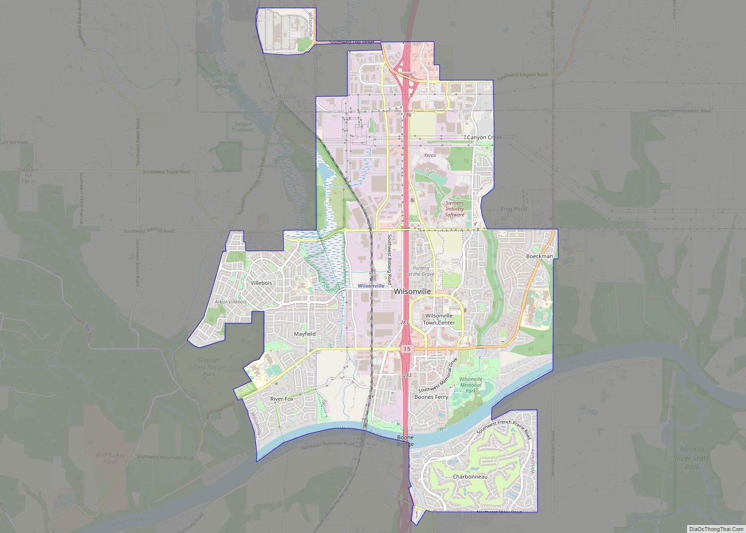
Map of Westport CDP, Oregon
Westport is an unincorporated community and census-designated place on the Columbia River in Clatsop County, Oregon, United States. As of the 2010 census, it had a population of 321. Westport is connected to Cathlamet, Washington, across the river via the Wahkiakum County ferry to Puget Island. U.S. Route 30 passes through the community, connecting it ... Read more
Map of Westport CDP, Oregon
Map of Wood Village city
Wood Village is a city in Multnomah County, Oregon, United States. The population was 3,878 at the 2010 census. Despite the name, Wood Village is classified as a city. Wood Village city overview: Name: Wood Village city LSAD Code: 25 LSAD Description: city (suffix) State: Oregon County: Multnomah County Incorporated: 1951 Elevation: 90–330 ft (27.4 –100.6 m) ... Read more
Map of Wood Village city
Map of Yoncalla city
Yoncalla is a city in Douglas County, Oregon, United States. The population was 1,047 at the 2010 census. Yoncalla city overview: Name: Yoncalla city LSAD Code: 25 LSAD Description: city (suffix) State: Oregon County: Douglas County Incorporated: February 27, 1901 Elevation: 390 ft (120 m) Total Area: 0.68 sq mi (1.76 km²) Land Area: 0.67 sq mi (1.74 km²) Water Area: 0.01 sq mi (0.02 km²) ... Read more
Map of Yoncalla city
Map of Yamhill city
Yamhill is a city in Yamhill County, Oregon, United States. Located in the northern part of the county, it is situated at the intersection of Oregon Route 47 and Oregon Route 240. The population was 1,147 at the 2020 census. Originally named North Yamhill, it was incorporated under that name by the Oregon Legislative Assembly ... Read more
Map of Yamhill city
Map of Yachats city
Yachats (/ˈjɑːhɑːts/ YAH-hahts) is a small coastal city in the southernmost area of Lincoln County, Oregon, United States. According to Oregon Geographic Names, the name comes from the Siletz language and means “dark water at the foot of the mountain”. There is a range of differing etymologies, however. William Bright says the name comes from ... Read more
Map of Yachats city
Map of Woodburn city, Oregon
Woodburn is a city in Marion County, Oregon, United States. Incorporated in 1889, the community had been platted in 1871 after the arrival of the railroad. The city is located in the northern end of the Willamette Valley between Portland and Salem. Interstate 5 connects it to major cities to the north and south. Oregon ... Read more
Map of Woodburn city, Oregon