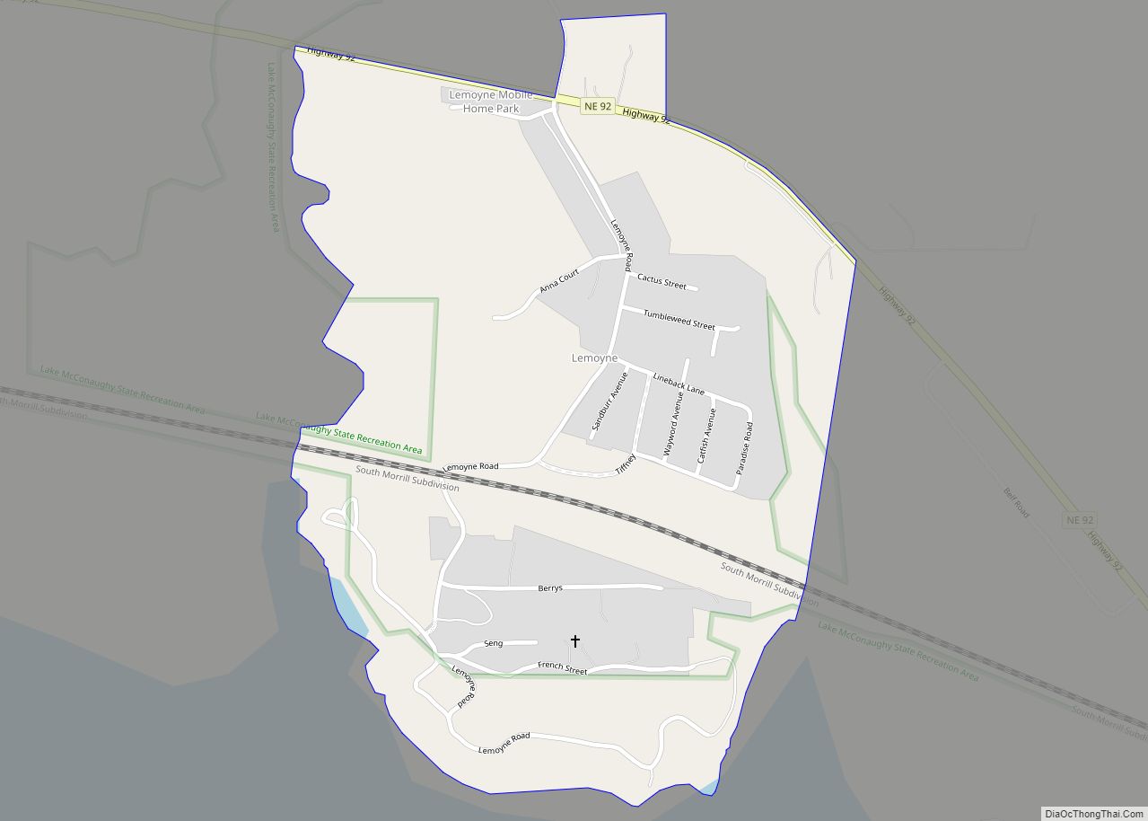
Lemoyne is an unincorporated community and census-designated place in northwestern Keith County, Nebraska, United States. As of the 2010 census it had a population of 82. It lies along Nebraska Highway 92 on the northern shore of Lake C.W. McConaughy, 20 miles (32 km) by road north of the city of Ogallala, the county seat of ... Read more
Map of US Cities and Places
Leigh is a village in Colfax County, Nebraska, United States. The population was 405 at the 2010 census. Leigh village overview: Name: Leigh village LSAD Code: 47 LSAD Description: village (suffix) State: Nebraska County: Colfax County Elevation: 1,604 ft (489 m) Total Area: 0.61 sq mi (1.58 km²) Land Area: 0.60 sq mi (1.55 km²) Water Area: 0.01 sq mi (0.03 km²) Total Population: 435 Population ... Read more
Lebanon is a village in Red Willow County, Nebraska, United States. The population was 80 at the 2010 census. Lebanon village overview: Name: Lebanon village LSAD Code: 47 LSAD Description: village (suffix) State: Nebraska County: Red Willow County Elevation: 2,395 ft (730 m) Total Area: 0.16 sq mi (0.42 km²) Land Area: 0.16 sq mi (0.42 km²) Water Area: 0.00 sq mi (0.00 km²) Total Population: ... Read more
Lawrence is a village in Nuckolls County, Nebraska, United States. The population was 304 at the 2010 census. Lawrence village overview: Name: Lawrence village LSAD Code: 47 LSAD Description: village (suffix) State: Nebraska County: Nuckolls County Elevation: 1,877 ft (572 m) Total Area: 0.41 sq mi (1.07 km²) Land Area: 0.41 sq mi (1.07 km²) Water Area: 0.00 sq mi (0.00 km²) Total Population: 272 Population ... Read more
Laurel is a city in Cedar County, Nebraska located at the merger of Highway 20 and Highway 15 in the northeast corner of the state. Laurel sits roughly 40 miles east of Norfolk, Nebraska, west of Sioux City, Iowa, and south of Yankton, South Dakota. Wayne State College in Wayne, Nebraska is 15 miles south ... Read more
Lamar is a village in Chase County, Nebraska, United States. The population was 23 at the 2010 census. Lamar village overview: Name: Lamar village LSAD Code: 47 LSAD Description: village (suffix) State: Nebraska County: Chase County Elevation: 3,520 ft (1,073 m) Total Area: 0.08 sq mi (0.20 km²) Land Area: 0.08 sq mi (0.20 km²) Water Area: 0.00 sq mi (0.00 km²) Total Population: 28 Population ... Read more
Lakeview is an unincorporated community and census-designated place in Platte County, Nebraska, United States. Its population was 317 as of the 2010 census. Lakeview CDP overview: Name: Lakeview CDP LSAD Code: 57 LSAD Description: CDP (suffix) State: Nebraska County: Platte County Elevation: 1,522 ft (464 m) Total Area: 0.61 sq mi (1.58 km²) Land Area: 0.61 sq mi (1.58 km²) Water Area: 0.00 sq mi ... Read more
La Vista is a city in Sarpy County, Nebraska, United States. The population was 16,746 at the 2020 census. The city was incorporated on February 23, 1960. La Vista is a suburb of Omaha. It is bordered by the cities of Omaha and Ralston on the north, Papillion on the south, Bellevue on the east, ... Read more
Lewiston is a village in northwest Pawnee County, Nebraska, United States. The population was 54 at the 2020 census. Lewiston village overview: Name: Lewiston village LSAD Code: 47 LSAD Description: village (suffix) State: Nebraska County: Pawnee County Elevation: 1,450 ft (440 m) Total Area: 0.10 sq mi (0.27 km²) Land Area: 0.10 sq mi (0.27 km²) Water Area: 0.00 sq mi (0.00 km²) Total Population: 54 ... Read more
Long Pine is a city in Brown County, Nebraska, United States. The population was 305 at the 2010 census. Long Pine city overview: Name: Long Pine city LSAD Code: 25 LSAD Description: city (suffix) State: Nebraska County: Brown County Elevation: 2,402 ft (732 m) Total Area: 0.58 sq mi (1.50 km²) Land Area: 0.58 sq mi (1.50 km²) Water Area: 0.00 sq mi (0.00 km²) Total ... Read more
Lodgepole is a village in Cheyenne County, Nebraska, United States. The population was 318 at the 2010 census. Lodgepole village overview: Name: Lodgepole village LSAD Code: 47 LSAD Description: village (suffix) State: Nebraska County: Cheyenne County Elevation: 3,845 ft (1,172 m) Total Area: 0.48 sq mi (1.24 km²) Land Area: 0.48 sq mi (1.24 km²) Water Area: 0.00 sq mi (0.00 km²) Total Population: 312 Population ... Read more
Litchfield is a village in Sherman County, Nebraska, United States. The population was 262 at the 2010 census. Litchfield village overview: Name: Litchfield village LSAD Code: 47 LSAD Description: village (suffix) State: Nebraska County: Sherman County Elevation: 2,165 ft (660 m) Total Area: 0.30 sq mi (0.79 km²) Land Area: 0.30 sq mi (0.79 km²) Water Area: 0.00 sq mi (0.00 km²) Total Population: 220 Population ... Read more