Map of Nakaibito CDP
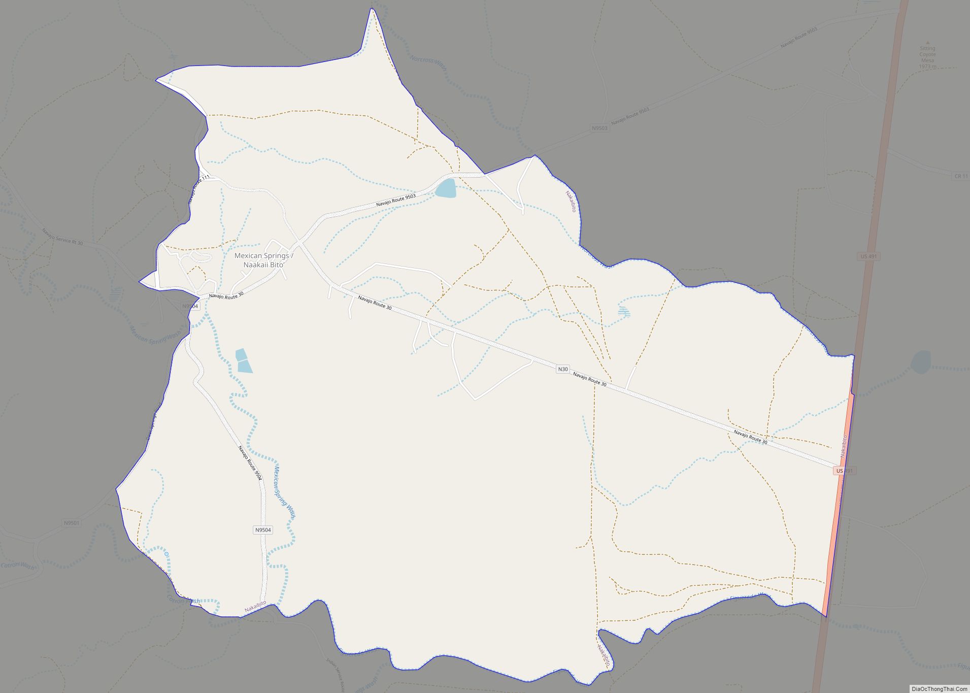
Nakaibito (Navajo: Naakaii Bitoʼ) (also known as Mexican Springs) is a census-designated place (CDP) in McKinley County, New Mexico, United States. The population was 455 at the 2000 census. Nakaibito CDP overview: Name: Nakaibito CDP LSAD Code: 57 LSAD Description: CDP (suffix) State: New Mexico County: McKinley County Elevation: 6,457 ft (1,968 m) Total Area: 7.00 sq mi (18.12 km²) ... Read more
Map of Nakaibito CDP
Map of Nageezi CDP
Nageezi (Navajo: Naayízí) is a census-designated place (CDP) in San Juan County, New Mexico, United States. The population was 296 at the 2000 census. It is part of the Farmington Metropolitan Statistical Area. A post office was established in 1941. Nageezi’s name in Navajo means “squash.” Nageezi CDP overview: Name: Nageezi CDP LSAD Code: 57 ... Read more
Map of Nageezi CDP
Map of Nadine CDP
Nadine is an unincorporated community and census-designated place in Lea County, New Mexico, United States. Its population was 376 as of the 2010 census. New Mexico State Road 18 passes through the community. Nadine CDP overview: Name: Nadine CDP LSAD Code: 57 LSAD Description: CDP (suffix) State: New Mexico County: Lea County Elevation: 3,583 ft (1,092 m) ... Read more
Map of Nadine CDP
Map of Mountainair town
Mountainair is a town in Torrance County, New Mexico, United States. It was founded in 1902 by John Corbett, Colonel E. C. Manning, and Elias S. Stover. The population was 928 at the 2010 census. It is part of the Albuquerque Metropolitan Statistical Area. The main visitor center for Salinas Pueblo Missions National Monument is ... Read more
Map of Mountainair town
Map of North Acomita Village CDP
North Acomita Village is a census-designated place (CDP) in Cibola County, New Mexico, United States. The population was 303 at the 2010 census. North Acomita Village CDP overview: Name: North Acomita Village CDP LSAD Code: 57 LSAD Description: CDP (suffix) State: New Mexico County: Cibola County Elevation: 6,047 ft (1,843 m) Total Area: 3.87 sq mi (10.03 km²) Land Area: ... Read more
Map of North Acomita Village CDP
Map of Nogal CDP
Nogal is a census-designated place and unincorporated community in Lincoln County, New Mexico, United States. Its population was 96 as of the 2010 census. Nogal has a post office with ZIP code 88341, which opened on November 9, 1880. Nogal CDP overview: Name: Nogal CDP LSAD Code: 57 LSAD Description: CDP (suffix) State: New Mexico ... Read more
Map of Nogal CDP
Map of Newkirk CDP, New Mexico
Newkirk is a village in Guadalupe County, New Mexico, United States. The community is located at the junction of Interstate 40 and New Mexico State Road 129; historic U.S. Route 66 also passes through the community. Its population was 7 as of the 2010 census. Newkirk has a post office serving ZIP Code 88431, and ... Read more
Map of Newkirk CDP, New Mexico
Map of Newcomb CDP
Newcomb (Navajo: Bis Deezʼáhí) is a census-designated place (CDP) in San Juan County, New Mexico, United States. The population was 387 at the 2000 census. It is part of the Farmington Metropolitan Statistical Area. It is on the Trails of the Ancients Byway, one of the designated New Mexico Scenic Byways. Newcomb was founded in ... Read more
Map of Newcomb CDP
Map of Nenahnezad CDP
Nenahnezad (Navajo: Niinahnízaad) is a census-designated place (CDP) in San Juan County, New Mexico, United States. The population was 726 at the 2000 census. Nenahnezad is a Chapter community just to the south of Fruitland, between the towns of Farmington and Shiprock. It is part of the Farmington Metropolitan Statistical Area. Nenahnezad CDP overview: Name: ... Read more
Map of Nenahnezad CDP
Map of Navajo CDP
Navajo (Navajo: Niʼiijíhí) is a census-designated place (CDP) on the Navajo Nation in McKinley County, New Mexico, United States. The population was 2,097 at the 2000 census. Navajo is the most Navajo town in the United States, with 95.04% of residents having full or partial Navajo ancestry. Navajo CDP overview: Name: Navajo CDP LSAD Code: ... Read more
Map of Navajo CDP
Map of Navajo Dam CDP
Navajo Dam is a census-designated place in San Juan County, New Mexico, United States. Its population was 253 as of the 2020 census. Navajo Dam has a post office with ZIP code 87419. The community is located in the vicinity of Navajo Dam. Navajo Dam CDP overview: Name: Navajo Dam CDP LSAD Code: 57 LSAD ... Read more
Map of Navajo Dam CDP
Map of Naschitti CDP
Naschitti (Navajo: Nahashchʼidí) is a census-designated place (CDP) in San Juan County, New Mexico, United States. The population was 360 at the 2000 census. It is part of the Farmington Metropolitan Statistical Area. The town was established in 1886, when Tom Bryan set up a trading post east of the Chuska Mountains. With a Navajo ... Read more
Map of Naschitti CDP