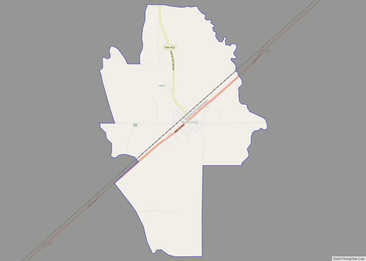
Nara Visa is an unincorporated village and locus of a same-named census-designated place in Quay County, New Mexico, United States. It has the post office serving the ZIP code of 88430; while the village is not specifically tracked by the Census Department, the population of the entire ZCTA for 88430 was 212 at the 2000 ... Read more
Map of US Cities and Places
Napi Headquarters CDP overview: Name: Napi Headquarters CDP LSAD Code: 57 LSAD Description: CDP (suffix) State: New Mexico County: San Juan County FIPS code: 3551035 Online Interactive Map Napi Headquarters online map. Source: Basemap layers from Google Map, Open Street Map (OSM), Arcgisonline, Wmflabs. Boundary Data from Database of Global Administrative Areas. Napi Headquarters location ... Read more
North Valley is a census-designated place (CDP) in Bernalillo County, New Mexico, United States. As of the 2010 Census, the CDP population was 11,333. It is part of the Albuquerque Metropolitan Statistical Area. North Valley CDP overview: Name: North Valley CDP LSAD Code: 57 LSAD Description: CDP (suffix) State: New Mexico County: Bernalillo County Elevation: ... Read more
North San Ysidro is an unincorporated community and census-designated place in San Miguel County, New Mexico, United States. Its population was 159 as of the 2010 census. North San Ysidro CDP overview: Name: North San Ysidro CDP LSAD Code: 57 LSAD Description: CDP (suffix) State: New Mexico County: San Miguel County Elevation: 6,522 ft (1,988 m) Total ... Read more
North Light Plant is an unincorporated community and census-designated place in San Juan County, New Mexico, United States. Its population was 414 as of the 2010 census. New Mexico State Road 574 passes through the community. North Light Plant CDP overview: Name: North Light Plant CDP LSAD Code: 57 LSAD Description: CDP (suffix) State: New ... Read more
North Hurley is a census-designated place in Grant County, New Mexico, United States. Its population was 300 as of the 2010 census. The community is located north of Hurley along U.S. Route 180. North Hurley CDP overview: Name: North Hurley CDP LSAD Code: 57 LSAD Description: CDP (suffix) State: New Mexico County: Grant County Elevation: ... Read more
North Hobbs is an unincorporated community and census-designated place in Lea County, New Mexico, United States. Its population was 5,391 as of the 2010 census. North Hobbs CDP overview: Name: North Hobbs CDP LSAD Code: 57 LSAD Description: CDP (suffix) State: New Mexico County: Lea County Elevation: 3,648 ft (1,112 m) Total Area: 26.08 sq mi (67.55 km²) Land Area: ... Read more
Orogrande is an unincorporated community in Otero County, New Mexico, United States, located at a latitude of 32.37111 and a longitude of -106.08389 in the Jarilla Mountains of the Tularosa Basin on U.S. 54 between El Paso, Texas and Alamogordo. Originally a mining town named Jarilla Junction due to its proximity to the Jarilla Mountains, ... Read more
Organ is an unincorporated community and census-designated place in Doña Ana County, New Mexico, United States. As of the 2010 census, its population was 323. Organ CDP overview: Name: Organ CDP LSAD Code: 57 LSAD Description: CDP (suffix) State: New Mexico County: Doña Ana County Founded: 1883 Elevation: 5,084 ft (1,550 m) Total Area: 0.86 sq mi (2.23 km²) Land ... Read more
Ojo Amarillo is a census-designated place (CDP) in San Juan County, New Mexico, United States. The population was 829 at the 2000 census. It is part of the Farmington Metropolitan Statistical Area. Ojo Amarillo CDP overview: Name: Ojo Amarillo CDP LSAD Code: 57 LSAD Description: CDP (suffix) State: New Mexico County: San Juan County Elevation: ... Read more
Ohkay Owingeh (Tewa: Ohkwee Ówîngeh [ʔòhkèː ʔówĩ̂ŋgè]), known by its Spanish name as San Juan de los Caballeros from 1589 to 2005, is a pueblo and census-designated place (CDP) in Rio Arriba County, New Mexico. Ohkay Owingeh is also a federally recognized tribe of Pueblo people inhabiting the town. Ohkay Owingeh CDP overview: Name: Ohkay ... Read more
Oasis is a census-designated place in Sierra County, New Mexico, United States. Its population was 149 as of the 2010 census. Oasis CDP overview: Name: Oasis CDP LSAD Code: 57 LSAD Description: CDP (suffix) State: New Mexico County: Sierra County Elevation: 4,258 ft (1,298 m) Total Area: 2.09 sq mi (5.41 km²) Land Area: 2.09 sq mi (5.41 km²) Water Area: 0.00 sq mi (0.00 km²) ... Read more