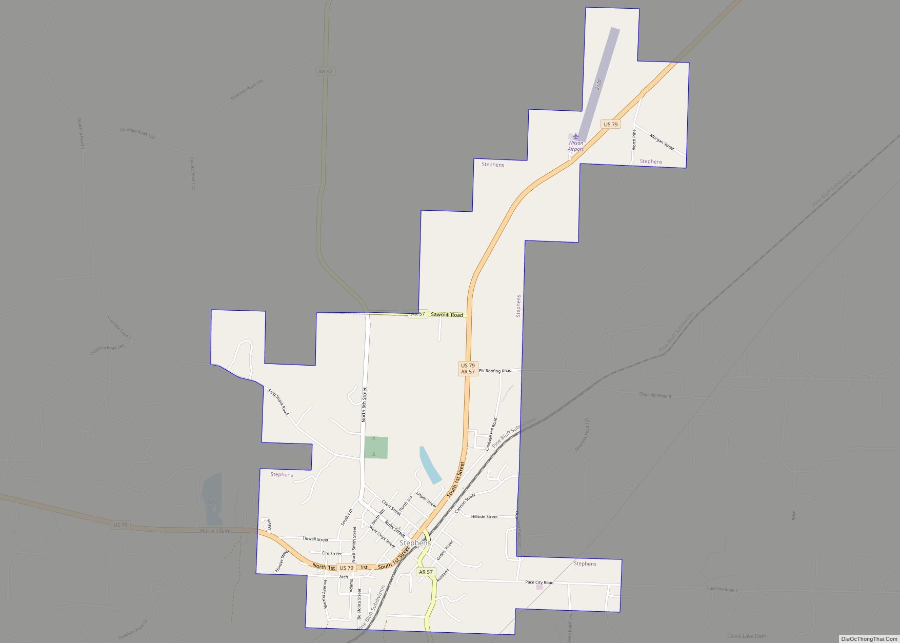
Map of Staves CDP
Staves is a census-designated place in Cleveland County, Arkansas, United States. Per the 2020 census, the population was 133. Staves was known locally as the “Y” Community, because State Route 212 created a “Y” where it intersected State Route 35, with connectors leading both north and south from State Route 212’s east–west direction. The road ... Read more
Map of Staves CDP
Map of Star City, Arkansas
Star City is a city in, and the county seat of, Lincoln County, Arkansas, United States. Incorporated in 1876, the city is located between the Arkansas Delta and Arkansas Timberlands. With an economy historically based on agriculture, today Star City has developed a diverse economy based on both industry and agriculture. As of the 2010 ... Read more
Map of Star City, Arkansas
Map of Stuttgart city
Stuttgart is a city in and the county seat of the northern district of Arkansas County, Arkansas, United States. Established by German settlers, it was named for its larger German counterpart. Known as the “Rice and Duck Capital of the World”, the city is an international destination for waterfowl hunting along the Mississippi Flyway. Stuttgart ... Read more
Map of Stuttgart city
Map of Strong city, Arkansas
Strong is a city in Union County, Arkansas, United States. The population was 558 at the 2010 census. Strong city overview: Name: Strong city LSAD Code: 25 LSAD Description: city (suffix) State: Arkansas County: Union County Elevation: 98 ft (30 m) Total Area: 1.60 sq mi (4.14 km²) Land Area: 1.60 sq mi (4.14 km²) Water Area: 0.00 sq mi (0.00 km²) Total Population: 410 Population ... Read more
Map of Strong city, Arkansas
Map of Strawberry town, Arkansas
Strawberry is a town in Lawrence County, Arkansas, United States. The population was 302 at the 2010 census. Strawberry town overview: Name: Strawberry town LSAD Code: 43 LSAD Description: town (suffix) State: Arkansas County: Lawrence County Elevation: 341 ft (104 m) Total Area: 2.34 sq mi (6.07 km²) Land Area: 2.34 sq mi (6.07 km²) Water Area: 0.00 sq mi (0.00 km²) Total Population: 268 Population ... Read more
Map of Strawberry town, Arkansas
Map of Sulphur Rock town
Sulphur Rock is a town in Independence County, Arkansas, United States. The population was 456 at the 2010 census. Sulphur Rock town overview: Name: Sulphur Rock town LSAD Code: 43 LSAD Description: town (suffix) State: Arkansas County: Independence County Elevation: 325 ft (99 m) Total Area: 1.25 sq mi (3.24 km²) Land Area: 1.25 sq mi (3.24 km²) Water Area: 0.00 sq mi (0.00 km²) Total ... Read more
Map of Sulphur Rock town
Map of Success town
Success is a town in Clay County, Arkansas, United States. The population was 149 at the 2010 census. The origin of the name “Success” is obscure. Success town overview: Name: Success town LSAD Code: 43 LSAD Description: town (suffix) State: Arkansas County: Clay County Elevation: 295 ft (90 m) Total Area: 0.22 sq mi (0.58 km²) Land Area: 0.22 sq mi (0.58 km²) ... Read more
Map of Success town
Map of Subiaco town
Subiaco is a town in Logan County, Arkansas, United States. The population was 572 at the 2010 census. The town is named after Subiaco Abbey, which is located there, and which donated 80 acres (32 hectares) in the early 20th century for a townsite and railroad connection. Founded as a priory in 1878, Subiaco Abbey ... Read more
Map of Subiaco town
Map of Sunset town, Arkansas
Sunset is a town in Crittenden County, Arkansas, United States. The population was 198 at the 2010 census. Sunset town overview: Name: Sunset town LSAD Code: 43 LSAD Description: town (suffix) State: Arkansas County: Crittenden County Elevation: 220 ft (67 m) Total Area: 0.26 sq mi (0.68 km²) Land Area: 0.26 sq mi (0.68 km²) Water Area: 0.00 sq mi (0.00 km²) Total Population: 184 Population ... Read more
Map of Sunset town, Arkansas
Map of Summit city, Arkansas
Summit is a city in Marion County, Arkansas, United States. The population was 544 at the 2020 census, down from 604 in 2010. Summit city overview: Name: Summit city LSAD Code: 25 LSAD Description: city (suffix) State: Arkansas County: Marion County Elevation: 863 ft (263 m) Total Area: 1.21 sq mi (3.12 km²) Land Area: 1.21 sq mi (3.12 km²) Water Area: 0.00 sq mi ... Read more
Map of Summit city, Arkansas
Map of Sulphur Springs CDP, Arkansas
Sulphur Springs, also known as White Sulphur Springs, is a census-designated place (CDP) in Spring Township, Jefferson County, Arkansas, United States. Per the 2020 census, the population was 1,032. Sulphur Springs CDP overview: Name: Sulphur Springs CDP LSAD Code: 57 LSAD Description: CDP (suffix) State: Arkansas County: Jefferson County Elevation: 292 ft (89 m) Total Area: 5.54 sq mi ... Read more
Map of Sulphur Springs CDP, Arkansas
Map of Sweet Home CDP, Arkansas
Sweet Home is a census-designated place (CDP) in Pulaski County, Arkansas, United States. Its population was 849 at the 2010 census. It is part of the ‘Little Rock–North Little Rock–AR Metropolitan Statistical Area’. Sweet Home CDP overview: Name: Sweet Home CDP LSAD Code: 57 LSAD Description: CDP (suffix) State: Arkansas County: Pulaski County Elevation: 272 ft ... Read more
Map of Sweet Home CDP, Arkansas