Map of Lakeway city
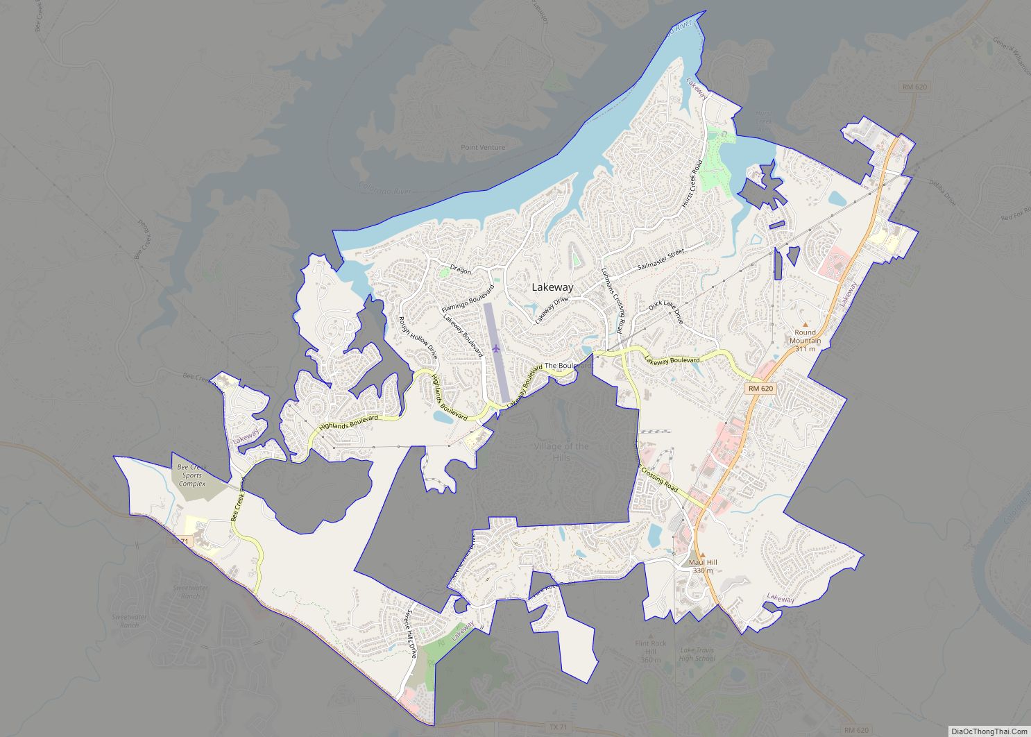
Lakeway is a city in Travis County, Texas, United States. The population was 19,189 at the 2020 census; up from 11,391 in 2010. The city is located next to Lake Travis. It is an exurb in Greater Austin. Lakeway city overview: Name: Lakeway city LSAD Code: 25 LSAD Description: city (suffix) State: Texas County: Travis ... Read more
Map of Lakeway city
Map of Lakeview town, Texas
Lakeview is a town in Hall County, Texas, United States. The population was 107 at the 2010 census, down from 152 at the 2000 census. Lakeview town overview: Name: Lakeview town LSAD Code: 43 LSAD Description: town (suffix) State: Texas County: Hall County Elevation: 2,129 ft (649 m) Total Area: 0.21 sq mi (0.53 km²) Land Area: 0.21 sq mi (0.53 km²) Water ... Read more
Map of Lakeview town, Texas
Map of Las Pilas CDP
Las Pilas is a census-designated place (CDP) in Webb County, Texas, United States. This was a new CDP formed from parts of the Ranchitos Las Lomas CDP prior to the 2010 census with a population of 28. Las Pilas CDP overview: Name: Las Pilas CDP LSAD Code: 57 LSAD Description: CDP (suffix) State: Texas County: ... Read more
Map of Las Pilas CDP
Map of Las Palmas CDP
Las Palmas is a census-designated place (CDP) in Zapata County in the U.S. state of Texas. It was a new CDP from the 2010 census with a population of 67. It is part of the Zapata Micropolitan Statistical Area. Las Palmas CDP overview: Name: Las Palmas CDP LSAD Code: 57 LSAD Description: CDP (suffix) State: ... Read more
Map of Las Palmas CDP
Map of Las Palmas II CDP
Las Palmas II is a census-designated place (CDP) in Cameron County, in the U.S. state of Texas. (The “II” distinguishes the CDP from Las Palmas, a CDP in Zapata County, Texas.) The population was 1,605 at the 2010 census. Prior to the 2010 census the community was part of the Las Palmas-Juarez CDP. It is ... Read more
Map of Las Palmas II CDP
Map of Las Lomitas CDP
Las Lomitas is an unincorporated community and census-designated place (CDP) in Jim Hogg County, Texas, United States. The population was 244 at the 2010 census. Las Lomitas CDP overview: Name: Las Lomitas CDP LSAD Code: 57 LSAD Description: CDP (suffix) State: Texas County: Jim Hogg County Elevation: 571 ft (174 m) Total Area: 3.9 sq mi (10.2 km²) Land Area: ... Read more
Map of Las Lomitas CDP
Map of Las Lomas CDP, Texas
Las Lomas is a census-designated place (CDP) in Starr County, Texas, United States. The population was 3,147 at the 2010 census. Las Lomas is one of several colonias in Starr County, within the Rio Grande Valley region. The name is derived from the community’s terrain. Las Lomas CDP overview: Name: Las Lomas CDP LSAD Code: ... Read more
Map of Las Lomas CDP, Texas
Map of Las Haciendas CDP
Las Haciendas is a census-designated place (CDP) in Webb County, Texas, United States. This was a new CDP formed from parts of the Ranchitos Las Lomas CDP prior to the 2010 census with a population of 7. Las Haciendas CDP overview: Name: Las Haciendas CDP LSAD Code: 57 LSAD Description: CDP (suffix) State: Texas County: ... Read more
Map of Las Haciendas CDP
Map of Laredo Ranchettes CDP
Laredo Ranchettes is a census-designated place (CDP) in Webb County, Texas, United States. The population was 22 at the 2010 census. Laredo Ranchettes CDP overview: Name: Laredo Ranchettes CDP LSAD Code: 57 LSAD Description: CDP (suffix) State: Texas County: Webb County Elevation: 591 ft (180 m) Total Area: 0.6 sq mi (2 km²) Land Area: 0.6 sq mi (2 km²) Water Area: 0.0 sq mi ... Read more
Map of Laredo Ranchettes CDP
Map of Laredo Ranchettes West CDP
Laredo Ranchettes West is a census-designated place (CDP) in Webb County, Texas, United States. This was a new CDP formed from parts of the Laredo Ranchettes CDP prior to the 2010 census. Although a new CDP the population was listed as zero. Laredo Ranchettes West CDP overview: Name: Laredo Ranchettes West CDP LSAD Code: 57 ... Read more
Map of Laredo Ranchettes West CDP
Map of Lantana CDP, Texas
Lantana is an upscale census-designated place (CDP) and master-planned community originally developed by Republic Property Group, 8 miles (13 km) south of Denton in unincorporated Denton County, Texas, United States. The population of the CDP at the 2010 census was 6,874. Lantana had 3,274 occupied homes as of December 31, 2015, with an estimated population of ... Read more
Map of Lantana CDP, Texas
Map of Las Quintas Fronterizas CDP
Las Quintas Fronterizas is a census-designated place (CDP) in Maverick County, Texas, United States. The population was 2,030 at the 2000 census. Las Quintas Fronterizas CDP overview: Name: Las Quintas Fronterizas CDP LSAD Code: 57 LSAD Description: CDP (suffix) State: Texas County: Maverick County Elevation: 745 ft (227 m) Total Area: 0.7 sq mi (1.7 km²) Land Area: 0.7 sq mi (1.7 km²) ... Read more
Map of Las Quintas Fronterizas CDP