Map of Quail CDP
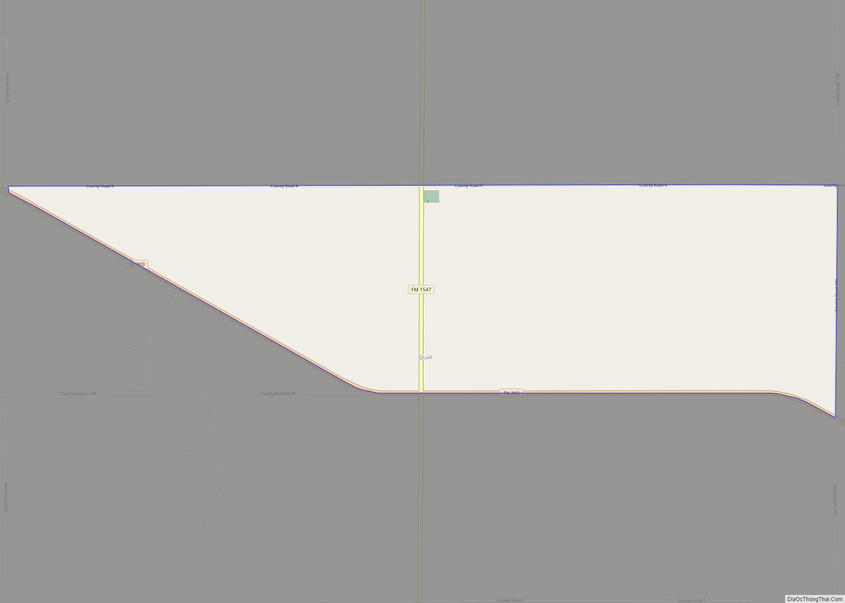
Quail is a rural small town and census-designated place in Collingsworth County, Texas, United States. The population was 19 at the 2010 census, down from 33 at the 2000 census. The town has a general store, a small hotel and an income tax service. Quail CDP overview: Name: Quail CDP LSAD Code: 57 LSAD Description: ... Read more
Map of Quail CDP
Map of Quail Creek CDP
Quail Creek is a census-designated place (CDP) in Victoria County, Texas, United States. This was a new CDP for the 2010 census with a population of 1628. Quail Creek CDP overview: Name: Quail Creek CDP LSAD Code: 57 LSAD Description: CDP (suffix) State: Texas County: Victoria County Total Area: 3.1 sq mi (8.0 km²) Land Area: 3.1 sq mi (8.0 km²) ... Read more
Map of Quail Creek CDP
Map of Quitman city, Texas
Quitman is a city and the county seat of Wood County, Texas, United States. Its population was 1,942 at the 2020 census. It is most notable for being the birthplace of Academy Award-winning actress Sissy Spacek. The city was named for John A. Quitman, a veteran of the Mexican–American War, and once governor of Mississippi. ... Read more
Map of Quitman city, Texas
Map of Quitaque city
Quitaque (/ˈkɪtɪkweɪ/ KIT-i-kway) is a city in southeastern Briscoe County, Texas, United States. The town lies directly south of Capcrock Canyon State Park and is a ranching and farming area in West Texas. The population was 411 at the 2010 census. According to tradition, Quitaque is a name derived from an American Indian language, meaning ... Read more
Map of Quitaque city
Map of Ranchitos Las Lomas CDP
Ranchitos Las Lomas is a census-designated place (CDP) in Webb County, Texas, United States. The population was 266 at the 2010 census. Las Lomas means “the hills” in Spanish. The town prides itself as “the place where nothing ever happened.” Ranchitos Las Lomas CDP overview: Name: Ranchitos Las Lomas CDP LSAD Code: 57 LSAD Description: ... Read more
Map of Ranchitos Las Lomas CDP
Map of Ranchitos East CDP
Ranchitos East is a census-designated place (CDP) in Webb County, Texas, United States.This was a new CDP formed from parts of the Laredo Ranchettes CDP prior to the 2010 census with a population of 212. Ranchitos East CDP overview: Name: Ranchitos East CDP LSAD Code: 57 LSAD Description: CDP (suffix) State: Texas County: Webb County ... Read more
Map of Ranchitos East CDP
Map of Ranchitos del Norte CDP
Ranchitos del Norte is a census-designated place (CDP) in Starr County, Texas, United States. It is a new CDP for the 2010 census with a population of 112. Parts of this new CDP were formed from the former Los Villareales CDP. Ranchitos del Norte CDP overview: Name: Ranchitos del Norte CDP LSAD Code: 57 LSAD ... Read more
Map of Ranchitos del Norte CDP
Map of Ranchette Estates CDP
Ranchette Estates is a census-designated place (CDP) in Willacy County, Texas, United States. The population was 152 at the 2010 census. Ranchette Estates CDP overview: Name: Ranchette Estates CDP LSAD Code: 57 LSAD Description: CDP (suffix) State: Texas County: Willacy County Elevation: 36 ft (11 m) Total Area: 0.6 sq mi (1.6 km²) Land Area: 0.6 sq mi (1.6 km²) Water Area: 0.0 sq mi ... Read more
Map of Ranchette Estates CDP
Map of Ramos CDP, Texas
Ramos is a census-designated place (CDP) in Starr County, Texas, United States. It is a new CDP formed from part of the Roma Creek CDP prior to the 2010 census with a population of 116. Ramos CDP overview: Name: Ramos CDP LSAD Code: 57 LSAD Description: CDP (suffix) State: Texas County: Starr County Total Area: ... Read more
Map of Ramos CDP, Texas
Map of Ramirez-Perez CDP
Ramirez-Perez is a census-designated place (CDP) in Starr County, Texas, United States. It is a new CDP formed from part of the former La Casita-Garciasville CDP prior to the 2010 census with a population of 78. Ramirez-Perez CDP overview: Name: Ramirez-Perez CDP LSAD Code: 57 LSAD Description: CDP (suffix) State: Texas County: Starr County Total ... Read more
Map of Ramirez-Perez CDP
Map of Ramireno CDP
Ramireno is a census-designated place (CDP) in Zapata County, Texas, United States. This was a new CDP for the 2010 census with a population of 35. Ramireno CDP overview: Name: Ramireno CDP LSAD Code: 57 LSAD Description: CDP (suffix) State: Texas County: Zapata County Total Area: 1.5 sq mi (4 km²) Land Area: 1.5 sq mi (4 km²) Water Area: 0.0 sq mi ... Read more
Map of Ramireno CDP
Map of Ralls city
Ralls is a city in Crosby County, Texas, United States. It was named after John Robinson Ralls, who with the help of W.E. McLaughlin, laid out the townsite in July 1911. As of the 2010 census, it had a population of 1,944, down from 2,252 at the 2000 census. Ralls is surrounded by productive farm ... Read more
Map of Ralls city