Map of Robstown city
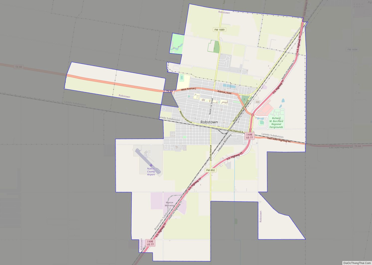
Robstown is a city in Nueces County, Texas, United States, and a western suburb of Corpus Christi. It was founded about 1906, and was named for Robert Driscoll. The population was 11,487 as of the 2010 census. The Texas State Legislature officially recognizes Robstown as the birthplace of Texas hold ’em poker. Robstown city overview: ... Read more
Map of Robstown city
Map of Robinson city, Texas
Robinson is a city in McLennan County, Texas, United States. The population was 12,443 at the 2020 census. It is part of the Waco Metropolitan Statistical Area. Robinson city overview: Name: Robinson city LSAD Code: 25 LSAD Description: city (suffix) State: Texas County: McLennan County Elevation: 495 ft (151 m) Total Area: 31.58 sq mi (81.80 km²) Land Area: 31.25 sq mi ... Read more
Map of Robinson city, Texas
Map of Ropesville city
Ropesville is a city in Hockley County, Texas, United States. Its population was 434 at the 2010 census, down from 517 at the 2000 census. Ropesville city overview: Name: Ropesville city LSAD Code: 25 LSAD Description: city (suffix) State: Texas County: Hockley County Elevation: 3,363 ft (1,025 m) Total Area: 0.36 sq mi (0.94 km²) Land Area: 0.36 sq mi (0.94 km²) Water ... Read more
Map of Ropesville city
Map of Roman Forest city
Roman Forest is a city in Montgomery County, Texas, United States. The population was 1,781 at the 2020 census. Roman Forest city overview: Name: Roman Forest city LSAD Code: 25 LSAD Description: city (suffix) State: Texas County: Montgomery County Elevation: 105 ft (32 m) Total Area: 2.20 sq mi (5.70 km²) Land Area: 2.18 sq mi (5.64 km²) Water Area: 0.02 sq mi (0.06 km²) Total ... Read more
Map of Roman Forest city
Map of Roma city
Roma is a city in Starr County, Texas, United States. Its population was 11,561 at the 2020 census. The city is located along the Rio Grande, across from Ciudad Miguel Alemán in Tamaulipas, Mexico. The city is also popularly known as Roma-Los Saenz, since the incorporated city also took the area known as Los Saenz. ... Read more
Map of Roma city
Map of Rollingwood city, Texas
Rollingwood is a city in Travis County, Texas, United States. Part of the Austin–Round Rock metropolitan area, the population was 1,467 at the 2020 census. Rollingwood city overview: Name: Rollingwood city LSAD Code: 25 LSAD Description: city (suffix) State: Texas County: Travis County Elevation: 646 ft (197 m) Total Area: 0.70 sq mi (1.81 km²) Land Area: 0.70 sq mi (1.81 km²) Water ... Read more
Map of Rollingwood city, Texas
Map of Rosharon CDP
Rosharon (/roʊˈʃɛərən/ roh-SHAIR-ən), is an unincorporated community and census-designated place (CDP) split between Brazoria County and Fort Bend County, Texas, United States, at the intersection of Farm to Market Road 521 and Farm to Market Road 1462. As of the 2010 census, it had a population of 1,152. Rosharon CDP overview: Name: Rosharon CDP LSAD ... Read more
Map of Rosharon CDP
Map of Rosenberg city
Rosenberg is a city in the U.S. state of Texas, within the Houston–The Woodlands–Sugar Land metropolitan area and Fort Bend County. Rosenberg was named for Henry Von Rosenberg who emigrated to Texas from Switzerland in 1843. Von Rosenberg was an important figure in the settlement of Fort Bend County and the Gulf Coast region. The population was ... Read more
Map of Rosenberg city
Map of Rosebud city, Texas
Rosebud is a city in Falls County, Texas, United States. Its population was 1,296 at the 2020 census. Rosebud city overview: Name: Rosebud city LSAD Code: 25 LSAD Description: city (suffix) State: Texas County: Falls County Elevation: 397 ft (121 m) Total Area: 0.81 sq mi (2.09 km²) Land Area: 0.80 sq mi (2.08 km²) Water Area: 0.00 sq mi (0.00 km²) Total Population: 1,296 Population ... Read more
Map of Rosebud city, Texas
Map of Rose Hill Acres city
Rose Hill Acres is a city in Hardin County, Texas, United States. The population was 441 at the 2010 census, down from 480 at the 2000 census. The city consists of two residential neighborhoods situated between Beaumont and Lumberton. It is part of the Beaumont–Port Arthur Metropolitan Statistical Area. Rose Hill Acres has a small ... Read more
Map of Rose Hill Acres city
Map of Rose City, Texas
Rose City is a city three miles east of Beaumont in Orange County, Texas, United States. The population was 502 at the 2010 census, down from 519 at the 2000 census. It is part of the Beaumont–Port Arthur Metropolitan Statistical Area. Rose City city overview: Name: Rose City city LSAD Code: 25 LSAD Description: city ... Read more
Map of Rose City, Texas
Map of Roscoe city, Texas
Roscoe is a city in Nolan County in the U.S. state of Texas near the intersection of Interstate 20 and US Highway 84. The Union Pacific Railroad passes through the center of the city. Roscoe city overview: Name: Roscoe city LSAD Code: 25 LSAD Description: city (suffix) State: Texas County: Nolan County Elevation: 2,388 ft (728 m) ... Read more
Map of Roscoe city, Texas