Map of Maple Valley city
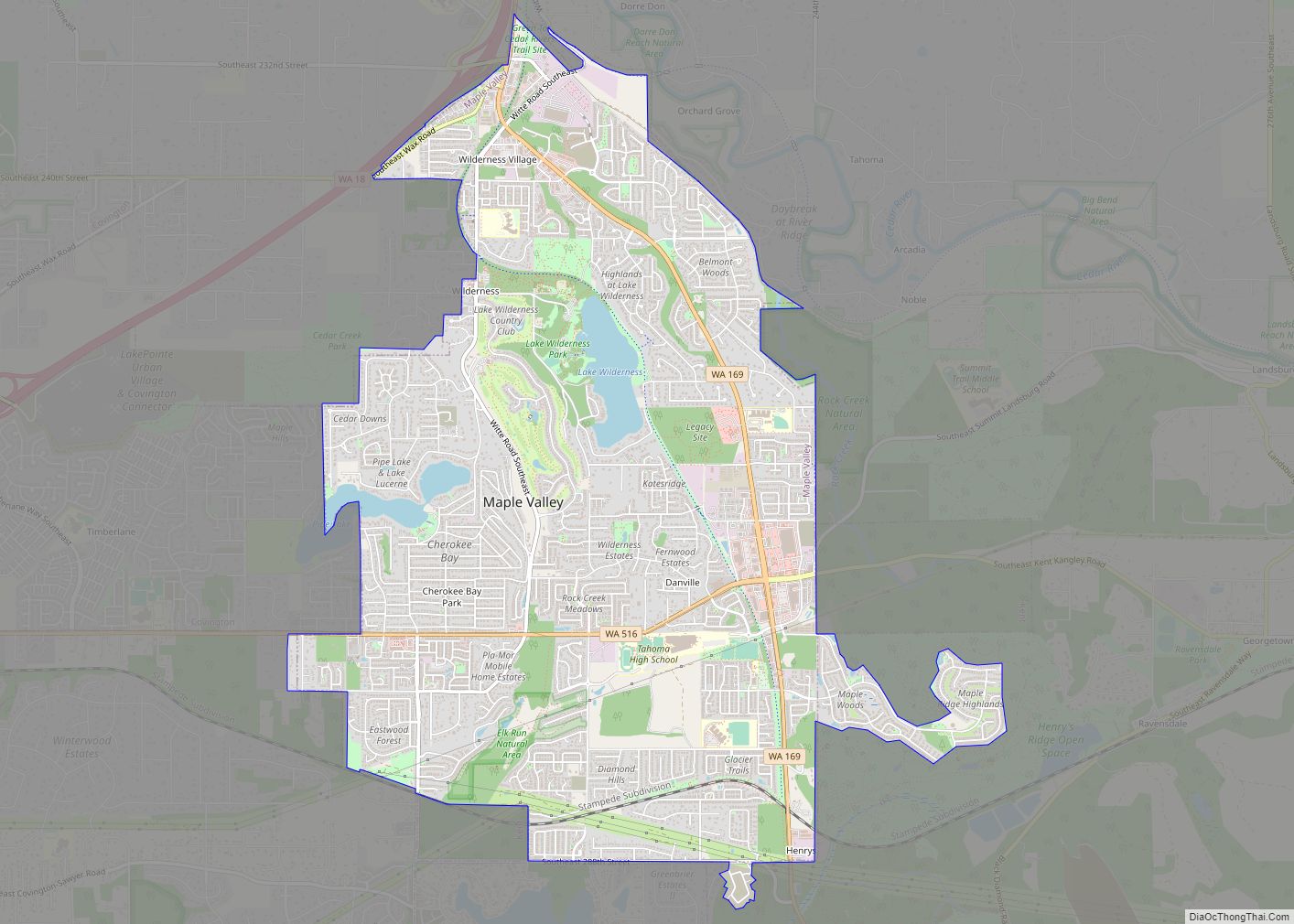
Maple Valley is a city in King County, Washington, United States. The population was 28,013 at the 2020 census. The city functions as a commuter town for residents, though there is an increasing amount of commercial activity in the area. Maple Valley city overview: Name: Maple Valley city LSAD Code: 25 LSAD Description: city (suffix) ... Read more
Map of Maple Valley city
Map of Maple Heights-Lake Desire CDP
Maple Heights-Lake Desire is a census-designated place (CDP) in King County, Washington, United States. At the 2010 census, the population was 3,152. Based on per capita income, one of the more reliable measures of affluence, Maple Heights-Lake Desire ranks 28th of 522 areas in the state of Washington to be ranked. Maple Heights-Lake Desire CDP ... Read more
Map of Maple Heights-Lake Desire CDP
Map of Maple Falls CDP
Maple Falls is a census-designated place (CDP) in Whatcom County, Washington, United States. The population was 324 at the 2010 census. Maple Falls CDP overview: Name: Maple Falls CDP LSAD Code: 57 LSAD Description: CDP (suffix) State: Washington County: Whatcom County Elevation: 646 ft (197 m) Total Area: 3.0 sq mi (7.8 km²) Land Area: 3.0 sq mi (7.8 km²) Water Area: 0.0 sq mi ... Read more
Map of Maple Falls CDP
Map of Martha Lake CDP
Martha Lake is a census-designated place (CDP) in Snohomish County, Washington, United States. The population was 21,129 at the 2020 census. It lies west of Mill Creek and northeast of Lynnwood, near the lake of the same name. Based on per capita income, one of the more reliable measures of affluence, Martha Lake ranks 95th ... Read more
Map of Martha Lake CDP
Map of Meadow Glade CDP
Meadow Glade is a census-designated place (CDP) in Clark County, Washington, United States. The population was 2,541 at the 2010 census. Meadow Glade CDP overview: Name: Meadow Glade CDP LSAD Code: 57 LSAD Description: CDP (suffix) State: Washington County: Clark County Elevation: 282 ft (86 m) Total Area: 3.9 sq mi (10.0 km²) Land Area: 3.9 sq mi (10.0 km²) Water Area: 0.0 sq mi ... Read more
Map of Meadow Glade CDP
Map of Mead CDP, Washington
Mead is an unincorporated suburb and census-designated place north of Spokane in Spokane County, Washington, United States. Named for Civil War general George Meade, this rural area is tracked by the United States Census Bureau. As of 2020, the population of Mead was 7,576. In 1900 Mead was the second stop on the Spokane Falls ... Read more
Map of Mead CDP, Washington
Map of McMillin CDP
McMillin is a census-designated place located in Pierce County, Washington. McMillin CDP overview: Name: McMillin CDP LSAD Code: 57 LSAD Description: CDP (suffix) State: Washington County: Pierce County Elevation: 128 ft (39 m) Total Area: 1.65 sq mi (4.3 km²) Land Area: 1.59 sq mi (4.1 km²) Water Area: 0.06 sq mi (0.2 km²) Total Population: 1,547 Population Density: 940/sq mi (360/km²) FIPS code: 5341785 Online Interactive ... Read more
Map of McMillin CDP
Map of McKenna CDP
McKenna is an unincorporated community in Pierce County, Washington, United States, located on State Route 507 and the Nisqually River, east of Yelm. Founded around 1908, McKenna is a former timber company town. McKenna CDP overview: Name: McKenna CDP LSAD Code: 57 LSAD Description: CDP (suffix) State: Washington County: Pierce County Elevation: 308 ft (94 m) Total ... Read more
Map of McKenna CDP
Map of McCleary city
McCleary (/məkˈklæriː/) is a city in Grays Harbor County, Washington, United States. The population was 1,997 at the 2020 census. McCleary city overview: Name: McCleary city LSAD Code: 25 LSAD Description: city (suffix) State: Washington County: Grays Harbor County Elevation: 276 ft (84 m) Total Area: 2.07 sq mi (5.37 km²) Land Area: 2.05 sq mi (5.31 km²) Water Area: 0.02 sq mi (0.06 km²) Total ... Read more
Map of McCleary city
Map of McChord AFB CDP
McChord AFB CDP overview: Name: McChord AFB CDP LSAD Code: 57 LSAD Description: CDP (suffix) State: Washington County: Pierce County FIPS code: 5341155 Online Interactive Map McChord AFB online map. Source: Basemap layers from Google Map, Open Street Map (OSM), Arcgisonline, Wmflabs. Boundary Data from Database of Global Administrative Areas. McChord AFB location map. Where ... Read more
Map of McChord AFB CDP
Map of May Creek CDP
May Creek is a census-designated place (CDP) in Snohomish County, Washington, United States. The population was 818 at the 2010 census. May Creek CDP overview: Name: May Creek CDP LSAD Code: 57 LSAD Description: CDP (suffix) State: Washington County: Snohomish County Elevation: 256 ft (78 m) Total Area: 1.7 sq mi (4.4 km²) Land Area: 1.7 sq mi (4.4 km²) Water Area: 0.0 sq mi ... Read more
Map of May Creek CDP
Map of Mattawa city
Mattawa is an incorporated city in Grant County, Washington, United States. The population was 3,335 at the 2020 census. Mattawa city overview: Name: Mattawa city LSAD Code: 25 LSAD Description: city (suffix) State: Washington County: Grant County Elevation: 768 ft (234 m) Total Area: 0.92 sq mi (2.39 km²) Land Area: 0.92 sq mi (2.39 km²) Water Area: 0.00 sq mi (0.00 km²) Total Population: 3,335 ... Read more
Map of Mattawa city