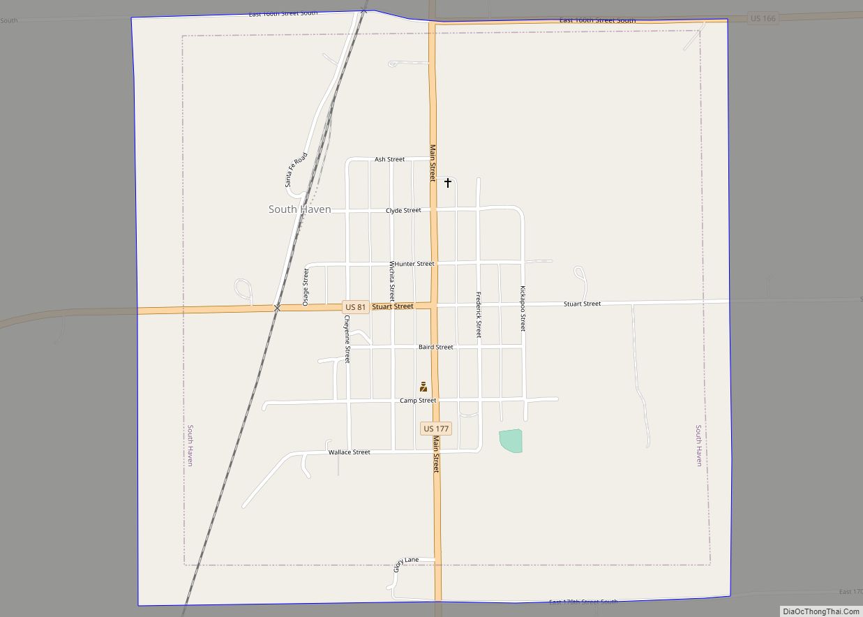
South Haven is a city in Sumner County, Kansas, United States. As of the 2020 census, the population of the city was 324. South Haven city overview: Name: South Haven city LSAD Code: 25 LSAD Description: city (suffix) State: Kansas County: Sumner County Founded: 1872 Incorporated: 1887 Elevation: 1,122 ft (342 m) Total Area: 1.00 sq mi (2.59 km²) Land ... Read more
Map of US Cities and Places
Solomon is a city in Dickinson and Saline counties in the U.S. state of Kansas. As of the 2020 census, the population of the city was 993. It is located approximately 6 miles west of Abilene. Solomon city overview: Name: Solomon city LSAD Code: 25 LSAD Description: city (suffix) State: Kansas County: Dickinson County, Saline ... Read more
Soldier is a city in Jackson County, Kansas, United States. As of the 2020 census, the population of the city was 102. Soldier city overview: Name: Soldier city LSAD Code: 25 LSAD Description: city (suffix) State: Kansas County: Jackson County Founded: 1877 Incorporated: 1896 Elevation: 1,221 ft (372 m) Total Area: 0.15 sq mi (0.38 km²) Land Area: 0.15 sq mi (0.38 km²) ... Read more
Speed is a city in Phillips County, Kansas, United States. As of the 2020 census, the population of the city was 37. Speed city overview: Name: Speed city LSAD Code: 25 LSAD Description: city (suffix) State: Kansas County: Phillips County Founded: 1890s Incorporated: 1928 Elevation: 1,860 ft (570 m) Total Area: 0.15 sq mi (0.39 km²) Land Area: 0.15 sq mi (0.39 km²) ... Read more
Spearville is a city in Ford County, Kansas, United States. As of the 2020 census, the population of the city was 791. Spearville city overview: Name: Spearville city LSAD Code: 25 LSAD Description: city (suffix) State: Kansas County: Ford County Founded: 1873 Incorporated: 1885 Elevation: 2,461 ft (750 m) Total Area: 0.63 sq mi (1.63 km²) Land Area: 0.63 sq mi (1.63 km²) ... Read more
South Hutchinson is a city in Reno County, Kansas, United States. As of the 2020 census, the population of the city was 2,521. It is a south suburb of Hutchinson. South Hutchinson city overview: Name: South Hutchinson city LSAD Code: 25 LSAD Description: city (suffix) State: Kansas County: Reno County Founded: 1887 Incorporated: 1887 Elevation: ... Read more
Spring Hill is a city in Johnson and Miami counties in the U.S. state of Kansas, and part of the Kansas City Metropolitan Area. As of the 2020 census, the population of the city was 7,952. Spring Hill city overview: Name: Spring Hill city LSAD Code: 25 LSAD Description: city (suffix) State: Kansas County: Johnson ... Read more
Spivey is a city in Kingman County, Kansas, United States. As of the 2020 census, the population of the city was 61. Spivey city overview: Name: Spivey city LSAD Code: 25 LSAD Description: city (suffix) State: Kansas County: Kingman County Founded: 1880s Incorporated: 1887 Elevation: 1,509 ft (460 m) Total Area: 0.52 sq mi (1.35 km²) Land Area: 0.52 sq mi (1.35 km²) ... Read more
St. Francis city overview: Name: St. Francis city LSAD Code: 25 LSAD Description: city (suffix) State: Kansas County: Cheyenne County FIPS code: 2062175 Online Interactive Map St. Francis online map. Source: Basemap layers from Google Map, Open Street Map (OSM), Arcgisonline, Wmflabs. Boundary Data from Database of Global Administrative Areas. St. Francis location map. Where ... Read more
St. Marys city overview: Name: St. Marys city LSAD Code: 25 LSAD Description: city (suffix) State: Kansas County: Pottawatomie County, Wabaunsee County FIPS code: 2062400 Online Interactive Map St. Marys online map. Source: Basemap layers from Google Map, Open Street Map (OSM), Arcgisonline, Wmflabs. Boundary Data from Database of Global Administrative Areas. St. Marys location ... Read more
St. John city overview: Name: St. John city LSAD Code: 25 LSAD Description: city (suffix) State: Kansas County: Stafford County FIPS code: 2062275 Online Interactive Map St. John online map. Source: Basemap layers from Google Map, Open Street Map (OSM), Arcgisonline, Wmflabs. Boundary Data from Database of Global Administrative Areas. St. John location map. Where ... Read more
St. George city overview: Name: St. George city LSAD Code: 25 LSAD Description: city (suffix) State: Kansas County: Pottawatomie County FIPS code: 2062200 Online Interactive Map St. George online map. Source: Basemap layers from Google Map, Open Street Map (OSM), Arcgisonline, Wmflabs. Boundary Data from Database of Global Administrative Areas. St. George location map. Where ... Read more