Map of Providence Village town

Map of Providence Village town

Providence Village is a new town in Denton County, Texas, United States. Composed largely of a master-planned community, it includes approximately 1,700 homes and 5,750 people. At the time of the 2010 census, the town had not yet incorporated, and was instead listed by the U.S. Census Bureau as the “Providence” census-designated place, with a … Read more

Map of Prosper town

Map of Prosper town

Prosper is a town in Collin and Denton counties in the U.S. state of Texas. Prosper is located within the Dallas-Fort Worth-Arlington metropolitan area. As of the 2010 census, its population was 9,423; as of 2020, its population was 30,174. Prosper town overview: Name: Prosper town LSAD Code: 43 LSAD Description: town (suffix) State: Texas … Read more

Map of Progreso city

Map of Progreso city

Progreso is a city in Hidalgo County, Texas. The population was 5,507 at the time of the 2010 United States Census. It is part of the McAllen–Edinburg–Mission and Reynosa–McAllen metropolitan areas. Progreso city overview: Name: Progreso city LSAD Code: 25 LSAD Description: city (suffix) State: Texas County: Hidalgo County Elevation: 69 ft (21 m) Total Area: 3.00 sq mi … Read more

Map of Progreso Lakes city

Map of Progreso Lakes city

Progreso Lakes is a city in Hidalgo County, Texas. The population was 240 at the 2010 United States Census. The city, incorporated in 1979, is centered on Lion and Moon Lakes, two resacas or ox-bow lakes. Progreso Lakes is part of the McAllen–Edinburg–Mission and Reynosa–McAllen metropolitan areas. In addition, it shares the U.S.-Mexico border with … Read more

Map of Princeton city, Texas

Map of Princeton city, Texas

Princeton is a city in Collin County, Texas, United States. As of the 2010 census it had a population of 6,807, with an increase to 17,027 in 2020. Princeton city overview: Name: Princeton city LSAD Code: 25 LSAD Description: city (suffix) State: Texas County: Collin County Elevation: 574 ft (175 m) Total Area: 10.16 sq mi (26.30 km²) Land Area: … Read more

Map of Primera town

Map of Primera town

Primera is a town in Cameron County, Texas, United States, near Combes. The population was 4,070 at the 2010 census. It is part of the Brownsville–Harlingen–Raymondville and the Matamoros–Brownsville metropolitan areas. Primera town overview: Name: Primera town LSAD Code: 43 LSAD Description: town (suffix) State: Texas County: Cameron County Elevation: 43 ft (13 m) Total Area: 2.78 sq mi … Read more

Map of Pyote town

Map of Pyote town

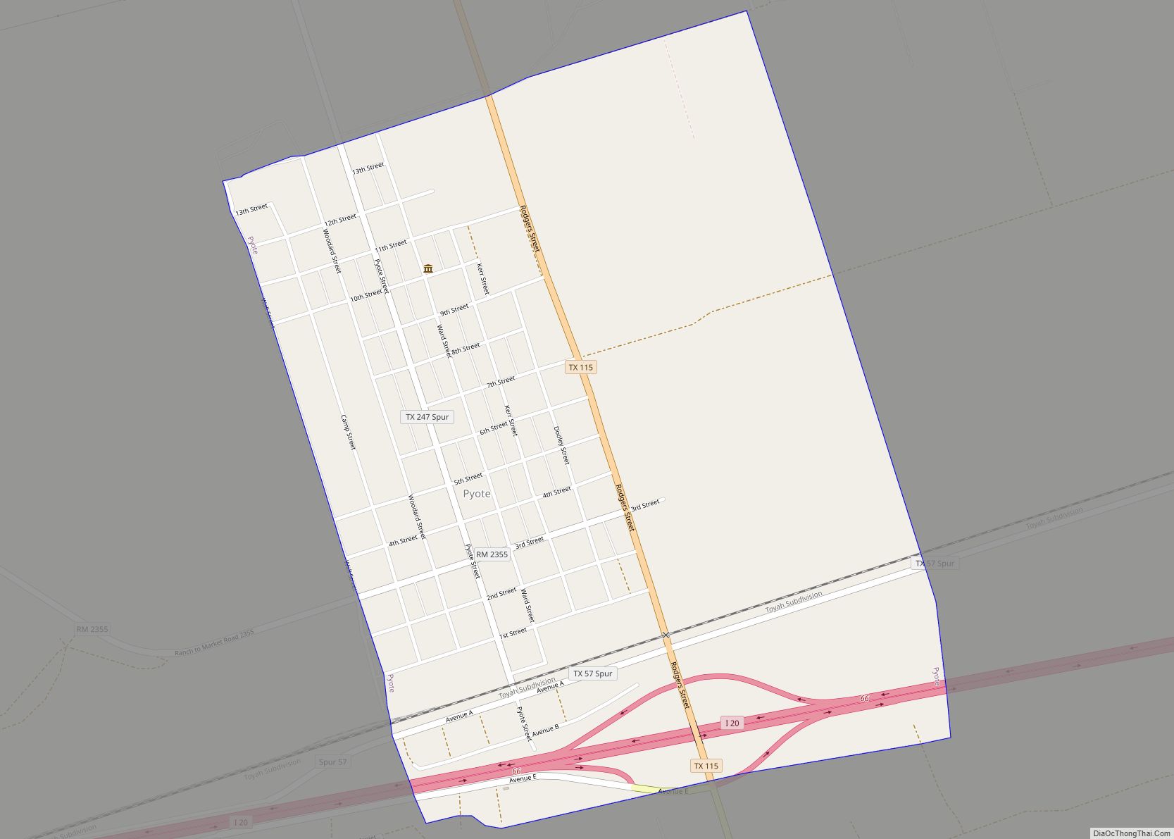
Pyote (/ˈpaɪoʊt/ PY-oht) is a town in Ward County, Texas, United States. Its population was 114 at the 2010 census. Pyote town overview: Name: Pyote town LSAD Code: 43 LSAD Description: town (suffix) State: Texas County: Ward County Elevation: 2,625 ft (800 m) Total Area: 1.27 sq mi (3.30 km²) Land Area: 1.27 sq mi (3.30 km²) Water Area: 0.00 sq mi (0.00 km²) Total Population: … Read more

Map of Putnam town, Texas

Map of Putnam town, Texas

Putnam is a town in Callahan County, Texas, United States. The population was 94 at the 2010 census. It is part of the Abilene, Texas Metropolitan Statistical Area. Putnam town overview: Name: Putnam town LSAD Code: 43 LSAD Description: town (suffix) State: Texas County: Callahan County Elevation: 1,608 ft (490 m) Total Area: 1.01 sq mi (2.62 km²) Land Area: … Read more

Map of Pueblo Nuevo CDP

Map of Pueblo Nuevo CDP

Pueblo Nuevo is a census-designated place (CDP) in Webb County, Texas, United States.This was a new CDP formed from parts of the Laredo Ranchettes CDP and additional area prior to the 2010 census with a population of 521. Pueblo Nuevo CDP overview: Name: Pueblo Nuevo CDP LSAD Code: 57 LSAD Description: CDP (suffix) State: Texas … Read more

Map of Pueblo East CDP

Map of Pueblo East CDP

Pueblo East is a census-designated place (CDP) in Webb County, Texas, United States. This was a new CDP formed from parts of the Ranchitos Las Lomas CDP prior to the 2010 census. Although a new CDP the population was listed as zero. Pueblo East CDP overview: Name: Pueblo East CDP LSAD Code: 57 LSAD Description: … Read more

Map of Quitman city, Texas

Map of Quitman city, Texas

Quitman is a city and the county seat of Wood County, Texas, United States. Its population was 1,942 at the 2020 census. It is most notable for being the birthplace of Academy Award-winning actress Sissy Spacek. The city was named for John A. Quitman, a veteran of the Mexican–American War, and once governor of Mississippi. … Read more

Map of Quitaque city

Map of Quitaque city

Quitaque (/ˈkɪtɪkweɪ/ KIT-i-kway) is a city in southeastern Briscoe County, Texas, United States. The town lies directly south of Capcrock Canyon State Park and is a ranching and farming area in West Texas. The population was 411 at the 2010 census. According to tradition, Quitaque is a name derived from an American Indian language, meaning … Read more