Map of Quintana town
Quintana is a town in Brazoria County, Texas, United States. Its population was 56 at the 2010 census. Quintana town overview: Name: Quintana town LSAD Code: 43 LSAD Description: town (suffix) State: Texas County: Brazoria County Elevation: 7 ft (2 m) Total Area: 2.39 sq mi (6.19 km²) Land Area: 0.69 sq mi (1.79 km²) Water Area: 1.70 sq mi (4.39 km²) Total Population: 56 Population ... Read more
Map of Quintana town
Map of Quinlan city
Quinlan is a rural city in the southern part of Hunt County, Texas, United States, within the Dallas–Fort Worth metropolitan area. As of the 2010 census, it had a population of 1,394. It is 5 miles (8 km) west of Lake Tawakoni. Quinlan city overview: Name: Quinlan city LSAD Code: 25 LSAD Description: city (suffix) State: ... Read more
Map of Quinlan city
Map of Quesada CDP
Quesada is a census-designated place (CDP) in Starr County, Texas, United States. This was a new CDP for the 2010 census with a population of 25. Quesada CDP overview: Name: Quesada CDP LSAD Code: 57 LSAD Description: CDP (suffix) State: Texas County: Starr County Total Area: 25 FIPS code: 4860098 Online Interactive Map Quesada online ... Read more
Map of Quesada CDP
Map of Quemado CDP, Texas
Quemado is a census-designated place (CDP) in Maverick County, Texas, United States. Its population was 230 at the 2010 census. Quemado CDP overview: Name: Quemado CDP LSAD Code: 57 LSAD Description: CDP (suffix) State: Texas County: Maverick County Elevation: 784 ft (239 m) Total Area: 0.1 sq mi (0.3 km²) Land Area: 0.1 sq mi (0.3 km²) Water Area: 0.0 sq mi (0.0 km²) Total Population: ... Read more
Map of Quemado CDP, Texas
Map of Queen City, Texas
Queen City is a city in Cass County, Texas, United States. The population was 1,476 as of the 2010 census; in 2020, its population was 1,397. Queen City city overview: Name: Queen City city LSAD Code: 25 LSAD Description: city (suffix) State: Texas County: Cass County Elevation: 358 ft (109 m) Total Area: 3.56 sq mi (9.23 km²) Land Area: ... Read more
Map of Queen City, Texas
Map of Quanah city
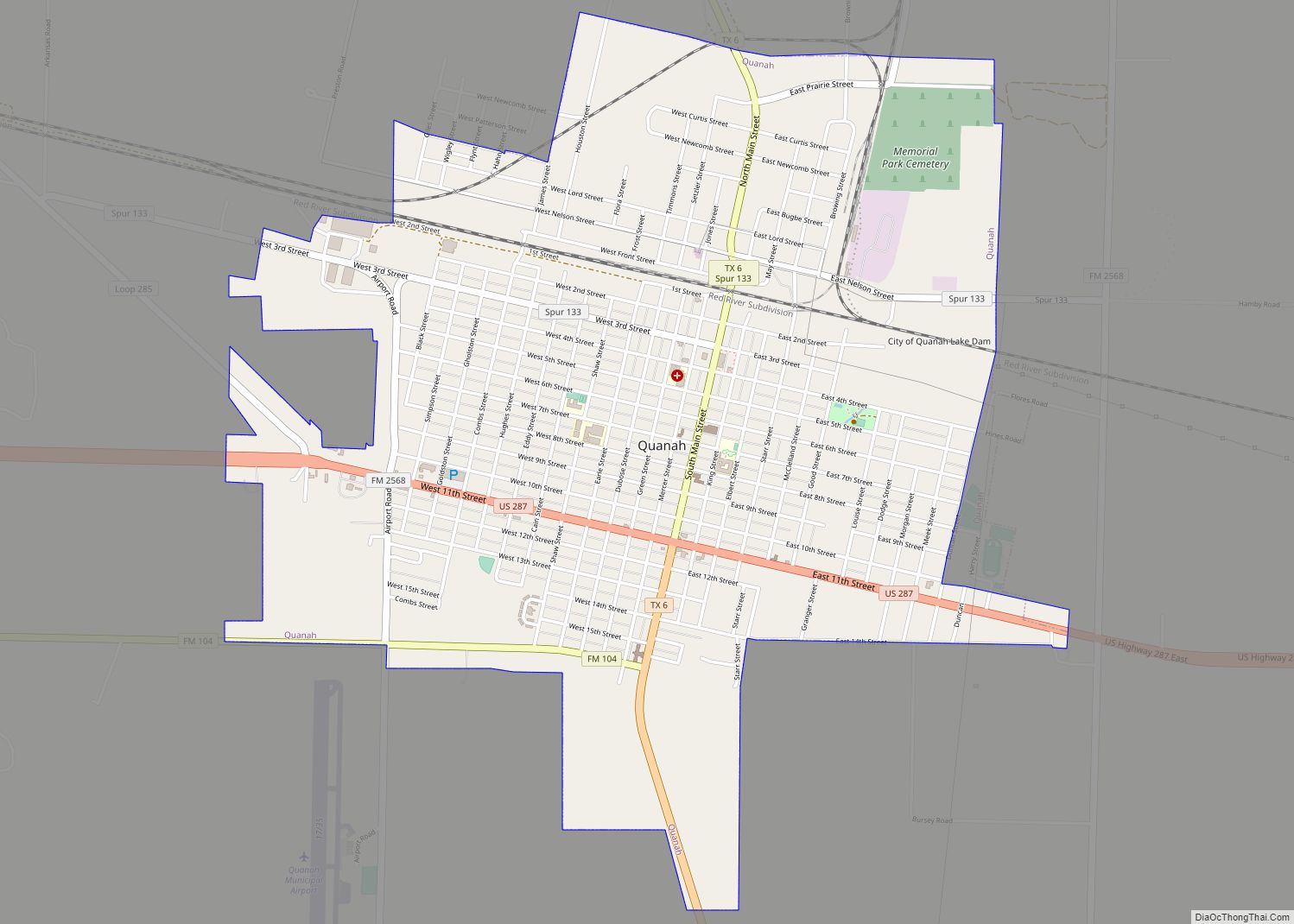
Quanah (/ˈkwɑːnə/) is a city in and the county seat of Hardeman County, Texas, United States. As of the 2010 census the population was 2,641, down from 3,022 at the 2000 census. Quanah is 192 miles (309 km) northwest of Fort Worth and 8 miles (13 km) south of the Red River, which forms the Oklahoma-Texas state ... Read more
Map of Quanah city
Map of Quail CDP
Quail is a rural small town and census-designated place in Collingsworth County, Texas, United States. The population was 19 at the 2010 census, down from 33 at the 2000 census. The town has a general store, a small hotel and an income tax service. Quail CDP overview: Name: Quail CDP LSAD Code: 57 LSAD Description: ... Read more
Map of Quail CDP
Map of Quail Creek CDP
Quail Creek is a census-designated place (CDP) in Victoria County, Texas, United States. This was a new CDP for the 2010 census with a population of 1628. Quail Creek CDP overview: Name: Quail Creek CDP LSAD Code: 57 LSAD Description: CDP (suffix) State: Texas County: Victoria County Total Area: 3.1 sq mi (8.0 km²) Land Area: 3.1 sq mi (8.0 km²) ... Read more
Map of Quail Creek CDP
Map of Ranchitos Las Lomas CDP
Ranchitos Las Lomas is a census-designated place (CDP) in Webb County, Texas, United States. The population was 266 at the 2010 census. Las Lomas means “the hills” in Spanish. The town prides itself as “the place where nothing ever happened.” Ranchitos Las Lomas CDP overview: Name: Ranchitos Las Lomas CDP LSAD Code: 57 LSAD Description: ... Read more
Map of Ranchitos Las Lomas CDP
Map of Ranchitos East CDP
Ranchitos East is a census-designated place (CDP) in Webb County, Texas, United States.This was a new CDP formed from parts of the Laredo Ranchettes CDP prior to the 2010 census with a population of 212. Ranchitos East CDP overview: Name: Ranchitos East CDP LSAD Code: 57 LSAD Description: CDP (suffix) State: Texas County: Webb County ... Read more
Map of Ranchitos East CDP
Map of Ranchitos del Norte CDP
Ranchitos del Norte is a census-designated place (CDP) in Starr County, Texas, United States. It is a new CDP for the 2010 census with a population of 112. Parts of this new CDP were formed from the former Los Villareales CDP. Ranchitos del Norte CDP overview: Name: Ranchitos del Norte CDP LSAD Code: 57 LSAD ... Read more
Map of Ranchitos del Norte CDP
Map of Ranchette Estates CDP
Ranchette Estates is a census-designated place (CDP) in Willacy County, Texas, United States. The population was 152 at the 2010 census. Ranchette Estates CDP overview: Name: Ranchette Estates CDP LSAD Code: 57 LSAD Description: CDP (suffix) State: Texas County: Willacy County Elevation: 36 ft (11 m) Total Area: 0.6 sq mi (1.6 km²) Land Area: 0.6 sq mi (1.6 km²) Water Area: 0.0 sq mi ... Read more
Map of Ranchette Estates CDP