Map of Troy city, Texas

Map of Troy city, Texas

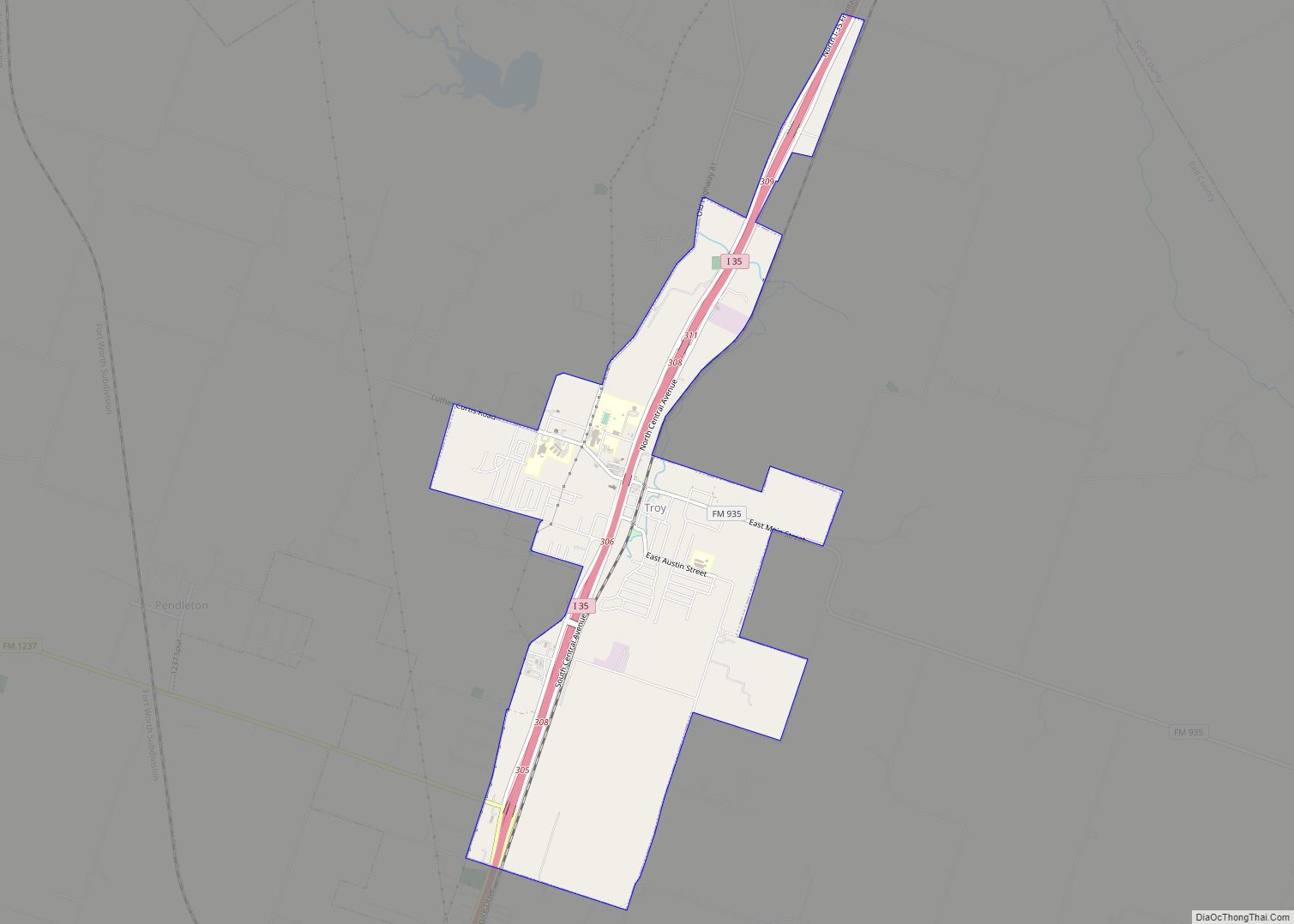
Troy is a city in Bell County, Texas, United States. The population was 2,375 at the 2020 census. It is part of the Killeen–Temple–Fort Hood Metropolitan Statistical Area. Troy city overview: Name: Troy city LSAD Code: 25 LSAD Description: city (suffix) State: Texas County: Bell County Elevation: 679 ft (207 m) Total Area: 4.66 sq mi (12.08 km²) Land Area: … Read more

Map of Troup city

Map of Troup city

Troup is a city in Smith and Cherokee Counties in the U.S. state of Texas. Its population was 2,006 at the 2020 census. Troup lies in two counties in East Texas. Troup city overview: Name: Troup city LSAD Code: 25 LSAD Description: city (suffix) State: Texas County: Cherokee County, Smith County Elevation: 456 ft (139 m) Total … Read more

Map of University Park city, Texas

Map of University Park city, Texas

University Park is a city in Dallas County, Texas, United States of America, in suburban Dallas. The population was 23,068 at the 2010 census. The city is home to Southern Methodist University. University Park is bordered on the north, east and west by Dallas and on the south by the town of Highland Park. University … Read more

Map of Universal City city

Map of Universal City

Universal City is a city in Bexar County, Texas, United States. It borders San Antonio to the northeast, and is adjacent to Randolph Air Force Base. The population was 19,720 at the 2020 census. It is part of the San Antonio Metropolitan Statistical Area. Universal City overview: Name: Universal City LSAD Code: 25 LSAD Description: … Read more

Map of Union Valley city

Map of Union Valley city

Union Valley is a city in Hunt County, Texas, United States. The city was incorporated in 2007. The population at the 2010 census was 307. Union Valley city overview: Name: Union Valley city LSAD Code: 25 LSAD Description: city (suffix) State: Texas County: Hunt County Elevation: 513 ft (156 m) Total Area: 2.47 sq mi (6.41 km²) Land Area: 2.46 sq mi … Read more

Map of Union Grove city, Texas

Map of Union Grove city, Texas

Union Grove is a city in Upshur County, Texas, United States. The population was 357 at the 2010 census. Union Grove city overview: Name: Union Grove city LSAD Code: 25 LSAD Description: city (suffix) State: Texas County: Upshur County Elevation: 410 ft (125 m) Total Area: 0.95 sq mi (2.45 km²) Land Area: 0.94 sq mi (2.42 km²) Water Area: 0.01 sq mi (0.03 km²) Total … Read more

Map of Uncertain city

Map of Uncertain city

Uncertain is a city in Harrison County, Texas, in the United States. According to the 2010 census, the city population was 94, down from 150 at the 2000 census. In 2020, it had a population of 85. Uncertain city overview: Name: Uncertain city LSAD Code: 25 LSAD Description: city (suffix) State: Texas County: Harrison County … Read more

Map of Valentine town, Texas

Map of Valentine town, Texas

Valentine is a town in Jeff Davis County, Texas, United States. The population was 134 at the 2010 census, down from 187 at the 2000 census. Valentine town overview: Name: Valentine town LSAD Code: 43 LSAD Description: town (suffix) State: Texas County: Jeff Davis County Elevation: 4,432 ft (1,351 m) Total Area: 0.49 sq mi (1.26 km²) Land Area: 0.49 sq mi … Read more

Map of Val Verde Park CDP

Map of Val Verde Park CDP

Val Verde Park is a census-designated place (CDP) in Val Verde County, Texas, United States. The population was 2,384 at the 2010 census. Val Verde Park CDP overview: Name: Val Verde Park CDP LSAD Code: 57 LSAD Description: CDP (suffix) State: Texas County: Val Verde County Elevation: 1,079 ft (329 m) Total Area: 0.8 sq mi (2.1 km²) Land Area: … Read more

Map of Uvalde city

Map of Uvalde city

Uvalde is a city and the county seat of Uvalde County, Texas, United States. The population was 15,217 at the 2020 census. Uvalde is located in the Texas Hill Country, 80 miles (130 km) west of downtown San Antonio and 54 miles (87 km) east of the Mexico–United States border. Uvalde city overview: Name: Uvalde city LSAD … Read more

Map of Uvalde Estates CDP

Map of Uvalde Estates CDP

Uvalde Estates is a census-designated place (CDP) in Uvalde County, Texas, United States. The population was 2,171 at the 2010 census. Uvalde Estates CDP overview: Name: Uvalde Estates CDP LSAD Code: 57 LSAD Description: CDP (suffix) State: Texas County: Uvalde County Elevation: 961 ft (293 m) Total Area: 5.9 sq mi (15.4 km²) Land Area: 5.9 sq mi (15.3 km²) Water Area: 0.02 sq mi … Read more

Map of Utopia CDP

Map of Utopia CDP

Utopia is a census-designated place (CDP) in Uvalde County, Texas, United States. The population was 227 at the 2010 census. Utopia CDP overview: Name: Utopia CDP LSAD Code: 57 LSAD Description: CDP (suffix) State: Texas County: Uvalde County Elevation: 1,362 ft (415 m) Total Area: 3.0 sq mi (7.6 km²) Land Area: 3.0 sq mi (7.6 km²) Water Area: 0.0 sq mi (0.0 km²) Total Population: … Read more