Map of Blum town

Map of Blum town

Blum is a town in Hill County, Texas, United States. The population was 444 at the 2010 census. Blum town overview: Name: Blum town LSAD Code: 43 LSAD Description: town (suffix) State: Texas County: Hill County Elevation: 591 ft (180 m) Total Area: 1.01 sq mi (2.61 km²) Land Area: 0.99 sq mi (2.56 km²) Water Area: 0.02 sq mi (0.05 km²) Total Population: 444 Population … Read more

Map of Bluetown CDP

Map of Bluetown CDP

Bluetown is a census-designated place (CDP) in Cameron County, in the U.S. state of Texas. The population was 356 at the 2010 census. Prior to the 2010 census the community was part of the Bluetown-Iglesia Antigua CDP. It is part of the Brownsville–Harlingen Metropolitan Statistical Area. Bluetown CDP overview: Name: Bluetown CDP LSAD Code: 57 … Read more

Map of Blue Ridge city, Texas

Map of Blue Ridge city, Texas

Blue Ridge is a city at the intersection of state highway 78, FM 981, and FM 545 in Collin County, Texas, United States. The population was 822 at the 2010 census, and 1,180 in 2020. Blue Ridge city overview: Name: Blue Ridge city LSAD Code: 25 LSAD Description: city (suffix) State: Texas County: Collin County … Read more

Map of Blue Mound city, Texas

Map of Blue Mound city, Texas

Blue Mound is a city in Tarrant County, Texas, United States. The population was 2,394 as of the 2010 census. Blue Mound city overview: Name: Blue Mound city LSAD Code: 25 LSAD Description: city (suffix) State: Texas County: Tarrant County Elevation: 673 ft (205 m) Total Area: 0.51 sq mi (1.31 km²) Land Area: 0.51 sq mi (1.31 km²) Water Area: 0.00 sq mi (0.00 km²) … Read more

Map of Blue Berry Hill CDP

Map of Blue Berry Hill CDP

Blueberry Hill is a census-designated place (CDP) in Bee County, Texas, United States. The population was 866 at the 2010 census. It is located just outside Beeville and has no services of its own. Drinking water and garbage services are provided by the city of Beeville. Mailing addresses for Blueberry Hill are labeled “Beeville”. Blue … Read more

Map of Blossom city

Map of Blossom city

Blossom is a town in Lamar County, Texas, United States. The population was 1,402 at the 2020 census. Blossom city overview: Name: Blossom city LSAD Code: 25 LSAD Description: city (suffix) State: Texas County: Lamar County Elevation: 528 ft (161 m) Total Area: 2.60 sq mi (6.72 km²) Land Area: 2.55 sq mi (6.62 km²) Water Area: 0.04 sq mi (0.11 km²) Total Population: 1,402 Population … Read more

Map of Bloomington CDP, Texas

Map of Bloomington CDP, Texas

Bloomington is a census-designated place (CDP) in Victoria County, Texas, United States. The population was 2,459 at the 2010 census. It is included in the Victoria, Texas Metropolitan Statistical Area. Bloomington CDP overview: Name: Bloomington CDP LSAD Code: 57 LSAD Description: CDP (suffix) State: Texas County: Victoria County Elevation: 59 ft (18 m) Total Area: 2.7 sq mi (6.9 km²) … Read more

Map of Blooming Grove town

Map of Blooming Grove town

Blooming Grove is a town in western Navarro County, Texas, United States. As of the 2010 census, the town population was 821. Blooming Grove town overview: Name: Blooming Grove town LSAD Code: 43 LSAD Description: town (suffix) State: Texas County: Navarro County Elevation: 597 ft (181.97 m) Total Area: 0.86 sq mi (2.22 km²) Land Area: 0.86 sq mi (2.22 km²) Water Area: … Read more

Map of Bogata city

Map of Bogata city

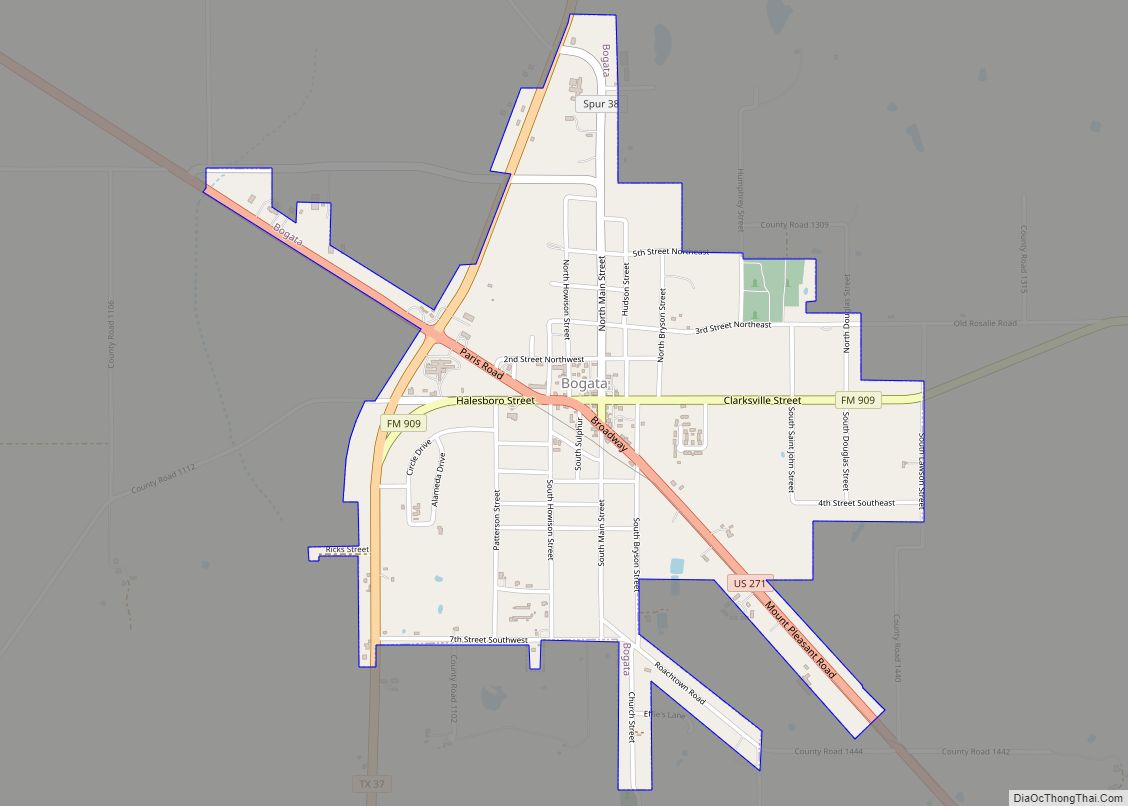
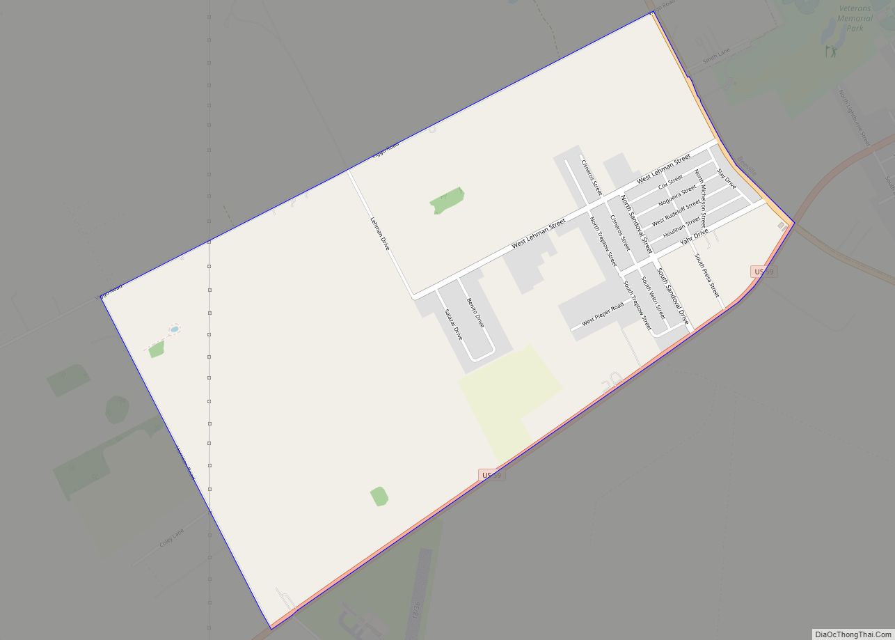
Bogata (/bəˈɡoʊtə/ bə-GOH-tə) is a city in Red River County, Texas, United States. The population was 1,074 at the 2020 census. The city was named after Bogotá, the capital of Colombia. Bogata city overview: Name: Bogata city LSAD Code: 25 LSAD Description: city (suffix) State: Texas County: Red River County Elevation: 423 ft (129 m) Total Area: … Read more

Map of Boerne city

Map of Boerne city

Boerne (/ˈbɜːrni/ BURN-ee) is a city in and the county seat of Kendall County, Texas, in the Texas Hill Country. Boerne is known for its German-Texan history, named in honor of German author and satirist Ludwig Börne by the German Founders of the town. The population of Boerne was 10,471 at the 2010 census, and … Read more

Map of Bowie city, Texas

Map of Bowie city, Texas

Bowie (/ˈbuːi/ BOO-ee) is a town in Montague County, Texas, United States. The population was 5,218 at the 2010 census. Bowie city overview: Name: Bowie city LSAD Code: 25 LSAD Description: city (suffix) State: Texas County: Montague County Elevation: 1,129 ft (344 m) Total Area: 5.54 sq mi (14.36 km²) Land Area: 5.52 sq mi (14.29 km²) Water Area: 0.02 sq mi (0.06 km²) Total Population: … Read more

Map of Bovina city

Map of Bovina city

Bovina is a city in Parmer County, Texas, United States. The population was 1,868 at the 2010 census. Bovina city overview: Name: Bovina city LSAD Code: 25 LSAD Description: city (suffix) State: Texas County: Parmer County Elevation: 4,068 ft (1,240 m) Total Area: 1.18 sq mi (3.05 km²) Land Area: 1.18 sq mi (3.05 km²) Water Area: 0.00 sq mi (0.00 km²) Total Population: 1,699 Population … Read more