Map of Dickinson city, Texas

Map of Dickinson city, Texas

Dickinson is a city in Galveston County, Texas, within Houston–The Woodlands–Sugar Land metropolitan area. The population was 20,847 at the 2020 census. Dickinson city overview: Name: Dickinson city LSAD Code: 25 LSAD Description: city (suffix) State: Texas County: Galveston County Incorporated: 1977 Elevation: 10 ft (3 m) Total Area: 10.33 sq mi (26.75 km²) Land Area: 9.89 sq mi (25.63 km²) Water Area: … Read more

Map of Dickens city, Texas

Map of Dickens city, Texas

Dickens is a city in and the county seat of Dickens County, Texas, United States. The population was 286 at the 2010 census, down from 332 at the 2000 census. Charles Weldon Cannon (1915–1997), a Dickens County native, made his famous boots and saddles in Dickens. Dickens city overview: Name: Dickens city LSAD Code: 25 … Read more

Map of Diboll city

Map of Diboll city

Diboll /ˈdaɪbɒl/ is a city in Angelina County, Texas, United States. The population was 4,457 at the 2020 census. Diboll is named for J. C. Diboll, a local timber salesman. Diboll city overview: Name: Diboll city LSAD Code: 25 LSAD Description: city (suffix) State: Texas County: Angelina County Elevation: 210 ft (60 m) Total Area: 5.03 sq mi (13.04 km²) … Read more

Map of Deweyville CDP

Map of Deweyville CDP, Texas

Deweyville is a census-designated place (CDP) in Newton County, on the central eastern border of Texas, United States. The population was 571 at the 2020 census, down from 1,023 at the 2010 census. Deweyville CDP overview: Name: Deweyville CDP LSAD Code: 57 LSAD Description: CDP (suffix) State: Texas County: Newton County Elevation: 20 ft (6 m) Total … Read more

Map of Devine city

Map of Devine city

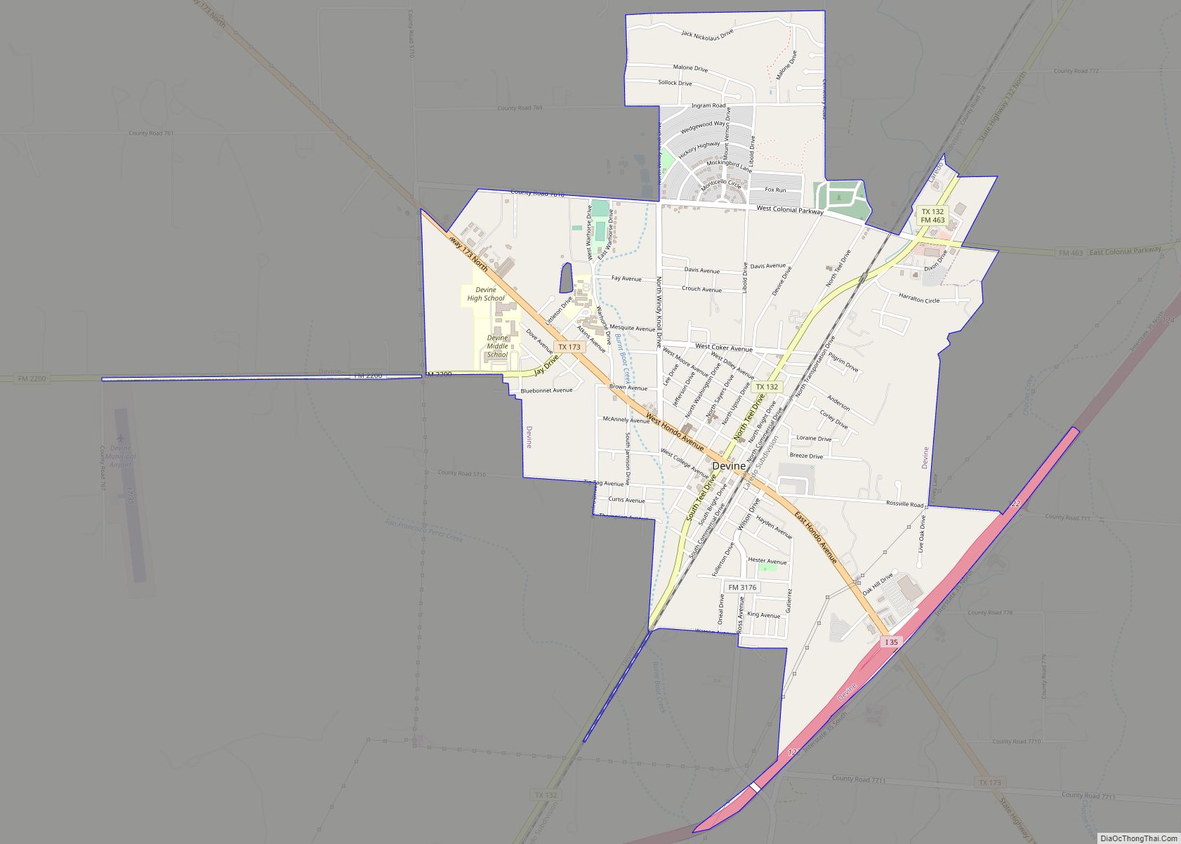
Devine is a city in Medina County, Texas, United States. The population was 4,350 at the 2010 census. It is part of the San Antonio Metropolitan Statistical Area. Devine city overview: Name: Devine city LSAD Code: 25 LSAD Description: city (suffix) State: Texas County: Medina County Elevation: 646 ft (197 m) Total Area: 3.22 sq mi (8.35 km²) Land Area: … Read more

Map of Devers city

Map of Devers city

Devers is a city in Liberty County, Texas, United States. The population was 447 at the 2010 census. Devers city overview: Name: Devers city LSAD Code: 25 LSAD Description: city (suffix) State: Texas County: Liberty County Elevation: 59 ft (18 m) Total Area: 1.86 sq mi (4.82 km²) Land Area: 1.86 sq mi (4.82 km²) Water Area: 0.00 sq mi (0.00 km²) Total Population: 447 Population … Read more

Map of Detroit town, Texas

Map of Detroit town, Texas

Detroit (dɪˈtɹɔɪt) is a town in Red River County, Texas, United States. The population was 704 at the 2020 census. John Nance Garner, 32nd Vice President of the United States, was born outside of Detroit but lived most of his life in Uvalde, on the southern rim of the Texas Hill Country. Detroit town overview: … Read more

Map of DISH town

Map of DISH town

DISH is a town in Denton County, Texas, United States. The town had a population of 201 at the 2010 census. This community, established in June 2000, was originally named Clark. In November 2005, the community accepted an offer to rename itself “DISH” (all capital letters) as part of a commercial agreement with satellite television … Read more

Map of Dimmitt city

Map of Dimmitt city

Dimmitt (/ˈdɪmɪt/ DIM-it) is a city and county seat in Castro County, Texas, United States. Its population was 4,393 at the 2010 census. Dimmitt city overview: Name: Dimmitt city LSAD Code: 25 LSAD Description: city (suffix) State: Texas County: Castro County Elevation: 3,875 ft (1,181 m) Total Area: 3.26 sq mi (8.43 km²) Land Area: 3.15 sq mi (8.16 km²) Water Area: 0.11 sq mi … Read more

Map of Dilley city

Map of Dilley city

Dilley is a city in Frio County, Texas, United States. The population was 3,894 at the 2010 census. It is located off Interstate 35 south of the county seat in Pearsall. Dilley city overview: Name: Dilley city LSAD Code: 25 LSAD Description: city (suffix) State: Texas County: Frio County Elevation: 561 ft (171 m) Total Area: 2.33 sq mi … Read more

Map of Driftwood CDP, Texas

Map of Driftwood CDP, Texas

Driftwood is a census-designated place and unincorporated community in northern Hays County, Texas, United States. Per the 2020 census, the population was 106. Driftwood CDP overview: Name: Driftwood CDP LSAD Code: 57 LSAD Description: CDP (suffix) State: Texas County: Hays County Elevation: 1,043 ft (318 m) Total Area: 1.29 sq mi (3.35 km²) Land Area: 1.29 sq mi (3.35 km²) Water Area: 0.0 sq mi … Read more

Map of Douglassville town, Texas

Map of Douglassville town, Texas

Douglassville is a town in Cass County, Texas, United States. The population was 229 at the 2010 census, up from 175 at the 2000 census. In 2020, its population was 211. Douglassville town overview: Name: Douglassville town LSAD Code: 43 LSAD Description: town (suffix) State: Texas County: Cass County Elevation: 394 ft (120 m) Total Area: 6.33 sq mi … Read more