Map of Enchanted Oaks town

Map of Enchanted Oaks town

Enchanted Oaks is a town in Henderson County, Texas, United States. The population was 326 at the 2010 census, down from 357 at the 2000 census. Enchanted Oaks town overview: Name: Enchanted Oaks town LSAD Code: 43 LSAD Description: town (suffix) State: Texas County: Henderson County Elevation: 345 ft (105 m) Total Area: 0.40 sq mi (1.02 km²) Land Area: … Read more

Map of Encantada-Ranchito-El Calaboz CDP

Map of Encantada-Ranchito-El Calaboz CDP

Encantada-Ranchito-El Calaboz, also known as El Calaboz Rancheria in the San Pedro de Carricitos Land Grant, is a census-designated place (CDP) in Cameron County, Texas, United States. The population was 2,255 at the 2010 census. It is part of the Brownsville–Harlingen Metropolitan Statistical Area. Encantada-Ranchito-El Calaboz CDP overview: Name: Encantada-Ranchito-El Calaboz CDP LSAD Code: 57 … Read more

Map of Emory city

Map of Emory city, Texas

Emory is a city in Rains County, Texas, United States. The population was 1,239 at the 2010 census. It is the county seat of Rains County. Previously known as Springville, the city and county are named after Emory Rains who was a legislator from the area. Rains was the author of the Homestead Law of … Read more

Map of Emhouse town

Map of Emhouse town

Emhouse is a town in Navarro County, Texas, United States. The population was 133 at the 2010 census. It was originally called Lyford when laid out around 1906 around the railroad right of way. Since another Lyford, Texas existed already, it was renamed after Col. Edward M. House, then superintendent of the Trinity and Brazos … Read more

Map of Emerald Bay CDP

Map of Emerald Bay CDP

Emerald Bay is in Smith County, Texas, United States. It is located on the eastern side of Lake Palestine near Bullard, Texas. It is a census-designated place (CDP) created for the 2010 census. Emerald Bay had a population of 1,146 as of the 2020 census. Emerald Bay CDP overview: Name: Emerald Bay CDP LSAD Code: … Read more

Map of Elsa city

Map of Elsa city

Elsa is a city in Hidalgo County, Texas, United States. The population was 7,181 at the 2020 census, It is part of the McAllen–Edinburg–Mission and Reynosa–McAllen metropolitan areas. Elsa city overview: Name: Elsa city LSAD Code: 25 LSAD Description: city (suffix) State: Texas County: Hidalgo County Elevation: 66 ft (20 m) Total Area: 2.09 sq mi (5.41 km²) Land Area: … Read more

Map of Escobares city

Map of Escobares city

Escobares is a city in Starr County, Texas, United States. The population was 2,588 at the 2020 census. The city was formed in 2005 from part of the deleted Escobares CDP, and parts of Garceno, and North Escobares CDPs, and additional area. Prior to its 2005 incorporation as a city, it was a census-designated place … Read more

Map of Ennis city, Texas

Map of Ennis city, Texas

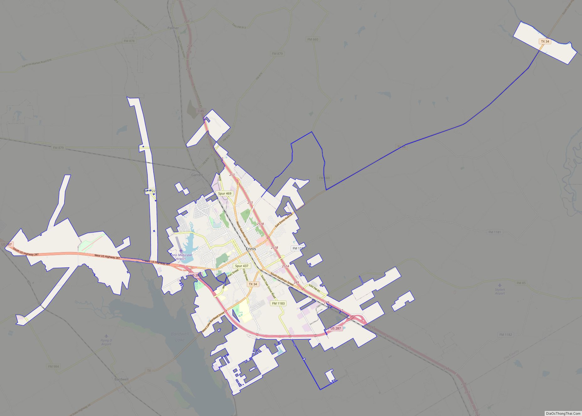
Ennis (/ˈɛnɪs/) is a city in eastern Ellis County, Texas. The population is 20,159 according to the 2020 census, with an estimated population of 21,210 in 2021. Ennis is home to the annual National Polka Festival. Ennis city overview: Name: Ennis city LSAD Code: 25 LSAD Description: city (suffix) State: Texas County: Ellis County Founded: … Read more

Map of Fabens CDP

Map of Fabens CDP

Fabens is a census-designated place (CDP) in El Paso County, Texas, United States. The population was 8,257 at the 2010 census. It is part of the El Paso Metropolitan Statistical Area. The ZIP Codes encompassing the CDP area are 79836 and 79838. Fabens is the birthplace of jockey Bill Shoemaker. Fabens CDP overview: Name: Fabens … Read more

Map of Everman city

Map of Everman city

Everman is a city in Tarrant County, Texas, United States. Its population was 6,154 in the 2020 census, up from 6,108 at the 2010 census. Everman city overview: Name: Everman city LSAD Code: 25 LSAD Description: city (suffix) State: Texas County: Tarrant County Elevation: 669 ft (204 m) Total Area: 1.77 sq mi (4.57 km²) Land Area: 1.76 sq mi (4.56 km²) Water … Read more

Map of Evergreen CDP, Texas

Map of Evergreen CDP, Texas

Evergreen is a census-designated place (CDP) in Starr County, Texas, United States. It is a new CDP formed from part of the Roma Creek CDP prior to the 2010 census with a population of 73. Evergreen CDP overview: Name: Evergreen CDP LSAD Code: 57 LSAD Description: CDP (suffix) State: Texas County: Starr County Total Area: … Read more

Map of Evant town

Map of Evant town

Evant (/ˈiːvænt/ EE-vant) is a town in Coryell and Hamilton counties in central Texas, United States. The population was 426 at the 2010 census. The Coryell County portion of Evant is part of the Killeen–Temple–Fort Hood Metropolitan Statistical Area. Evant town overview: Name: Evant town LSAD Code: 43 LSAD Description: town (suffix) State: Texas County: … Read more