Map of Evadale CDP
Evadale is an unincorporated community and census-designated place (CDP) in Jasper County, Texas, United States. The population was 1,246 at the 2020 census. Evadale CDP overview: Name: Evadale CDP LSAD Code: 57 LSAD Description: CDP (suffix) State: Texas County: Jasper County Elevation: 46 ft (14 m) Total Area: 17.7 sq mi (45.8 km²) Land Area: 17.0 sq mi (44.1 km²) Water Area: 0.7 sq mi ... Read more
Map of Evadale CDP
Map of Eustace city
Eustace is a city in Henderson County, Texas, United States. The population was 991 at the 2010 census, up from 798 at the 2000 census. Eustace city overview: Name: Eustace city LSAD Code: 25 LSAD Description: city (suffix) State: Texas County: Henderson County Elevation: 423 ft (129 m) Total Area: 2.93 sq mi (7.58 km²) Land Area: 2.93 sq mi (7.58 km²) Water ... Read more
Map of Eustace city
Map of Eureka city, Texas
Eureka is a city in Navarro County, Texas, United States. The population was 307 at the 2010 census. Eureka city overview: Name: Eureka city LSAD Code: 25 LSAD Description: city (suffix) State: Texas County: Navarro County Elevation: 397 ft (121 m) Total Area: 2.46 sq mi (6.37 km²) Land Area: 2.39 sq mi (6.19 km²) Water Area: 0.07 sq mi (0.18 km²) Total Population: 307 Population ... Read more
Map of Eureka city, Texas
Map of Euless city
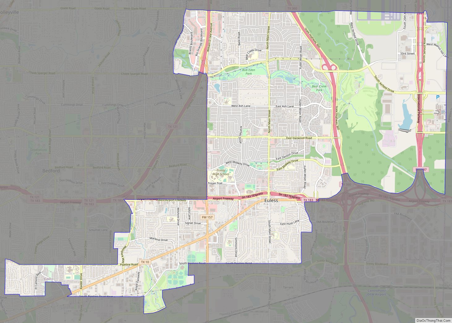
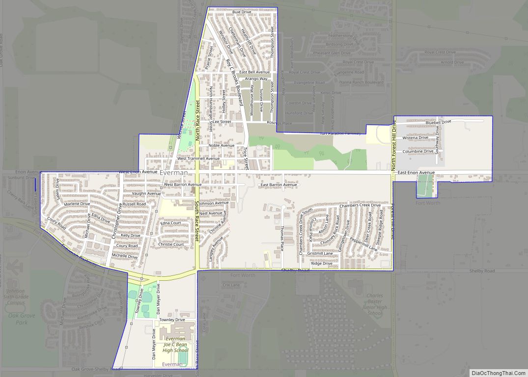
Euless (/ˈjuːlɪs/ YOO-liss) is a city in Tarrant County, Texas, United States, and a suburb of Dallas and Fort Worth. Euless is part of the Mid-Cities region between Dallas and Fort Worth. In 2020 Census, the population of Euless was 61,032. The population of the city increased by 19.02% in 10 years. The city’s population ... Read more
Map of Euless city
Map of Eugenio Saenz CDP
Eugenio Saenz is a census-designated place (CDP) in Starr County, Texas, United States. It is a new CDP formed from part of the old La Victoria CDP prior to the 2010 census with a population of 159. Eugenio Saenz CDP overview: Name: Eugenio Saenz CDP LSAD Code: 57 LSAD Description: CDP (suffix) State: Texas County: ... Read more
Map of Eugenio Saenz CDP
Map of Estelline town, Texas
Estelline is a town located in Hall County, Texas, United States. The population in 2010 was 145. The population was estimated at 141 in 2013. In 2012, Estelline was ranked #1 in a National Motorists Association listing of its “Worst Speed Trap Cities” in North America (with a population of less than 50,000). Estelline often ... Read more
Map of Estelline town, Texas
Map of Falcon Heights CDP, Texas
Falcon Heights is a census-designated place (CDP) in Starr County, Texas, United States. The population was 18 at the 2020 census, down from 53 at the 2010 census. The Lake Falcon Dam International Crossing connects Falcon Heights with Nueva Ciudad Guerrero, Tamaulipas. Falcon Heights CDP overview: Name: Falcon Heights CDP LSAD Code: 57 LSAD Description: ... Read more
Map of Falcon Heights CDP, Texas
Map of Fairview town, Texas
Fairview is a town in Collin County, Texas, United States. It is part of the Dallas-Fort Worth metropolitan area. As of the 2017 census, the town population was 8,950. The estimated population in 2018 was 9,092. The town is adjacent to the 289-acre (1.17 km) Heard Natural Science Museum and Wildlife Sanctuary. Fairview town overview: Name: ... Read more
Map of Fairview town, Texas
Map of Fairfield city, Texas
Fairfield is a city in Freestone County, Texas, United States. The population was 2,850 at the 2020 census, down from 3,094 at the 2000 census. It is the county seat of Freestone County and was founded as such in 1851. Fairfield city overview: Name: Fairfield city LSAD Code: 25 LSAD Description: city (suffix) State: Texas ... Read more
Map of Fairfield city, Texas
Map of Fairchilds village
Fairchilds is a village in Fort Bend County, Texas, United States, within the Houston–Sugar Land–Baytown metropolitan area. The population was 763 at the 2010 census, up from 678 at the 2000 census. As of 2018 the population had risen to an estimated 1,224. The center of Fairchilds is located 4 miles (6 km) northeast of Needville at ... Read more
Map of Fairchilds village
Map of Fair Oaks Ranch city
Fair Oaks Ranch is a city in Bexar, Comal, and Kendall counties in the U.S. state of Texas. The population was 5,986 at the 2010 census and an estimated 9,700 in 2018. It is part of the San Antonio-New Braunfels Metropolitan Statistical Area. The city was named after Ralph Fair Sr, an oilman who had ... Read more
Map of Fair Oaks Ranch city
Map of Fabrica CDP
Fabrica is an unincorporated community and census-designated place in Maverick County, Texas, United States. Its population was 923 as of the 2010 census. U.S. Route 277 passes through the community. Fabrica CDP overview: Name: Fabrica CDP LSAD Code: 57 LSAD Description: CDP (suffix) State: Texas County: Maverick County Elevation: 719 ft (219 m) Total Area: 0.310 sq mi (0.80 km²) ... Read more
Map of Fabrica CDP