Map of Fulton town, Texas

Map of Fulton town, Texas

Fulton is a town in Aransas County, Texas, United States. As of the 2010 census, this South Texas coastal fishing community had a population of 1,358. The town is named for George Ware Fulton, a land developer in the area. Fulton town overview: Name: Fulton town LSAD Code: 43 LSAD Description: town (suffix) State: Texas … Read more

Map of Fulshear city

Map of Fulshear city

Fulshear (/ˈfʊlʃər/ FUUL-shər) is a city in northwest Fort Bend County, Texas, United States, and is located on the western edge of the Houston–The Woodlands–Sugar Land metropolitan area. The population was 16,856 as of the 2020 census. Fulshear city overview: Name: Fulshear city LSAD Code: 25 LSAD Description: city (suffix) State: Texas County: Fort Bend … Read more

Map of Fruitvale city, Texas

Map of Fruitvale city, Texas

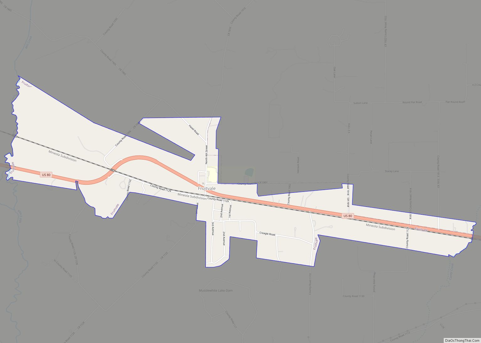
Fruitvale is a small city in Van Zandt County, Texas, United States. The population was 408 at the 2010 census, and 428 as of 2019. The town draws its name from its location. Missouri Pacific Railroad in the center of the historic fruit-growing district of the Sabine River valley in northeastern Van Zandt County. Its … Read more

Map of Frost city, Texas

Map of Frost city, Texas

Frost is a city in Navarro County, Texas, United States. The population was 643 at the 2010 census. Frost city overview: Name: Frost city LSAD Code: 25 LSAD Description: city (suffix) State: Texas County: Navarro County Elevation: 525 ft (160 m) Total Area: 1.13 sq mi (2.94 km²) Land Area: 1.13 sq mi (2.93 km²) Water Area: 0.00 sq mi (0.01 km²) Total Population: 643 Population … Read more

Map of Fronton CDP

Map of Fronton CDP

Fronton is a census-designated place (CDP) in Starr County, Texas, United States, bordering the Mexican state of Tamaulipas, close to Ciudad Miguel Alemán. The population was 180 at the 2010 census down from 599 at the 2000 census. Fronton CDP overview: Name: Fronton CDP LSAD Code: 57 LSAD Description: CDP (suffix) State: Texas County: Starr … Read more

Map of Fronton Ranchettes CDP

Map of Fronton Ranchettes CDP

Fronton Ranchettes is a census-designated place (CDP) in Starr County, Texas, United States. It is a new CDP formed from part of the Roma Creek CDP prior to the 2010 census with a population of 113. Fronton Ranchettes CDP overview: Name: Fronton Ranchettes CDP LSAD Code: 57 LSAD Description: CDP (suffix) State: Texas County: Starr … Read more

Map of Garden Ridge city

Map of Garden Ridge city

Garden Ridge is a city in Comal County, Texas, United States, incorporated in 1972. The population was 4,186 at the 2020 census, up from 3,259 at the 2010 census. It is part of the San Antonio metropolitan statistical rea. Garden Ridge city overview: Name: Garden Ridge city LSAD Code: 25 LSAD Description: city (suffix) State: … Read more

Map of Garden City CDP, Texas

Map of Garden City CDP, Texas

Garden City is an unincorporated community and census-designated place (CDP) in Glasscock County, Texas, United States. It lies near the center of the county, 27 miles (43 km) south of Big Spring. Garden City serves as the Glasscock County seat, and at the 2010 census had a population of 334. The ZIP code is 79739. Garden … Read more

Map of Garciasville CDP

Map of Garciasville CDP

Garciasville is a census-designated place (CDP) in Starr County, Texas, United States. It is a new CDP for 2010 census with a population of 46. Garciasville CDP overview: Name: Garciasville CDP LSAD Code: 57 LSAD Description: CDP (suffix) State: Texas County: Starr County Elevation: 141 ft (43 m) Total Area: 0.5 sq mi (1.3 km²) Land Area: 0.5 sq mi (1.3 km²) Water … Read more

Map of Garceno CDP

Map of Garceno CDP

Garceno is a census-designated place (CDP) in Starr County, Texas, United States. The population was 420 at the 2010 census down from 1,438 at the 2000 census. Garceno CDP overview: Name: Garceno CDP LSAD Code: 57 LSAD Description: CDP (suffix) State: Texas County: Starr County Elevation: 194 ft (59 m) Total Area: 0.2 sq mi (0.5 km²) Land Area: 0.2 sq mi … Read more

Map of Ganado city, Texas

Map of Ganado city, Texas

Ganado (/ɡəˈneɪdoʊ/ gə-NAY-doh) is a city in Jackson County, Texas, United States. The population was 1,975 at the 2020 census. Ganado city overview: Name: Ganado city LSAD Code: 25 LSAD Description: city (suffix) State: Texas County: Jackson County Incorporated: 1909 Elevation: 66 ft (20 m) Total Area: 1.17 sq mi (3.03 km²) Land Area: 1.17 sq mi (3.02 km²) Water Area: 0.00 sq mi (0.01 km²) … Read more

Map of Galveston city, Texas

Map of Galveston city, Texas

Galveston city overview: Name: Galveston city LSAD Code: 25 LSAD Description: city (suffix) State: Texas County: Galveston County Incorporated: town incorporated 1839 Elevation: 7 ft (2 m) Land Area: 41.05 sq mi (106.33 km²) Water Area: 170.66 sq mi (442.02 km²) Population Density: 1,307.9/sq mi (505.0/km²) Area code: 409 FIPS code: 4828068 GNISfeature ID: 1377745 Website: galvestontx.gov Online Interactive Map Galveston online map. Source: … Read more