Map of La Grulla city

Map of La Grulla city

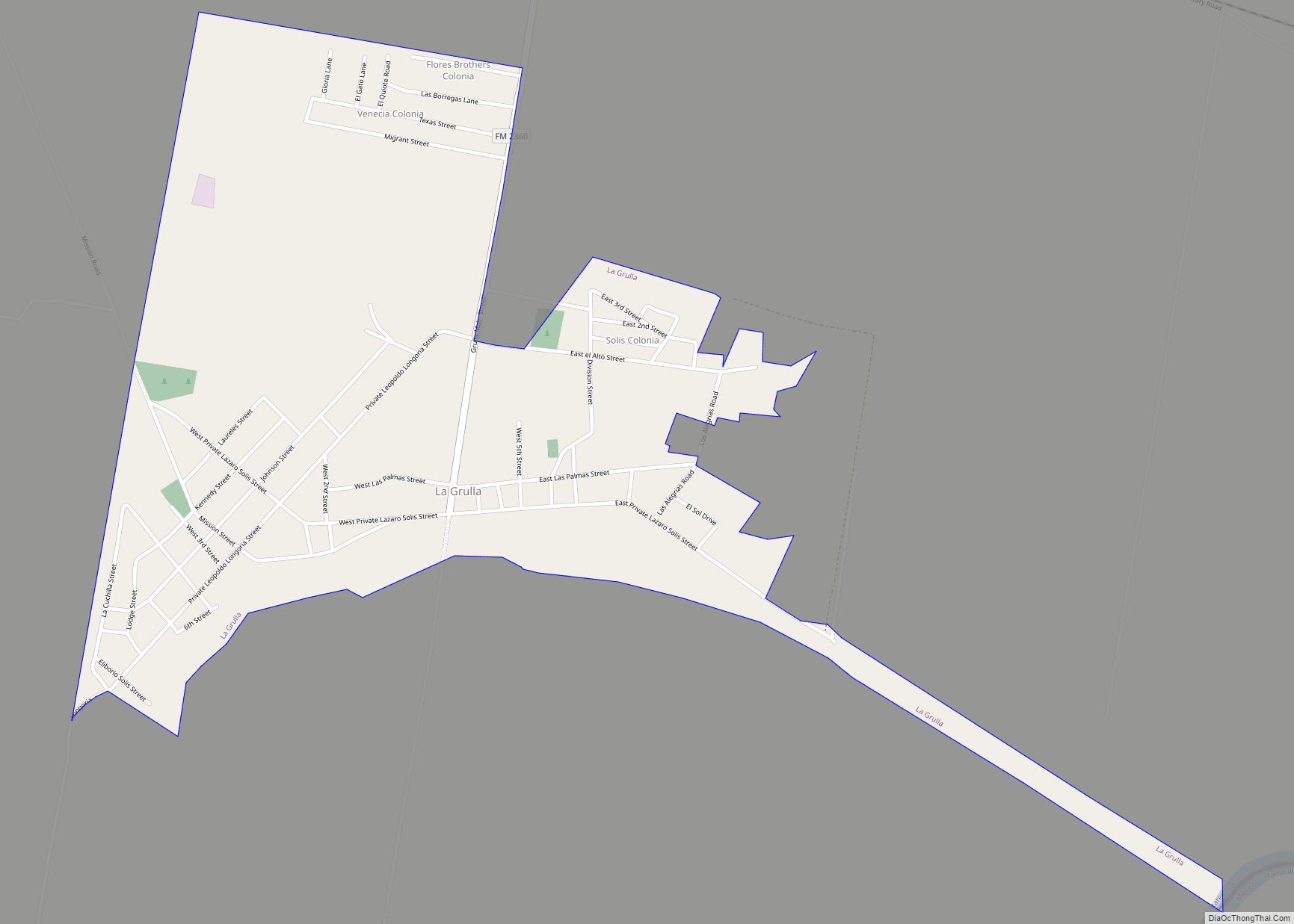
La Grulla is a city in Starr County, Texas, United States, founded by Juan Santiago Longoria (3rd great grandfather of actress Eva Longoria) in 1836. The population was 1,622 at the 2010 census. La Grulla city overview: Name: La Grulla city LSAD Code: 25 LSAD Description: city (suffix) State: Texas County: Starr County Elevation: 141 ft … Read more

Map of La Grange city, Texas

Map of La Grange city, Texas

La Grange (/lə ˈɡreɪndʒ/ lə GRAYNJ) is a city in Fayette County, Texas, United States, near the Colorado River. La Grange is in the center of the Texas-German belt. The population was 4,391 at the 2020 census, and in 2018 the estimated population was 4,632. La Grange is the county seat of Fayette County. La … Read more

Map of La Feria city

Map of La Feria city

La Feria is a city in Cameron County, Texas, United States. Its population was 7,302 at the time of the 2010 census. It is part of the Brownsville–Harlingen–Raymondville, the Matamoros–Brownsville, and the McAllen–Edinburg–Mission metropolitan areas. La Feria city overview: Name: La Feria city LSAD Code: 25 LSAD Description: city (suffix) State: Texas County: Cameron County … Read more

Map of La Feria North CDP

Map of La Feria North CDP

La Feria North is a census-designated place (CDP) in Cameron County, Texas, United States. The population was 212 at the 2010 census. It is part of the Brownsville–Harlingen Metropolitan Statistical Area. La Feria North CDP overview: Name: La Feria North CDP LSAD Code: 57 LSAD Description: CDP (suffix) State: Texas County: Cameron County Elevation: 56 ft … Read more

Map of La Pryor CDP

Map of La Pryor CDP

La Pryor (/lə ˈpraɪ.ər/ lə PRY-ər) is a census-designated place (CDP) in Zavala County, Texas, United States. Its population was 1,643 at the 2010 census. The town is named for Col. Isaac (Ike) T. Pryor, who in the 1880s owned a ranch that included the site of the community. The Nueces River crosses U.S. Highway … Read more

Map of La Presa CDP, Texas

Map of La Presa CDP, Texas

La Presa is a census-designated place (CDP) in Webb County, Texas, United States. The population was 319 at the 2010 census. It is one of several colonias in the county. La Presa CDP overview: Name: La Presa CDP LSAD Code: 57 LSAD Description: CDP (suffix) State: Texas County: Webb County Elevation: 512 ft (156 m) Total Area: … Read more

Map of La Porte city, Texas

Map of La Porte city, Texas

La Porte (/lə ˈpɔːrt/ lə PORT) is a city in Harris County, Texas, United States, within the Bay Area of the Houston–Sugar Land–Baytown metropolitan area. As of the 2020 census, the city population was 35,124. La Porte is the fourth-largest incorporated city in Harris County. When La Porte celebrated its centennial in 1992, it was the … Read more

Map of La Paloma CDP

Map of La Paloma CDP

La Paloma is a census-designated place (CDP) in Cameron County, Texas, United States. The population was 2,903 at the 2010 census, up from 354 at the 2000 census, when it was drawn to cover a much smaller area. It is part of the Brownsville–Harlingen Metropolitan Statistical Area. La Paloma means “the dove” in Spanish. La … Read more

Map of La Paloma Ranchettes CDP

Map of La Paloma Ranchettes CDP

La Paloma Ranchettes is a census-designated place (CDP) in Starr County, Texas, United States. This was a new CDP for the 2010 census with a population of 239. La Paloma Ranchettes CDP overview: Name: La Paloma Ranchettes CDP LSAD Code: 57 LSAD Description: CDP (suffix) State: Texas County: Starr County Total Area: 0.5 sq mi (1 km²) Land … Read more

Map of La Paloma-Lost Creek CDP

Map of La Paloma-Lost Creek CDP

La Paloma-Lost Creek is a census-designated place (CDP) in Nueces County, Texas, United States. The population was 408 at the 2010 census, up from 323 at the 2000 census. La Paloma-Lost Creek CDP overview: Name: La Paloma-Lost Creek CDP LSAD Code: 57 LSAD Description: CDP (suffix) State: Texas County: Nueces County Total Area: 8.3 sq mi (21.5 km²) … Read more

Map of La Vernia city

Map of La Vernia city

La Vernia is a city in Wilson County, Texas, United States. La Vernia is on the south bank of Cibolo Creek at the junction of U.S. Highway 87 and Texas Farm to Market Road 775, about 25 miles east of downtown San Antonio. The population was 1,077 at the 2020 census. La Vernia is part … Read more

Map of La Tina Ranch CDP

Map of La Tina Ranch CDP

La Tina Ranch is a census-designated place (CDP) in Cameron County, in the U.S. state of Texas. The population was 618 at the 2010 census. Prior to the 2010 census the community was part of the Arroyo Gardens-La Tina Ranch CDP. It is part of the Brownsville–Harlingen Metropolitan Statistical Area. La Tina Ranch CDP overview: … Read more