Map of Lake Kiowa CDP

Map of Lake Kiowa CDP

Lake Kiowa is a census-designated place (CDP) in Cooke County, Texas, United States, the majority of which consists of the gated community of the same name. The population was 1,906 at the 2010 census. Lake Kiowa CDP overview: Name: Lake Kiowa CDP LSAD Code: 57 LSAD Description: CDP (suffix) State: Texas County: Cooke County Elevation: … Read more

Map of Lake Jackson city

Map of Lake Jackson city

Lake Jackson is a city in Brazoria County, Texas, United States, within the Greater Houston metropolitan area. As of the 2020 census, the city population was 28,177. In 1942 a portion of Lake Jackson was first developed as a company town for workers of the Dow Chemical Company; it developed 5,000 acres on the former … Read more

Map of Lake Dunlap CDP

Map of Lake Dunlap CDP

Lake Dunlap is a census-designated place in Guadalupe County, Texas, United States. The population was 1,934 at the 2010 census. It is part of the San Antonio–New Braunfels metropolitan area. The community is named after the former Lake Dunlap, a small reservoir on the Guadalupe River that ceased to exist in 2019. Lake Dunlap CDP … Read more

Map of Lakeport city, Texas

Map of Lakeport city, Texas

Lakeport is a city in Gregg County, Texas, United States. The population was 974 at the 2010 census, up from 861 at the 2000 census; in 2020, its population was 976. Lakeport city overview: Name: Lakeport city LSAD Code: 25 LSAD Description: city (suffix) State: Texas County: Gregg County Elevation: 295 ft (90 m) Total Area: 1.59 sq mi … Read more

Map of Lakehills CDP

Map of Lakehills CDP

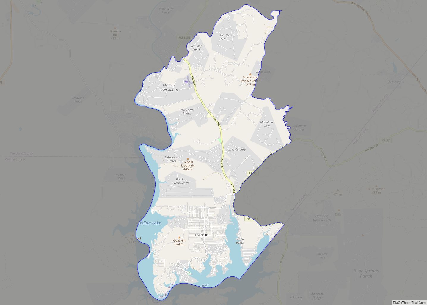
Lakehills is a census-designated place (CDP) in Bandera County, Texas, United States. The population was 5,150 at the 2010 census, making it the most populous place in Bandera county. It is part of the San Antonio Metropolitan Statistical Area. Lakehills CDP overview: Name: Lakehills CDP LSAD Code: 57 LSAD Description: CDP (suffix) State: Texas County: … Read more

Map of Lake Worth city, Texas

Map of Lake Worth city, Texas

Lake Worth is a city in Tarrant County, Texas, United States. The population was 4,584 at the 2010 census. The city is adjacent to, and named after, Lake Worth, a popular recreational lake in the northwestern portion of Tarrant County. Lake Worth city overview: Name: Lake Worth city LSAD Code: 25 LSAD Description: city (suffix) … Read more

Map of Lake View CDP, Texas

Map of Lake View CDP, Texas

Lake View is a census-designated place (CDP) in Val Verde County, Texas, United States. Its population was 199 at the 2010 census. Lake View CDP overview: Name: Lake View CDP LSAD Code: 57 LSAD Description: CDP (suffix) State: Texas County: Val Verde County Total Area: 0.5 sq mi (1.3 km²) Land Area: 0.5 sq mi (1.3 km²) Total Population: 199 Population … Read more

Map of Lake Tanglewood village

Map of Lake Tanglewood village

Lake Tanglewood is a village in Randall County, Texas, United States. The population was 796 at the 2010 census. It is part of the Amarillo, Texas Metropolitan Statistical Area. Lake Tanglewood village overview: Name: Lake Tanglewood village LSAD Code: 47 LSAD Description: village (suffix) State: Texas County: Randall County Elevation: 3,474 ft (1,059 m) Total Area: 1.50 sq mi … Read more

Map of Lancaster city, Texas

Map of Lancaster city, Texas

Lancaster (/ˈlæŋkɪstər/ LANK-is-tər) is a city in Dallas County, Texas, United States. Its population was 41,275 according to the 2020 census. Founded in 1852 as a frontier post, Lancaster is one of Dallas County’s earliest settlements. Today, it is a suburban community located in the Dallas–Fort Worth metroplex, about 15 mi (24 km) south of downtown Dallas. … Read more

Map of Lampasas city

Map of Lampasas city

Lampasas (/læmˈpæsəs/ lam-PASS-əs) is a city in Lampasas County, Texas, United States. Its population was 7,291 at the 2020 census. It is the seat of Lampasas County. Lampasas is part of the Killeen–Temple–Fort Hood metropolitan statistical area. Lampasas city overview: Name: Lampasas city LSAD Code: 25 LSAD Description: city (suffix) State: Texas County: Lampasas County … Read more

Map of Lamesa city

Map of Lamesa city

Lamesa (/ləˈmiːsə/ lə-MEE-sə) is a city in and the county seat of Dawson County, Texas, United States. The population was 8,674 at the 2020 census, down from 9,952 at the 2000 census. Located south of Lubbock on the Llano Estacado, Lamesa was founded in 1903. Most of its economy is based on cotton farming. The … Read more

Map of Lamar CDP, Texas

Map of Lamar CDP, Texas

Lamar is a small, unincorporated community and census-designated place (CDP) in Aransas County, Texas, United States, 10 miles (16 km) north of Rockport and 40 miles (64 km) north of Corpus Christi. As of the 2010 census it had a population of 636. The community was named for Mirabeau B. Lamar, the second president of the Republic … Read more