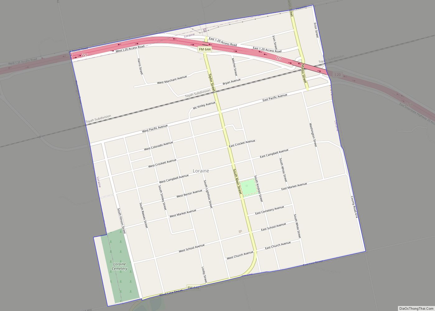
Map of Los Arcos CDP

Map of Los Arcos CDP

Los Arcos is a census-designated place (CDP) in Webb County, Texas, United States. This was a new CDP for the 2010 census with a population of 127. Los Arcos CDP overview: Name: Los Arcos CDP LSAD Code: 57 LSAD Description: CDP (suffix) State: Texas County: Webb County Elevation: 610 ft (190 m) Total Area: 0.2 sq mi (0.5 km²) Land … Read more

Map of Los Angeles CDP, Texas

Map of Los Angeles CDP, Texas

Los Angeles is a census-designated place (CDP) in Willacy County, Texas, United States. The population was 121 at the 2010 census. Prior to the 2010 census, the CDP was known as Los Angeles Subdivision. Los Angeles CDP overview: Name: Los Angeles CDP LSAD Code: 57 LSAD Description: CDP (suffix) State: Texas County: Willacy County Elevation: … Read more

Map of Los Alvarez CDP

Map of Los Alvarez CDP

Los Alvarez is a census-designated place (CDP) in Starr County, Texas, United States. The population was 303 at the 2010 census down from 1,434 at the 2000 census. Los Alvarez CDP overview: Name: Los Alvarez CDP LSAD Code: 57 LSAD Description: CDP (suffix) State: Texas County: Starr County Elevation: 197 ft (60 m) Total Area: 0.1 sq mi (0.3 km²) … Read more

Map of Los Altos CDP, Texas

Map of Los Altos CDP, Texas

Los Altos is a census-designated place (CDP) in Webb County, Texas, United States. This was a new CDP formed from parts of the Laredo Ranchettes CDP prior to the 2010 census with a population of 140. It is one of several colonias in Webb County. Los Altos CDP overview: Name: Los Altos CDP LSAD Code: … Read more

Map of Los Minerales CDP

Map of Los Minerales CDP

Los Minerales is a census-designated place (CDP) in Webb County, Texas, United States. This was a new CDP formed from parts of the Ranchos Penitas West CDP and additional area prior to the 2010 census with a population of 20. It is one of several colonias in the county. Los Minerales CDP overview: Name: Los … Read more

Map of Los Lobos CDP

Map of Los Lobos CDP

Los Lobos is a census-designated place (CDP) in Zapata County, Texas, United States. This was a new CDP for the 2010 census with a population of 9. Los Lobos CDP overview: Name: Los Lobos CDP LSAD Code: 57 LSAD Description: CDP (suffix) State: Texas County: Zapata County Total Area: 0.1 sq mi (0.3 km²) Land Area: 0.1 sq mi (0.3 km²) … Read more

Map of Los Indios town

Map of Los Indios town

Los Indios is a U.S. border town in Cameron County, Texas. The population was 1,008 at the 2020 census. It is included as part of the Brownsville–Harlingen–Raymondville and the Matamoros–Brownsville metropolitan areas. The Free Trade International Bridge connects Los Indios with Matamoros, Tamaulipas. Los Indios town overview: Name: Los Indios town LSAD Code: 43 LSAD … Read more

Map of Los Huisaches CDP

Map of Los Huisaches CDP

Los Huisaches is a census-designated place (CDP) in Webb County, Texas, United States. This was a new CDP for the 2010 census with a population of 17. It is one of several colonias in the county. Los Huisaches CDP overview: Name: Los Huisaches CDP LSAD Code: 57 LSAD Description: CDP (suffix) State: Texas County: Webb … Read more

Map of Los Fresnos CDP

Map of Los Fresnos CDP

Los Fresnos is a census-designated place (CDP) in Webb County, Texas, United States. This was a new CDP for the 2010 census with a population of 67. Los Fresnos CDP overview: Name: Los Fresnos CDP LSAD Code: 57 LSAD Description: CDP (suffix) State: Texas County: Webb County Elevation: 617 ft (188 m) Total Area: 0.2 sq mi (0.5 km²) Land … Read more

Map of Los Ebanos CDP

Map of Los Ebanos CDP

Los Ebanos is a census-designated place (CDP) in Starr County, Texas, United States. It is a new CDP formed from part of the La Rosita CDP prior to the 2010 census with a population of 280. Los Ebanos CDP overview: Name: Los Ebanos CDP LSAD Code: 57 LSAD Description: CDP (suffix) State: Texas County: Starr … Read more

Map of Los Corralitos CDP

Map of Los Corralitos CDP

Los Corralitos is a census-designated place (CDP) in Webb County, Texas, United States. This was a new CDP for the 2010 census with a population of 35. Los Corralitos CDP overview: Name: Los Corralitos CDP LSAD Code: 57 LSAD Description: CDP (suffix) State: Texas County: Webb County Elevation: 492 ft (150 m) Total Area: 35 FIPS code: … Read more

Map of Los Centenarios CDP

Map of Los Centenarios CDP

Los Centenarios is a census-designated place (CDP) in Webb County, Texas, United States. This was a new CDP for the 2010 census with a population of 87. Los Centenarios CDP overview: Name: Los Centenarios CDP LSAD Code: 57 LSAD Description: CDP (suffix) State: Texas County: Webb County Elevation: 617 ft (188 m) Total Area: 0.2 sq mi (0.5 km²) Land … Read more