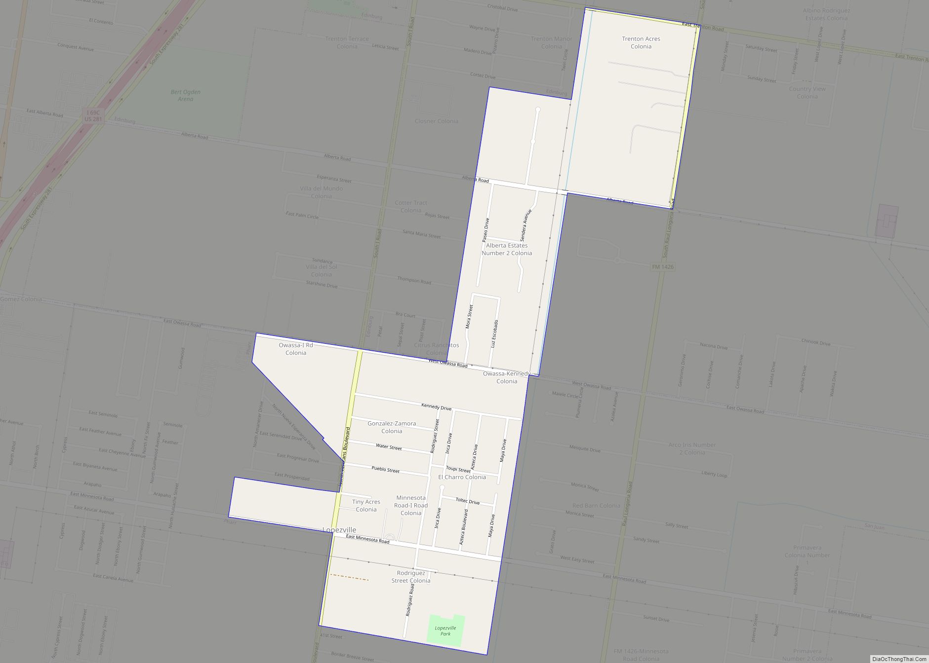
Map of Lorenzo city, Texas
Lorenzo is a city in Crosby County, Texas, United States. As of the 2010 census, the city population was 1,147, down from 1,372 in 2000. It is part of the Lubbock Metropolitan Statistical Area. Lorenzo city overview: Name: Lorenzo city LSAD Code: 25 LSAD Description: city (suffix) State: Texas County: Crosby County Elevation: 3,166 ft (965 m) ... Read more
Map of Lorenzo city, Texas
Map of Lorena city
Lorena is a small city in McLennan County, Texas, United States. The population was 1,785 at the 2020 census. It is part of the Waco Metropolitan Statistical Area. Lorena city overview: Name: Lorena city LSAD Code: 25 LSAD Description: city (suffix) State: Texas County: McLennan County Elevation: 604 ft (184 m) Total Area: 3.40 sq mi (8.80 km²) Land Area: ... Read more
Map of Lorena city
Map of Loraine town, Texas
Loraine is a town in Mitchell County, Texas, United States. The population was 602 at the 2010 census. Loraine town overview: Name: Loraine town LSAD Code: 43 LSAD Description: town (suffix) State: Texas County: Mitchell County Elevation: 2,267 ft (691 m) Total Area: 1.04 sq mi (2.69 km²) Land Area: 1.04 sq mi (2.69 km²) Water Area: 0.00 sq mi (0.00 km²) Total Population: 602 Population ... Read more
Map of Loraine town, Texas
Map of Lopeño CDP
Lopeño (pronounced loh-peh-nyo) is a census-designated place (CDP) in Zapata County, Texas, United States. The population was 174 at the 2010 census. Lopeño CDP overview: Name: Lopeño CDP LSAD Code: 57 LSAD Description: CDP (suffix) State: Texas County: Zapata County Elevation: 390 ft (119 m) Total Area: 0.8 sq mi (2.0 km²) Land Area: 0.8 sq mi (2.0 km²) Water Area: 0.0 sq mi (0.0 km²) ... Read more
Map of Lopeño CDP
Map of Los Indios town
Los Indios is a U.S. border town in Cameron County, Texas. The population was 1,008 at the 2020 census. It is included as part of the Brownsville–Harlingen–Raymondville and the Matamoros–Brownsville metropolitan areas. The Free Trade International Bridge connects Los Indios with Matamoros, Tamaulipas. Los Indios town overview: Name: Los Indios town LSAD Code: 43 LSAD ... Read more
Map of Los Indios town
Map of Los Huisaches CDP
Los Huisaches is a census-designated place (CDP) in Webb County, Texas, United States. This was a new CDP for the 2010 census with a population of 17. It is one of several colonias in the county. Los Huisaches CDP overview: Name: Los Huisaches CDP LSAD Code: 57 LSAD Description: CDP (suffix) State: Texas County: Webb ... Read more
Map of Los Huisaches CDP
Map of Los Fresnos CDP
Los Fresnos is a census-designated place (CDP) in Webb County, Texas, United States. This was a new CDP for the 2010 census with a population of 67. Los Fresnos CDP overview: Name: Los Fresnos CDP LSAD Code: 57 LSAD Description: CDP (suffix) State: Texas County: Webb County Elevation: 617 ft (188 m) Total Area: 0.2 sq mi (0.5 km²) Land ... Read more
Map of Los Fresnos CDP
Map of Los Ebanos CDP
Los Ebanos is a census-designated place (CDP) in Starr County, Texas, United States. It is a new CDP formed from part of the La Rosita CDP prior to the 2010 census with a population of 280. Los Ebanos CDP overview: Name: Los Ebanos CDP LSAD Code: 57 LSAD Description: CDP (suffix) State: Texas County: Starr ... Read more
Map of Los Ebanos CDP
Map of Los Corralitos CDP
Los Corralitos is a census-designated place (CDP) in Webb County, Texas, United States. This was a new CDP for the 2010 census with a population of 35. Los Corralitos CDP overview: Name: Los Corralitos CDP LSAD Code: 57 LSAD Description: CDP (suffix) State: Texas County: Webb County Elevation: 492 ft (150 m) Total Area: 35 FIPS code: ... Read more
Map of Los Corralitos CDP
Map of Los Centenarios CDP
Los Centenarios is a census-designated place (CDP) in Webb County, Texas, United States. This was a new CDP for the 2010 census with a population of 87. Los Centenarios CDP overview: Name: Los Centenarios CDP LSAD Code: 57 LSAD Description: CDP (suffix) State: Texas County: Webb County Elevation: 617 ft (188 m) Total Area: 0.2 sq mi (0.5 km²) Land ... Read more
Map of Los Centenarios CDP
Map of Los Barreras CDP
Los Barreras is a census-designated place (CDP) in Starr County, Texas, United States. It is a new CDP formed from part of the La Rosita CDP prior to the 2010 census with a population of 288. Los Barreras CDP overview: Name: Los Barreras CDP LSAD Code: 57 LSAD Description: CDP (suffix) State: Texas County: Starr ... Read more
Map of Los Barreras CDP
Map of Los Arrieros CDP
Los Arrieros is an unincorporated community and census-designated place in Starr County, Texas, United States. Its population was 91 as of the 2010 census. U.S. Route 83 passes through the community. Los Arrieros CDP overview: Name: Los Arrieros CDP LSAD Code: 57 LSAD Description: CDP (suffix) State: Texas County: Starr County Elevation: 302 ft (92 m) Total ... Read more
Map of Los Arrieros CDP