Plainfield is a census-designated place (CDP) comprising the main village of the town of Plainfield, Washington County, Vermont, United States. The population of the CDP was 401 at the 2010 census. Plainfield CDP overview: Name: Plainfield CDP LSAD Code: 57 LSAD Description: CDP (suffix) State: Vermont County: Washington County Elevation: 755.2 ft (230.2 m) Total Area: 0.23 sq mi ... Read more
Vermont Cities and Places
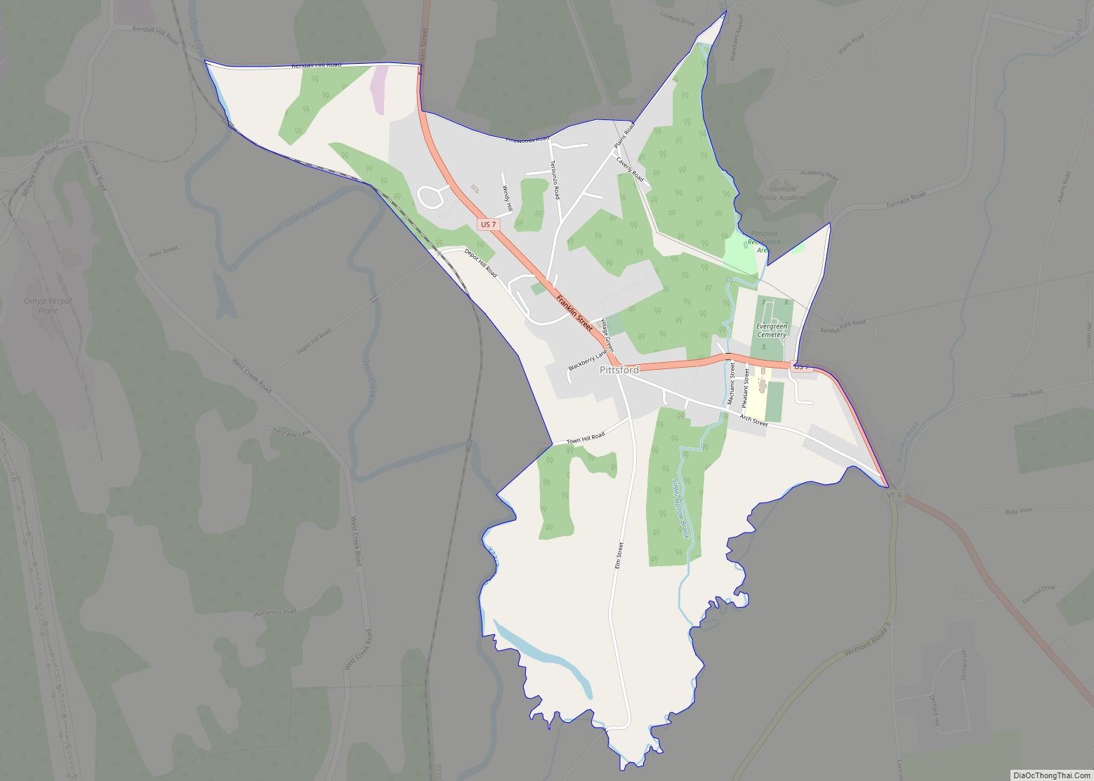
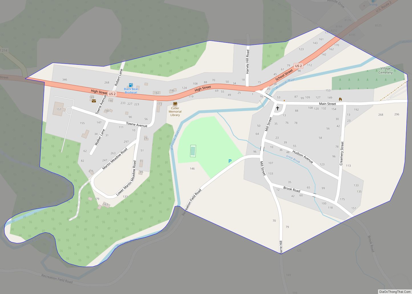
Pittsford is the central village and a census-designated place (CDP) in the town of Pittsford, Rutland County, Vermont, United States. As of the 2020 census, it had a population of 805, out of 2,862 in the entire town. The CDP is in northern Rutland County, slightly east of the center of the town of Pittsford. ... Read more
Perkinsville village overview: Name: Perkinsville village LSAD Code: 47 LSAD Description: village (suffix) State: Vermont County: Windsor County FIPS code: 5054850 Online Interactive Map Perkinsville online map. Source: Basemap layers from Google Map, Open Street Map (OSM), Arcgisonline, Wmflabs. Boundary Data from Database of Global Administrative Areas. Perkinsville location map. Where is Perkinsville village? Perkinsville ... Read more
Orleans village overview: Name: Orleans village LSAD Code: 47 LSAD Description: village (suffix) State: Vermont County: Orleans County FIPS code: 5053575 Online Interactive Map Orleans online map. Source: Basemap layers from Google Map, Open Street Map (OSM), Arcgisonline, Wmflabs. Boundary Data from Database of Global Administrative Areas. Orleans location map. Where is Orleans village? Orleans ... Read more
Old Bennington village overview: Name: Old Bennington village LSAD Code: 47 LSAD Description: village (suffix) State: Vermont County: Bennington County FIPS code: 5053125 Online Interactive Map Old Bennington online map. Source: Basemap layers from Google Map, Open Street Map (OSM), Arcgisonline, Wmflabs. Boundary Data from Database of Global Administrative Areas. Old Bennington location map. Where ... Read more
Norwich is a census-designated place (CDP) that comprises the central village of the town of Norwich, Windsor County, Vermont, United States. As of the 2010 census, the population of the CDP was 878, compared to 3,414 for the entire town of Norwich. Norwich CDP overview: Name: Norwich CDP LSAD Code: 57 LSAD Description: CDP (suffix) ... Read more
Quechee is a census-designated place and one of five unincorporated villages in the town of Hartford, Windsor County, Vermont, United States. As of the 2010 census, the population of the CDP was 656. It is the site of Quechee Gorge on the Ottauquechee River and is also the home to the Quechee Lakes planned community, ... Read more
Proctorsville is a census-designated place (CDP) in the town of Cavendish, Windsor County, Vermont, United States. As of the 2010 census, the population of the CDP was 454. Proctorsville CDP overview: Name: Proctorsville CDP LSAD Code: 57 LSAD Description: CDP (suffix) State: Vermont County: Windsor County Elevation: 931 ft (284 m) Total Area: 2.9 sq mi (7.6 km²) Land Area: ... Read more
Poultney is a town in Rutland County in the southwestern part of the U.S. state of Vermont. New York state is on its western border. Castleton, Vermont, is on its northern border. Poultney was home to Green Mountain College, a private liberal arts college that closed in 2019. The Village of Poultney is entirely within ... Read more
South Burlington city overview: Name: South Burlington city LSAD Code: 25 LSAD Description: city (suffix) State: Vermont County: Chittenden County FIPS code: 5066175 Online Interactive Map South Burlington online map. Source: Basemap layers from Google Map, Open Street Map (OSM), Arcgisonline, Wmflabs. Boundary Data from Database of Global Administrative Areas. South Burlington location map. Where ... Read more
South Barre is a census-designated place (CDP) in the town of Barre in Washington County, Vermont, United States. The population was 1,242 at the 2000 census. South Barre CDP overview: Name: South Barre CDP LSAD Code: 57 LSAD Description: CDP (suffix) State: Vermont County: Washington County Elevation: 738 ft (225 m) Total Area: 2.1 sq mi (5.4 km²) Land Area: ... Read more
Shelburne is a census-designated place (CDP) comprising the central village and surrounding suburban land in the town of Shelburne, Chittenden County, Vermont, United States. As of the 2020 census, the CDP had a population of 6,178, out of 7,717 in the entire town. The CDP is in western Chittenden County, in the central part of ... Read more