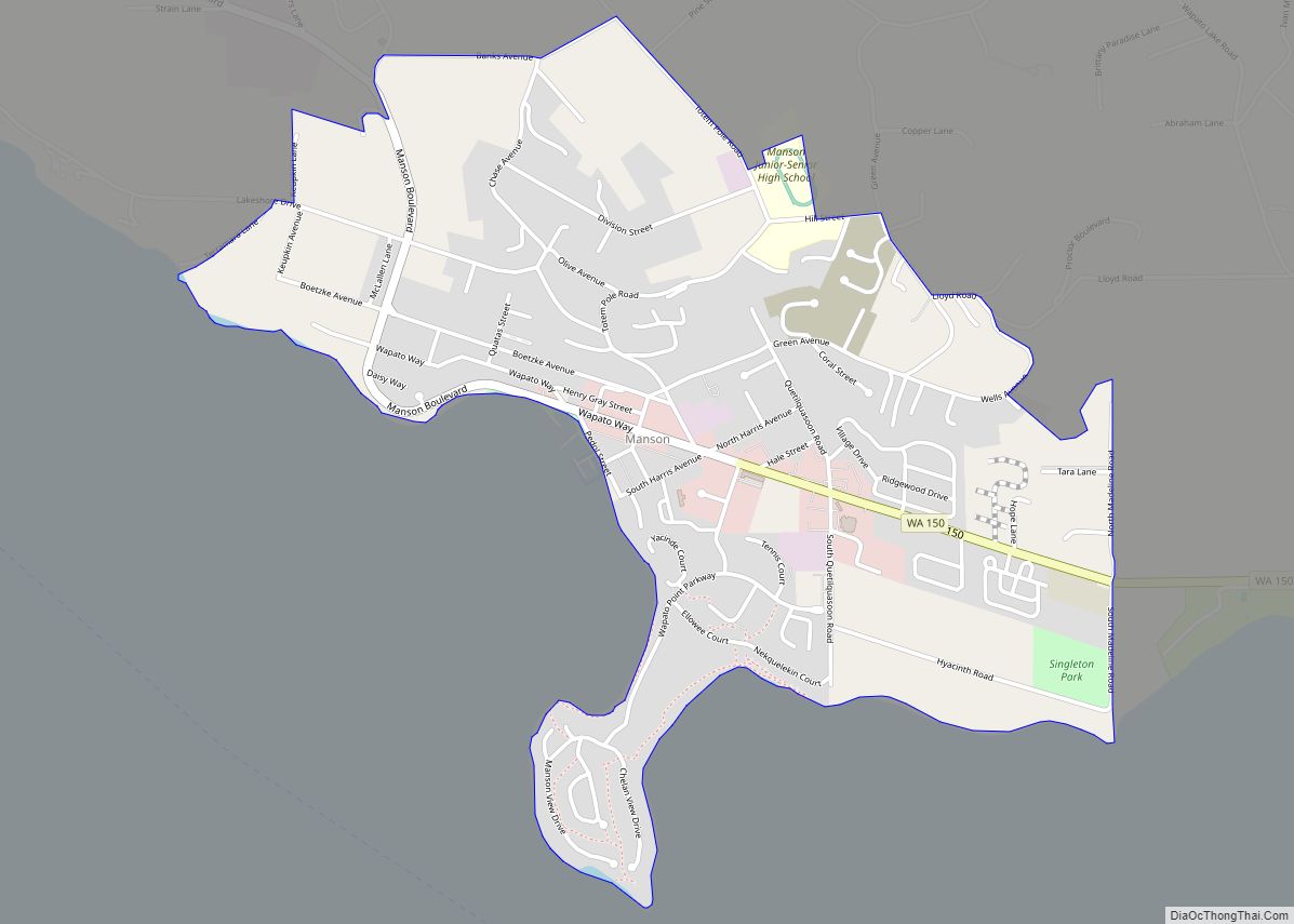
Map of Endicott town, Washington

Map of Endicott town, Washington

Endicott town overview: Name: Endicott town LSAD Code: 43 LSAD Description: town (suffix) State: Washington County: Whitman County FIPS code: 5321730 Online Interactive Map Endicott online map. Source: Basemap layers from Google Map, Open Street Map (OSM), Arcgisonline, Wmflabs. Boundary Data from Database of Global Administrative Areas. Endicott location map. Where is Endicott town? Endicott … Read more

Map of Elmer City town

Map of Elmer City town

Elmer City town overview: Name: Elmer City town LSAD Code: 43 LSAD Description: town (suffix) State: Washington County: Okanogan County FIPS code: 5321485 Online Interactive Map Elmer City online map. Source: Basemap layers from Google Map, Open Street Map (OSM), Arcgisonline, Wmflabs. Boundary Data from Database of Global Administrative Areas. Elmer City location map. Where … Read more

Map of Elma city, Washington

Map of Elma city, Washington

Elma is a city in Grays Harbor County, Washington, United States. The population was 3,438 at the 2020 census. Elma city overview: Name: Elma city LSAD Code: 25 LSAD Description: city (suffix) State: Washington County: Grays Harbor County Elevation: 49 ft (15 m) Total Area: 2.58 sq mi (6.69 km²) Land Area: 2.55 sq mi (6.60 km²) Water Area: 0.03 sq mi (0.08 km²) Total Population: … Read more

Map of Ellensburg city

Map of Ellensburg city

Ellensburg is a city in and the county seat of Kittitas County, Washington, United States. It is located just east of the Cascade Range near the junction of Interstate 90 and Interstate 82. The population was 18,666 at the 2020 census. and was estimated to be 19,596 in 2021. The city is located along the … Read more

Map of Elk Plain CDP

Map of Elk Plain CDP

Elk Plain is a census-designated place (CDP) in Pierce County, Washington, United States. The population was 14,534 at the 2020 census. Elk Plain CDP overview: Name: Elk Plain CDP LSAD Code: 57 LSAD Description: CDP (suffix) State: Washington County: Pierce County Elevation: 433 ft (132 m) Total Area: 9.6 sq mi (24.8 km²) Land Area: 9.6 sq mi (24.8 km²) Water Area: 0.0 sq mi … Read more

Map of Electric City city

Map of Electric City

Electric City is a city in Grant County, Washington. The population was 956 at the time of the 2020 census. The community was named for its proximity to the power source at Grand Coulee Dam. Electric City overview: Name: Electric City LSAD Code: 25 LSAD Description: city (suffix) State: Washington County: Grant County Elevation: 1,650 ft … Read more

Map of Eschbach CDP

Map of Eschbach CDP

Eschbach is a census-designated place (CDP) in Yakima County, Washington, United States. The population was 415 at the 2010 census. Eschbach CDP overview: Name: Eschbach CDP LSAD Code: 57 LSAD Description: CDP (suffix) State: Washington County: Yakima County Elevation: 1,296 ft (395 m) Total Area: 1.4 sq mi (3.6 km²) Land Area: 1.3 sq mi (3.3 km²) Water Area: 0.1 sq mi (0.2 km²) Total Population: … Read more

Map of Erlands Point-Kitsap Lake CDP

Map of Erlands Point-Kitsap Lake CDP

Erlands Point-Kitsap Lake is an unincorporated area and former census-designated place (CDP) in Kitsap County, Washington, United States. The population was 2,935 at the 2010 census. For the 2020 census, the area was split into two CDPs, Erlands Point and Kitsap Lake. Based on per capita income, one of the more reliable measures of affluence, … Read more

Map of Federal Way city

Map of Federal Way city

Federal Way is a city in King County, Washington, United States. One of the most recently incorporated cities in the county, its population was 101,030 at the 2020 census. Federal Way is the tenth-largest city in Washington and the fifth-largest in King County. Federal Way city overview: Name: Federal Way city LSAD Code: 25 LSAD … Read more

Map of Farmington town, Washington

Map of Farmington town, Washington

Farmington town overview: Name: Farmington town LSAD Code: 43 LSAD Description: town (suffix) State: Washington County: Whitman County FIPS code: 5323340 Online Interactive Map Farmington online map. Source: Basemap layers from Google Map, Open Street Map (OSM), Arcgisonline, Wmflabs. Boundary Data from Database of Global Administrative Areas. Farmington location map. Where is Farmington town? Farmington … Read more

Map of Fall City CDP

Map of Fall City CDP

Fall City is an unincorporated community and census-designated place (CDP) in King County, Washington, United States, 25 miles (40 km) east of Seattle. The community lies along the Snoqualmie River and Raging River. The population was 2,032 as of the 2020 census. Fall City CDP overview: Name: Fall City CDP LSAD Code: 57 LSAD Description: CDP … Read more

Map of Fairwood CDP, Washington

Map of Fairwood CDP, Washington

Fairwood CDP overview: Name: Fairwood CDP LSAD Code: 57 LSAD Description: CDP (suffix) State: Washington County: Spokane County FIPS code: 5323165 Online Interactive Map Fairwood online map. Source: Basemap layers from Google Map, Open Street Map (OSM), Arcgisonline, Wmflabs. Boundary Data from Database of Global Administrative Areas. Fairwood location map. Where is Fairwood CDP? Fairwood … Read more