Map of Seattle city

Map of Seattle city

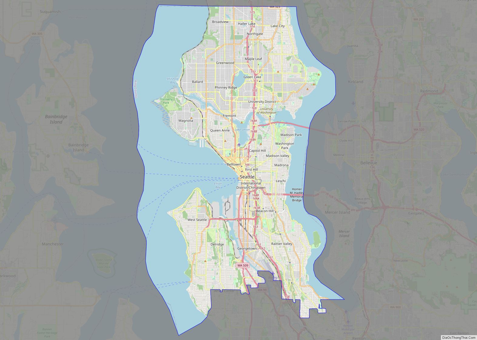
Seattle (/siˈætəl/ (listen) see-AT-əl) is a seaport city on the West Coast of the United States. It is the seat of King County, Washington. With a 2020 population of 737,015, it is the largest city in both the state of Washington and the Pacific Northwest region of North America. The Seattle metropolitan area’s population is … Read more

Map of Spokane city, Washington

Map of Spokane city, Washington

Spokane (/spoʊˈkæn/ (listen) spoh-KAN) is the largest city and county seat of Spokane County, Washington, United States. It is in eastern Washington, along the Spokane River, adjacent to the Selkirk Mountains, and west of the Rocky Mountain foothills, 92 miles (148 km) south of the Canadian border, 18 miles (30 km) west of the Washington–Idaho border, and … Read more

Map of Tacoma city

Map of Tacoma city

Tacoma (/təˈkoʊmə/ tə-KOH-mə) is the county seat of Pierce County, Washington, United States. A port city, it is situated along Washington’s Puget Sound, 32 miles (51 km) southwest of Seattle, 31 miles (50 km) northeast of the state capital, Olympia, and 58 miles (93 km) northwest of Mount Rainier National Park. The city’s population was 219,346 at the … Read more

Map of Vancouver city

Map of Vancouver city

Vancouver is a city on the north bank of the Columbia River in the U.S. state of Washington, located in Clark County. Incorporated in 1857, Vancouver has a population of 190,915 as of the 2020 census, making it the fourth-largest city in Washington state. Vancouver is the county seat of Clark County and forms part … Read more

Map of Bellevue city, Washington

Map of Bellevue city, Washington

Bellevue (/ˈbɛlvjuː/ BEL-vew) is a city in the Eastside region of King County, Washington, United States, located across Lake Washington from Seattle. It is the third-largest city in the Seattle metropolitan area and has variously been characterized as a satellite city, a suburb, a boomburb, or an edge city. Its population was 122,363 at the … Read more

Map of Kent city, Washington

Map of Kent city, Washington

Kent is a city in King County, Washington, United States. It is part of the Seattle–Tacoma–Bellevue metropolitan area and had a population of 136,588 as of the 2020 census, making it the fourth-largest municipality in greater Seattle and the sixth-largest in Washington state. The city is connected to Seattle, Bellevue and Tacoma via State Route … Read more

Map of Spokane Valley city

Map of Spokane Valley city

Spokane Valley is a city in Spokane County, Washington, United States, and the largest suburb of Spokane. It is located east of Spokane, west of Coeur d’Alene, Idaho, and surrounds the city of Millwood on three sides. The city incorporated as the City of Spokane Valley on March 31, 2003. The population was 102,976 at … Read more

Map of Kennewick city

Map of Kennewick city

Kennewick (/ˈkɛnəwɪk/) is a city in Benton County in the U.S. state of Washington. It is located along the southwest bank of the Columbia River, just southeast of the confluence of the Columbia and Yakima rivers and across from the confluence of the Columbia and Snake rivers. It is the most populous of the three … Read more

Map of Yakima city

Map of Yakima city

Yakima (/ˈjækɪmɑː/ or /ˈjækɪmə/) is a city in and the county seat of Yakima County, Washington, United States, and the state’s 11th-largest city by population. As of the 2020 census, the city had a total population of 96,968 and a metropolitan population of 256,728. The unincorporated suburban areas of West Valley and Terrace Heights are … Read more