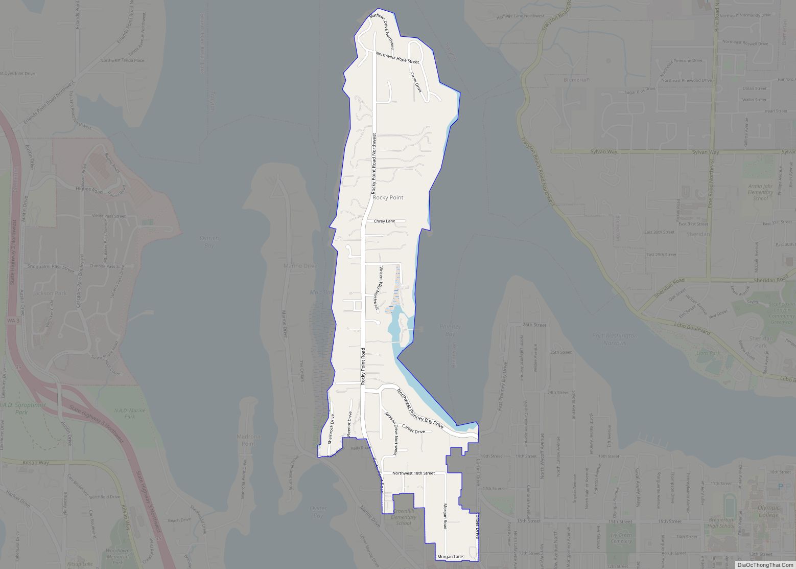
Map of Lind town

Map of Lind town

Lind town overview: Name: Lind town LSAD Code: 43 LSAD Description: town (suffix) State: Washington County: Adams County FIPS code: 5339510 Online Interactive Map Lind online map. Source: Basemap layers from Google Map, Open Street Map (OSM), Arcgisonline, Wmflabs. Boundary Data from Database of Global Administrative Areas. Lind location map. Where is Lind town? Lind … Read more

Map of Liberty Lake city

Map of Liberty Lake city

Liberty Lake is a city in Spokane County, Washington, United States located adjacent to the eponymous lake. Located just over a mile (about 2 km) west of the Washington–Idaho border, Liberty Lake is both a suburb of Spokane, Washington and a bedroom community to Coeur d’Alene, Idaho. The population was 12,003 at the 2020 census. … Read more

Map of Lewisville CDP, Washington

Map of Lewisville CDP, Washington

Lewisville is a census-designated place (CDP) in Clark County, Washington, United States. The population was 1,722 at the 2010 census. Lewisville CDP overview: Name: Lewisville CDP LSAD Code: 57 LSAD Description: CDP (suffix) State: Washington County: Clark County Elevation: 413 ft (126 m) Total Area: 5.6 sq mi (14.6 km²) Land Area: 5.6 sq mi (14.5 km²) Water Area: 0.04 sq mi (0.1 km²) Total Population: … Read more

Map of Lynnwood city

Map of Lynnwood city

Lynnwood is a city in Snohomish County, Washington, United States. The city is part of the Seattle metropolitan area and is located 16 miles (26 km) north of Seattle and 13 miles (21 km) south of Everett, near the junction of Interstate 5 and Interstate 405. It is the fourth-largest city in Snohomish County, with a population … Read more

Map of Lynden city

Map of Lynden city

Lynden is a city in Whatcom County, Washington, United States. It is located 15 miles (24 km) north of Bellingham and approximately 5 miles (8.0 km) south of Canada–US border. The city is located along the Nooksack River and State Route 539. The population of Lynden is about 14,259, according to the United States Census Bureau. Lynden … Read more

Map of Lyman town, Washington

Map of Lyman town, Washington

Lyman town overview: Name: Lyman town LSAD Code: 43 LSAD Description: town (suffix) State: Washington County: Skagit County FIPS code: 5340770 Online Interactive Map Lyman online map. Source: Basemap layers from Google Map, Open Street Map (OSM), Arcgisonline, Wmflabs. Boundary Data from Database of Global Administrative Areas. Lyman location map. Where is Lyman town? Lyman … Read more

Map of Lyle CDP, Washington

Map of Lyle CDP, Washington

Lyle is an unincorporated community and census-designated place (CDP) in Klickitat County, Washington, United States. The population was 499 at the 2010 census. Lyle CDP overview: Name: Lyle CDP LSAD Code: 57 LSAD Description: CDP (suffix) State: Washington County: Klickitat County Elevation: 203 ft (62 m) Total Area: 0.71 sq mi (1.83 km²) Land Area: 0.71 sq mi (1.83 km²) Water Area: 0.0 sq mi … Read more

Map of Lower Elochoman CDP

Map of Lower Elochoman CDP

Lower Elochoman is a census-designated place (CDP) in Wahkiakum County, Washington, United States. The population was 185 at the 2010 census. Lower Elochoman CDP overview: Name: Lower Elochoman CDP LSAD Code: 57 LSAD Description: CDP (suffix) State: Washington County: Wahkiakum County Elevation: 108 ft (33 m) Total Area: 185 Area code: 360 FIPS code: 5340570 Online Interactive … Read more

Map of Loon Lake CDP

Map of Loon Lake CDP

Loon Lake is an unincorporated community and census-designated place in Stevens County, Washington, United States. Loon Lake is located on the northern shore of Loon Lake 5 miles (8.0 km) east of Springdale. The community is served by U.S. Route 395 and Washington State Route 292. Loon Lake has a post office with ZIP code 99148. … Read more

Map of Loomis CDP, Washington

Map of Loomis CDP, Washington

Loomis is a census-designated place (CDP) in Okanogan County, Washington, United States. The population was 159 at the 2010 Census. Its area is 0.85 square miles (2.2 km), which is all land and no water. Loomis CDP overview: Name: Loomis CDP LSAD Code: 57 LSAD Description: CDP (suffix) State: Washington County: Okanogan County Elevation: 1,316 ft (401 m) … Read more

Map of Longview city, Washington

Map of Longview city, Washington

Longview is a city in Cowlitz County, Washington, United States. It is the principal city of the Longview, Washington Metropolitan Statistical Area, which encompasses all of Cowlitz County. Longview’s population was 37,818 at the time of the 2020 census, making it the largest city in Cowlitz County. The city is located in southwestern Washington, at … Read more

Map of Longview Heights CDP

Map of Longview Heights CDP

Longview Heights is a census-designated place (CDP) in Cowlitz County, Washington, United States. The population was 3,851 at the 2010 Census. The CDP is known locally as Columbia Heights. Longview Heights CDP overview: Name: Longview Heights CDP LSAD Code: 57 LSAD Description: CDP (suffix) State: Washington County: Cowlitz County Elevation: 886 ft (270 m) Total Area: 4.3 sq mi … Read more