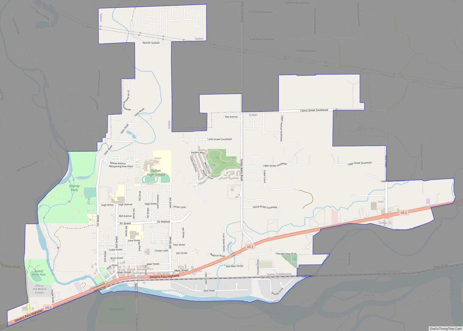
Map of Stansberry Lake CDP
Stansberry Lake is a census-designated place located in Pierce County, Washington. Stansberry Lake CDP overview: Name: Stansberry Lake CDP LSAD Code: 57 LSAD Description: CDP (suffix) State: Washington County: Pierce County Elevation: 243 ft (74 m) Total Area: 2.08 sq mi (5.4 km²) Total Population: 2,101 Population Density: 1,000/sq mi (390/km²) FIPS code: 5367435 Online Interactive Map Stansberry Lake online map. ... Read more
Map of Stansberry Lake CDP
Map of Tonasket city
Tonasket /təˈnæskət/ is a city in Okanogan County, Washington, United States. The population was 1,032 at the 2010 census. Tonasket city overview: Name: Tonasket city LSAD Code: 25 LSAD Description: city (suffix) State: Washington County: Okanogan County Elevation: 919 ft (280 m) Total Area: 0.96 sq mi (2.49 km²) Land Area: 0.94 sq mi (2.44 km²) Water Area: 0.02 sq mi (0.05 km²) Total Population: 1,032 ... Read more
Map of Tonasket city
Map of Toledo city, Washington
Toledo is a city in Lewis County, Washington, United States. The population was 631 at the 2020 census. Toledo city overview: Name: Toledo city LSAD Code: 25 LSAD Description: city (suffix) State: Washington County: Lewis County Elevation: 121 ft (37 m) Total Area: 0.40 sq mi (1.03 km²) Land Area: 0.39 sq mi (1.02 km²) Water Area: 0.00 sq mi (0.01 km²) Total Population: 631 Population ... Read more
Map of Toledo city, Washington
Map of Tokeland CDP
Tokeland is a census-designated place (CDP) in Pacific County, Washington, United States. The population was 151 at the 2010 census, a sharp decrease from the 194 at the 2000 census. The town was named after Chief Toke, an Indian chief of the 19th century. Tokeland CDP overview: Name: Tokeland CDP LSAD Code: 57 LSAD Description: ... Read more
Map of Tokeland CDP
Map of Tieton city
Tieton (/ˈtaɪ.ətən/) is a city in Yakima County, Washington, United States. The population was 1,389 at the 2020 census. In recent years, Tieton has suffered economic depression, with the decline of its fruit warehouses. As of 2007, a Seattle lawyer and the founding president of the art publishing house Marquand Books have been investing in ... Read more
Map of Tieton city
Map of Three Lakes CDP, Washington
Three Lakes is a census-designated place (CDP) in Snohomish County, Washington, United States. The population was 3,184 at the 2010 census. Based on per capita income, one of the more reliable measures of affluence, Three Lakes ranks 56th of 522 areas in the state of Washington to be ranked. Three Lakes CDP overview: Name: Three ... Read more
Map of Three Lakes CDP, Washington
Map of Terrace Heights CDP
Terrace Heights is a census-designated place (CDP) in Yakima County, Washington, United States. The population was 6,937 at the 2010 census. It is essentially a suburb of the city of Yakima. Terrace Heights CDP overview: Name: Terrace Heights CDP LSAD Code: 57 LSAD Description: CDP (suffix) State: Washington County: Yakima County Elevation: 1,198 ft (365 m) Total ... Read more
Map of Terrace Heights CDP
Map of Tenino city
Tenino (/təˈnaɪnoʊ/) is a city in Thurston County, Washington, United States. The population was 1,870 at the 2020 census. Incorporated in 1906, the city sits upon land first established as a food-source prairie for Native Americans living in the area. The town grew around an economy of stone quarrying, with local sandstone being used in ... Read more
Map of Tenino city
Map of Tekoa city
Tekoa (/ˈtikoʊ/ TEE-koh) is a small farming town in Whitman County, Washington, United States. The population was 778 at the 2010 census. Based on per capita income, one of the more reliable measures of affluence, Tekoa ranks 420th of 522 areas in the state of Washington to be ranked. The town is centered in the ... Read more
Map of Tekoa city
Map of Tanner CDP
Riverpoint is an unincorporated community and census-designated place (CDP) in east King County, Washington, United States. As of the 2020 census, it had a population of 774. At the 2010 census, the area was listed as the Tanner CDP and had a population of 1,018 over a larger area. In 2010, the Tanner CDP ranked ... Read more
Map of Tanner CDP
Map of Tampico CDP, Washington
Tampico is a census-designated place and unincorporated community in Yakima County, Washington, United States, located approximately eighteen miles west of Yakima on Ahtanum Creek. The population was 312 at the 2010 United States Census. Tampico CDP overview: Name: Tampico CDP LSAD Code: 57 LSAD Description: CDP (suffix) State: Washington County: Yakima County Total Area: 312 ... Read more
Map of Tampico CDP, Washington
Map of Town and Country CDP, Washington
Town and Country (often referred to locally as ‘Lynwood’) is a census-designated place (CDP) in Spokane County, Washington, United States. The population was 5,068 at the 2020 census. Town and Country CDP overview: Name: Town and Country CDP LSAD Code: 57 LSAD Description: CDP (suffix) State: Washington County: Spokane County Elevation: 2,060 ft (628 m) Total Area: ... Read more
Map of Town and Country CDP, Washington