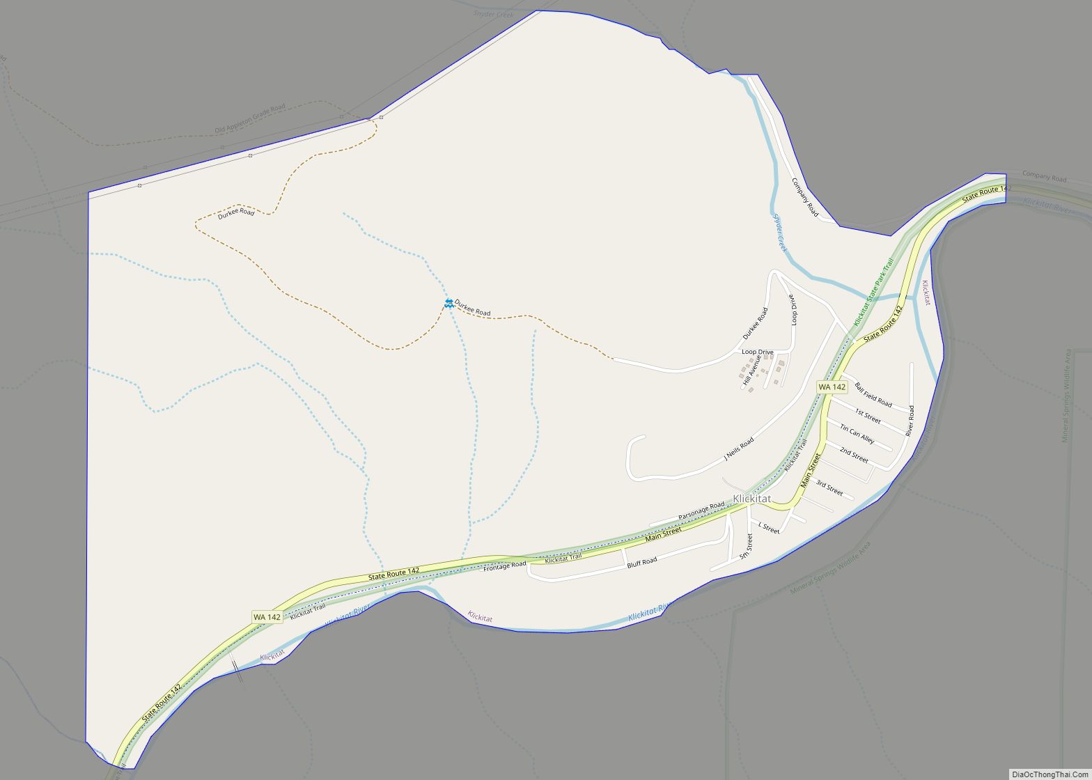
Map of Lacey city
Lacey is a city in Thurston County, Washington, United States. It is a suburb of Olympia with a population of 53,526 at the 2020 census. Lacey is located along Interstate 5 between Olympia and the Nisqually River, which marks the border with Pierce County and Joint Base Lewis–McChord. Lacey city overview: Name: Lacey city LSAD ... Read more
Map of Lacey city
Map of Lebam CDP
Lebam is a census-designated place (CDP) in Pacific County, Washington, United States. The population was 160 at the 2010 census. Lebam CDP overview: Name: Lebam CDP LSAD Code: 57 LSAD Description: CDP (suffix) State: Washington County: Pacific County Elevation: 184 ft (56 m) Total Area: 1.5 sq mi (3.8 km²) Land Area: 1.5 sq mi (3.8 km²) Water Area: 0.0 sq mi (0.0 km²) Total Population: ... Read more
Map of Lebam CDP
Map of Long Beach city, Washington
Long Beach is a city in Pacific County, Washington, United States. The population was 1,392 at the 2010 census. Long Beach city overview: Name: Long Beach city LSAD Code: 25 LSAD Description: city (suffix) State: Washington County: Pacific County Incorporated: January 18, 1922 Elevation: 10 ft (3 m) Total Area: 1.89 sq mi (4.90 km²) Land Area: 1.38 sq mi (3.57 km²) Water ... Read more
Map of Long Beach city, Washington
Map of Lyle CDP, Washington
Lyle is an unincorporated community and census-designated place (CDP) in Klickitat County, Washington, United States. The population was 499 at the 2010 census. Lyle CDP overview: Name: Lyle CDP LSAD Code: 57 LSAD Description: CDP (suffix) State: Washington County: Klickitat County Elevation: 203 ft (62 m) Total Area: 0.71 sq mi (1.83 km²) Land Area: 0.71 sq mi (1.83 km²) Water Area: 0.0 sq mi ... Read more
Map of Lyle CDP, Washington
Map of Marcus town, Washington
Marcus town overview: Name: Marcus town LSAD Code: 43 LSAD Description: town (suffix) State: Washington County: Stevens County FIPS code: 5343395 Online Interactive Map Marcus online map. Source: Basemap layers from Google Map, Open Street Map (OSM), Arcgisonline, Wmflabs. Boundary Data from Database of Global Administrative Areas. Marcus location map. Where is Marcus town? Marcus ... Read more
Map of Marcus town, Washington
Map of Maryhill CDP
Maryhill is an unincorporated community and census-designated place (CDP) in Klickitat County, Washington, United States. The population was 58 at the 2010 census, down from 98 at the 2000 census. Maryhill CDP overview: Name: Maryhill CDP LSAD Code: 57 LSAD Description: CDP (suffix) State: Washington County: Klickitat County Elevation: 187 ft (57 m) Total Area: 2.8 sq mi (7.3 km²) ... Read more
Map of Maryhill CDP
Map of Metaline Falls town
Metaline Falls town overview: Name: Metaline Falls town LSAD Code: 43 LSAD Description: town (suffix) State: Washington County: Pend Oreille County FIPS code: 5345320 Online Interactive Map Metaline Falls online map. Source: Basemap layers from Google Map, Open Street Map (OSM), Arcgisonline, Wmflabs. Boundary Data from Database of Global Administrative Areas. Metaline Falls location map. ... Read more
Map of Metaline Falls town
Map of Morton city, Washington
Morton is a city in Lewis County, Washington, United States. The population was 1,036 at the 2020 census. Morton city overview: Name: Morton city LSAD Code: 25 LSAD Description: city (suffix) State: Washington County: Lewis County Elevation: 948 ft (289 m) Total Area: 0.83 sq mi (2.16 km²) Land Area: 0.82 sq mi (2.13 km²) Water Area: 0.01 sq mi (0.03 km²) Total Population: 1,036 Population ... Read more
Map of Morton city, Washington
Map of Mossyrock city
Mossyrock is a city in Lewis County, Washington, United States. The population was 768 at the 2020 census. Mossyrock city overview: Name: Mossyrock city LSAD Code: 25 LSAD Description: city (suffix) State: Washington County: Lewis County Elevation: 656 ft (200 m) Total Area: 0.69 sq mi (1.78 km²) Land Area: 0.69 sq mi (1.78 km²) Water Area: 0.00 sq mi (0.00 km²) Total Population: 768 Population ... Read more
Map of Mossyrock city
Map of Nespelem Community CDP
Nespelem Community is a census-designated place (CDP) in Okanogan County, Washington, United States. The population was 253 at the 2010 census. Nespelem Community CDP overview: Name: Nespelem Community CDP LSAD Code: 57 LSAD Description: CDP (suffix) State: Washington County: Okanogan County Total Area: 23.1 sq mi (59.9 km²) Land Area: 23.1 sq mi (59.8 km²) Water Area: 0.0 sq mi (0.0 km²) Total Population: ... Read more
Map of Nespelem Community CDP
Map of Neah Bay CDP
Neah Bay is a census-designated place (CDP) on the Makah Reservation in Clallam County, Washington, United States. The population was 865 at the 2010 census. It is across the Canada–US border from British Columbia. Originally called “Scarborough Harbour” in honor of Captain James Scarborough of the Hudson’s Bay Company, it was changed to Neah in ... Read more
Map of Neah Bay CDP
Map of Naselle CDP
Naselle is a census-designated place (CDP) in Pacific County, Washington, United States located about 23 miles (37 km) from the mouth of the Columbia River. The population was 419 at the 2010 census. The valley’s Naselle River flows west into nearby Willapa Bay and then into the Pacific Ocean. Close about the town lie the ... Read more
Map of Naselle CDP